|
|
|
0 members (),
1,932
guests, and
26
robots. |
|
Key:
Admin,
Global Mod,
Mod
|
|
S |
M |
T |
W |
T |
F |
S |
|
|
|
|
|
1
|
2
|
3
|
|
4
|
5
|
6
|
7
|
8
|
9
|
10
|
|
11
|
12
|
13
|
14
|
15
|
16
|
17
|
|
18
|
19
|
20
|
21
|
22
|
23
|
24
|
|
25
|
26
|
27
|
28
|
29
|
30
|
31
|
|
There are no members with birthdays on this day. |
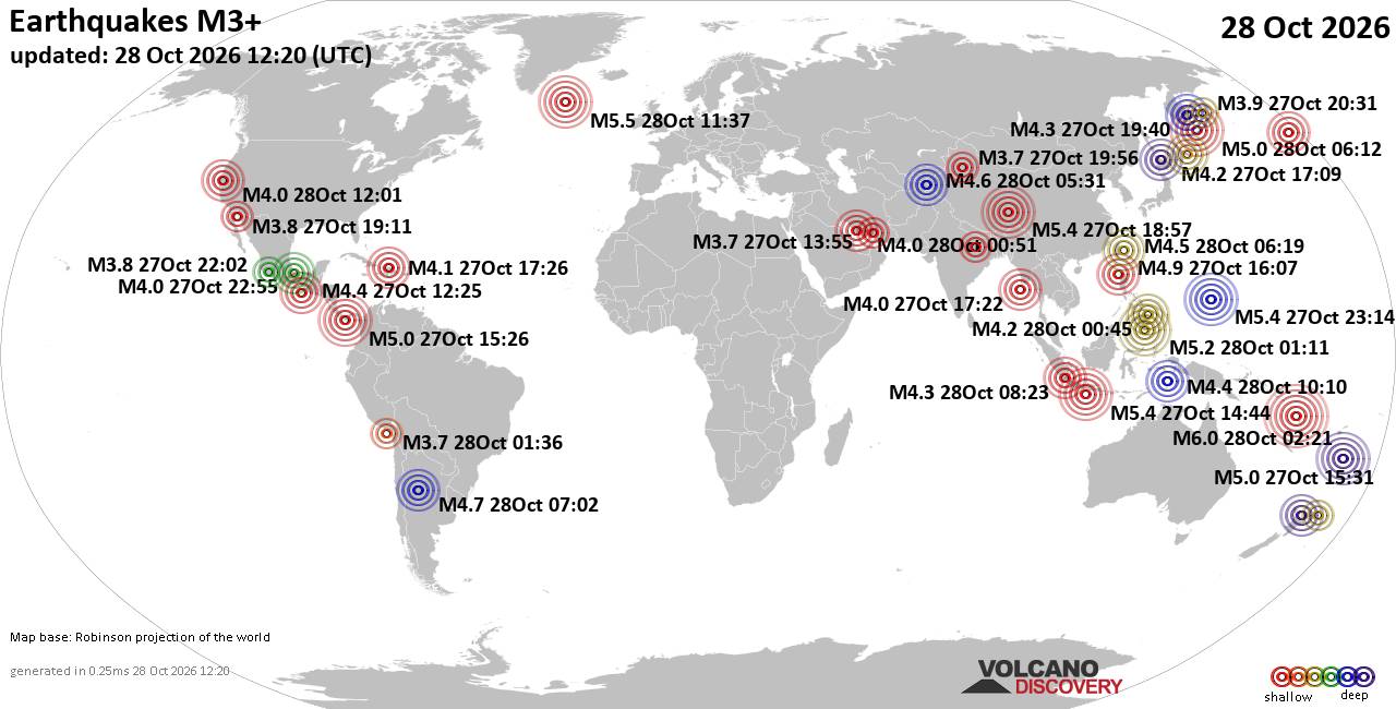
World Earthquake Report for Wednesday, 28 October 2026
• M 1.6 - 11 km N of Lake Pillsbury, CA
• M 1.6 Quarry Blast - 2 km E of Owasso, Oklahoma
• M 4.0 - 10 km N of Lake Pillsbury, CA
• M 4.0 - 10 km N of Lake Pillsbury, CA
• M 4.7 - 207 km NW of Port-Olry, Vanuatu
|
|
|
Joined: Feb 2001
Posts: 678,977
Launch Director
|
|
Launch Director
Joined: Feb 2001
Posts: 678,977 |
SPC Oct 28, 2026 0730 UTC Day 3 Severe Thunderstorm OutlookSPC 0730Z Day 3 Outlook 
Day 3 Convective Outlook
NWS Storm Prediction Center Norman OK
0144 AM CDT Wed Oct 28 2026

Valid 301200Z - 311200Z

...NO SEVERE THUNDERSTORM AREAS FORECAST...

...SUMMARY...
Severe thunderstorm potential appears low on Friday.

...Synopsis...

Showers and thunderstorms will again be possible on Friday across
portions of the south-central U.S. as a weak midlevel shortwave
trough continues to slowly lift northeast across the
southern/central Plains. Weak instability and limited vertical shear
will preclude severe thunderstorm potential.

Further west, southerly low-level flow will maintain 50s to near 60
F surface dewpoints across southern AZ as a weak upper shortwave
trough moves across the Lower CO Valley and Southwest. Cool
temperatures aloft will support steep midlevel lapse rates atop the
relatively moist boundary layer, fostering areas of modest
destabilization. Isolated to scattered thunderstorm development will
be possible, though deep-layer shear is expected to remain somewhat
weak (15-25 kt effective shear). Currently, severe thunderstorm
potential appears limited, but a stronger storm or two could produce
small hail. Trends bear watching as any uptick in instability or
strengthening shear could support a more isolated risk for severe
thunderstorms across southern/central AZ.

..Leitman.. 10/28/2026
Read morehttps://www.spc.noaa.gov/products/outlook/day3otlk_0730.html
|
|



CMS The Best Conveyancing solicitors conveyancing quotes throughout the UK
For any webhosting enquiries please email webmaster@aus-city.com
|
|
Entire Thread
|

 SPC Oct 28, 2026 0730 UTC Day 3 Severe Thunderstorm Outlook |
Webmaster
|
6 hours ago
|
|
Forums60
Topics898,431
Posts933,228
Members2,960
| |
Most Online102,106
Jul 10th, 2026
|
|
|
|
|

|









































