|
0 members (),
2,147
guests, and
27
robots. |
|
Key:
Admin,
Global Mod,
Mod
|
|
S |
M |
T |
W |
T |
F |
S |
|
|
|
|
|
1
|
2
|
3
|
|
4
|
5
|
6
|
7
|
8
|
9
|
10
|
|
11
|
12
|
13
|
14
|
15
|
16
|
17
|
|
18
|
19
|
20
|
21
|
22
|
23
|
24
|
|
25
|
26
|
27
|
28
|
29
|
30
|
31
|
|
There are no members with birthdays on this day. |
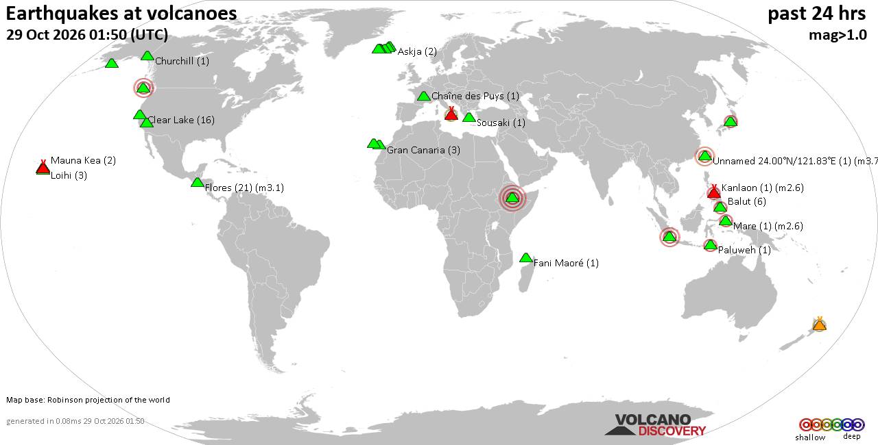
Volcano earthquake report for Thursday, 29 October 2026
• M 4.3 - 196 km WNW of Port-Olry, Vanuatu
• M 4.1 - 6 km NE of Pocrí, Panama
• M 2.7 - 2 km NE of Pacifica, CA
• M 1.8 - 26 km ESE of Fallon Station, Nevada
• M 2.3 - 14 km ESE of Pāhala, Hawaii
• M 1.8 - 13 km ESE of Naalehu, Hawaii
|
|
|
Joined: Feb 2001
Posts: 678,977
Launch Director
|
|
Launch Director
Joined: Feb 2001
Posts: 678,977 |
SPC MD 2417MD 2417 CONCERNING TORNADO WATCH 698... FOR NORTHWESTERN WISCONSIN INTO FAR WESTERN UPPER MICHIGAN 
Mesoscale Discussion 2417
NWS Storm Prediction Center Norman OK
0708 PM CDT Wed Oct 28 2026

Areas affected...northwestern Wisconsin into far western Upper
Michigan

Concerning...Tornado Watch 698...

Valid 290008Z - 290145Z

The severe weather threat for Tornado Watch 698 continues.

SUMMARY...A couple instances of severe hail/wind or a tornado could
still occur into early tonight, though the severe threat is expected
to be more isolated from this point forward.

DISCUSSION...A line of strong to occasionally severe storms has
become established primarily north of a warm front, and will
progress eastward with time. Across west-central WI, a strong storm
cluster has become sustained over Buffalo County, WI. These storms
continue to track along the eastern periphery of a surface-based
buoyancy axis (characterized by 500 J/kg MLCAPE per the 00Z MPX
observed sounding). However, these storms are also progressing into
an intensifying (40-50 kt) LLJ, with the ARX VAD profiler showing a
large/curved hodograph and over 500 m2/s2 of 0-3 km SRH.

In the near-term, the ongoing storms will pose a threat for isolated
severe gusts/hail, and a tornado may still occur, though confidence
in this scenario is decreasing as these storms approach increasing
MLCINH. Furthermore, nocturnal cooling should also contribute to a
gradually waning severe threat.

..Squitieri.. 10/29/2026

...Please see www.spc.noaa.gov for graphic product...

ATTN...WFO...MQT...GRB...DLH...ARX...MPX...

LAT...LON   45278973 44359057 44239090 44219145 44269174 44529182
            45709174 46259146 46779086 46798994 46578916 46048914
            45278973

MOST PROBABLE PEAK TORNADO INTENSITY...UP TO 90 MPH
MOST PROBABLE PEAK WIND GUST...UP TO 60 MPH
MOST PROBABLE PEAK HAIL SIZE...UP TO 1.25 IN
Read morehttps://www.spc.noaa.gov/products/md/md2417.html
|
|



CMS The Best Conveyancing solicitors conveyancing quotes throughout the UK
For any webhosting enquiries please email webmaster@aus-city.com
|
|
Entire Thread
|

 SPC MD 2417 |
Webmaster
|
4 hours ago
|
|
Forums60
Topics899,787
Posts934,584
Members2,960
| |
Most Online102,106
Jul 10th, 2026
|
|
|









































