|
|
|
0 members (),
1,426
guests, and
28
robots. |
|
Key:
Admin,
Global Mod,
Mod
|
|
S |
M |
T |
W |
T |
F |
S |
|
|
|
|
|
1
|
2
|
3
|
|
4
|
5
|
6
|
7
|
8
|
9
|
10
|
|
11
|
12
|
13
|
14
|
15
|
16
|
17
|
|
18
|
19
|
20
|
21
|
22
|
23
|
24
|
|
25
|
26
|
27
|
28
|
29
|
30
|
31
|
|
There are no members with birthdays on this day. |
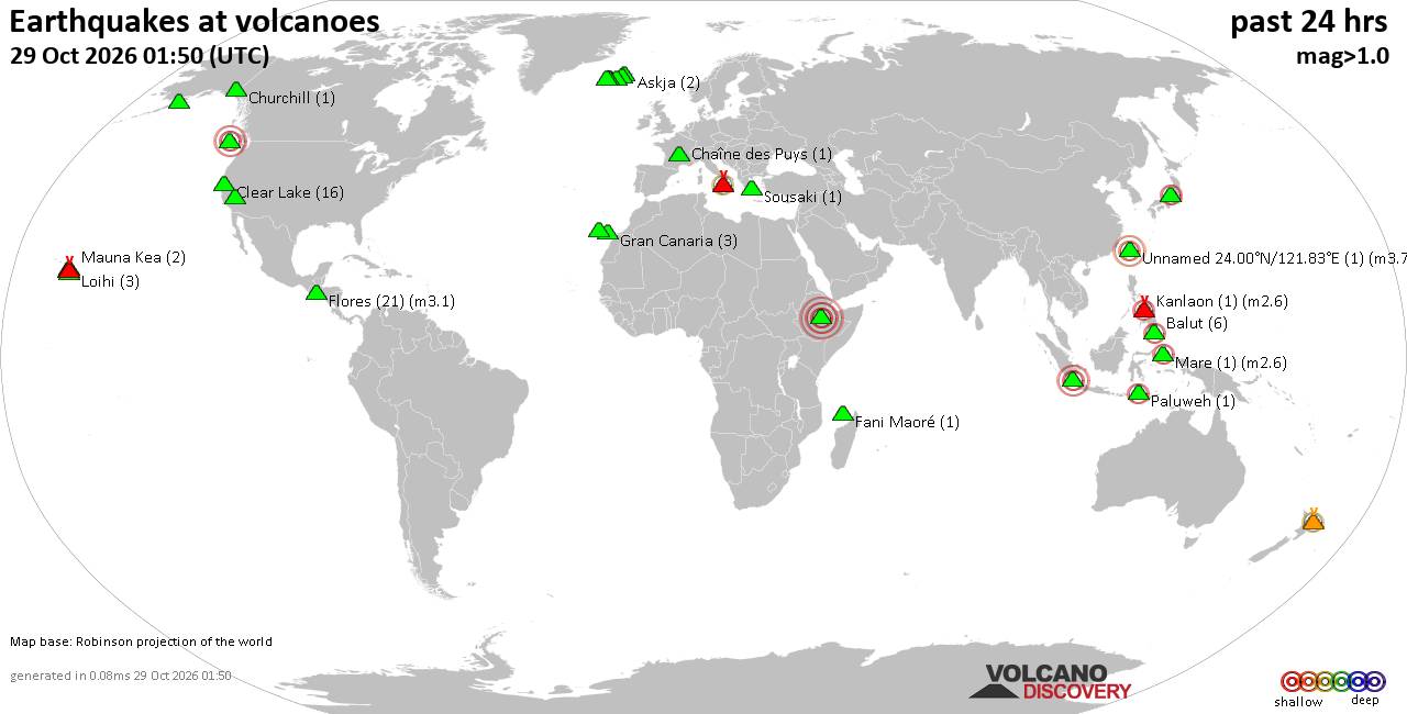
Volcano earthquake report for Thursday, 29 October 2026
• M 2.7 - 53 km NW of Toyah, Texas
• M 5.4 - South Sandwich Islands region
• M 4.6 - 41 km W of Mosteiros, Portugal
• M 4.6 - 41 km W of Mosteiros, Portugal
• M 4.6 - 41 km W of Mosteiros, Portugal
• M 1.1 - 5 km NNW of The Geysers, CA
|
|
|
Joined: Feb 2001
Posts: 678,977
Launch Director
|
|
Launch Director
Joined: Feb 2001
Posts: 678,977 |
SPC Oct 29, 2026 0730 UTC Day 3 Severe Thunderstorm OutlookSPC 0730Z Day 3 Outlook 
Day 3 Convective Outlook
NWS Storm Prediction Center Norman OK
0134 AM CDT Thu Oct 29 2026

Valid 311200Z - 011200Z

...NO SEVERE THUNDERSTORM AREAS FORECAST...

...SUMMARY...
Severe thunderstorms are not expected on Saturday.

...Synopsis...

A weak mid/upper shortwave impulse will spread east from the
central/southern Plains to the Mid/Lower MS Valley on Saturday.
Modest boundary layer moisture (increasing near the Gulf Coast) and
cool temperatures aloft (around -10 to -12 C at 500 mb) will support
sufficient instability for widely scattered showers and
thunderstorms from OK/TX toward the Lower MS Valley. Overall severe
thunderstorm potential will remain limited by generally weak flow
and lack of stronger surface cyclogenesis. Additional thunderstorms
are possible across portions of the Great Basin as an upper trough
deepens across the Pacific Northwest and northern Great Basin at the
same time as a southern stream upper trough approaches the southern
CA and Baja coasts. Severe thunderstorms are not expected with this
activity.

..Leitman.. 10/29/2026
Read morehttps://www.spc.noaa.gov/products/outlook/day3otlk_0730.html
|
|



CMS The Best Conveyancing solicitors conveyancing quotes throughout the UK
For any webhosting enquiries please email webmaster@aus-city.com
|
|
Entire Thread
|

 SPC Oct 29, 2026 0730 UTC Day 3 Severe Thunderstorm Outlook |
Webmaster
|
2 hours ago
|
|
Forums60
Topics900,053
Posts934,850
Members2,960
| |
Most Online102,106
Jul 10th, 2026
|
|
|
|
|

|









































