|
|
|
0 members (),
1,374
guests, and
22
robots. |
|
Key:
Admin,
Global Mod,
Mod
|
|
S |
M |
T |
W |
T |
F |
S |
|
|
|
|
|
1
|
2
|
3
|
|
4
|
5
|
6
|
7
|
8
|
9
|
10
|
|
11
|
12
|
13
|
14
|
15
|
16
|
17
|
|
18
|
19
|
20
|
21
|
22
|
23
|
24
|
|
25
|
26
|
27
|
28
|
29
|
30
|
31
|
|
There are no members with birthdays on this day. |
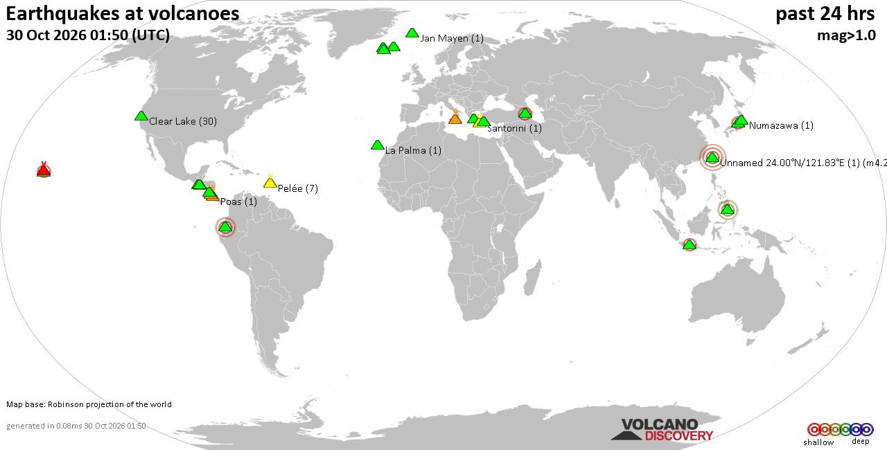
Volcano earthquake report for Friday, 30 October 2026
• M 0.7 - 2 km SE of Loma Linda, CA
• M 0.7 - 2 km SE of Loma Linda, CA
• M 4.6 - 64 km SSW of Shikotan, Russia
• M 4.7 - 98 km S of Encounter Bay, Australia
• M 0.2 - 8 km NW of The Geysers, CA
• M 0.9 - 3 km SE of Loma Linda, CA
|
|
|
Joined: Feb 2001
Posts: 678,977
Launch Director
|
|
Launch Director
Joined: Feb 2001
Posts: 678,977 |
SPC Oct 30, 2026 0600 UTC Day 2 Convective OutlookSPC 0600Z Day 2 Outlook 
Day 2 Convective Outlook
NWS Storm Prediction Center Norman OK
1240 AM CDT Fri Oct 30 2026

Valid 311200Z - 011200Z

...NO SEVERE THUNDERSTORM AREAS FORECAST...

...SUMMARY...
Severe thunderstorms are not expected on Saturday.

...Discussion...
Shortwave ridging will occur from the Northern Plains to the Upper
Great Lakes on Saturday as a shortwave trough exits the Maritimes
and multiple waves converge across the West. In the wake of the
northeastern trough, high pressure will become centered over the Mid
Atlantic, with dry low-level trajectories over much of the eastern
CONUS.

Easterly surface winds will maintain a boundary near the Gulf Coast,
though southerly winds may bring upper 60s well inland across
eastern TX into LA. Here, scattered showers and thunderstorms will
be likely within a weak low-level warm advection regime. Lapse rates
will be poor with little if any severe potential.

Elsewhere, cool temperatures aloft will exist along the West Coast
and into much of the Intermountain West as an amplified upper trough
moves ashore late in the day over WA/OR/CA, and another
southern-stream wave approaches southern CA and northern Baja
overnight. While shear will increase across most of the region,
instability will be quite weak, with isolated lightning possible
from eastern ID southward across the Great Basin late in the day and
overnight.

..Jewell.. 10/30/2026
Read morehttps://www.spc.noaa.gov/products/outlook/day2otlk_0600.html
|
|



CMS The Best Conveyancing solicitors conveyancing quotes throughout the UK
For any webhosting enquiries please email webmaster@aus-city.com
|
|
Entire Thread
|

 SPC Oct 30, 2026 0600 UTC Day 2 Convective Outlook |
Webmaster
|
3 hours ago
|
|
Forums60
Topics902,014
Posts936,811
Members2,960
| |
Most Online102,106
Jul 10th, 2026
|
|
|
|
|

|









































