|
|
|
0 members (),
1,374
guests, and
22
robots. |
|
Key:
Admin,
Global Mod,
Mod
|
|
S |
M |
T |
W |
T |
F |
S |
|
|
|
|
|
1
|
2
|
3
|
|
4
|
5
|
6
|
7
|
8
|
9
|
10
|
|
11
|
12
|
13
|
14
|
15
|
16
|
17
|
|
18
|
19
|
20
|
21
|
22
|
23
|
24
|
|
25
|
26
|
27
|
28
|
29
|
30
|
31
|
|
There are no members with birthdays on this day. |
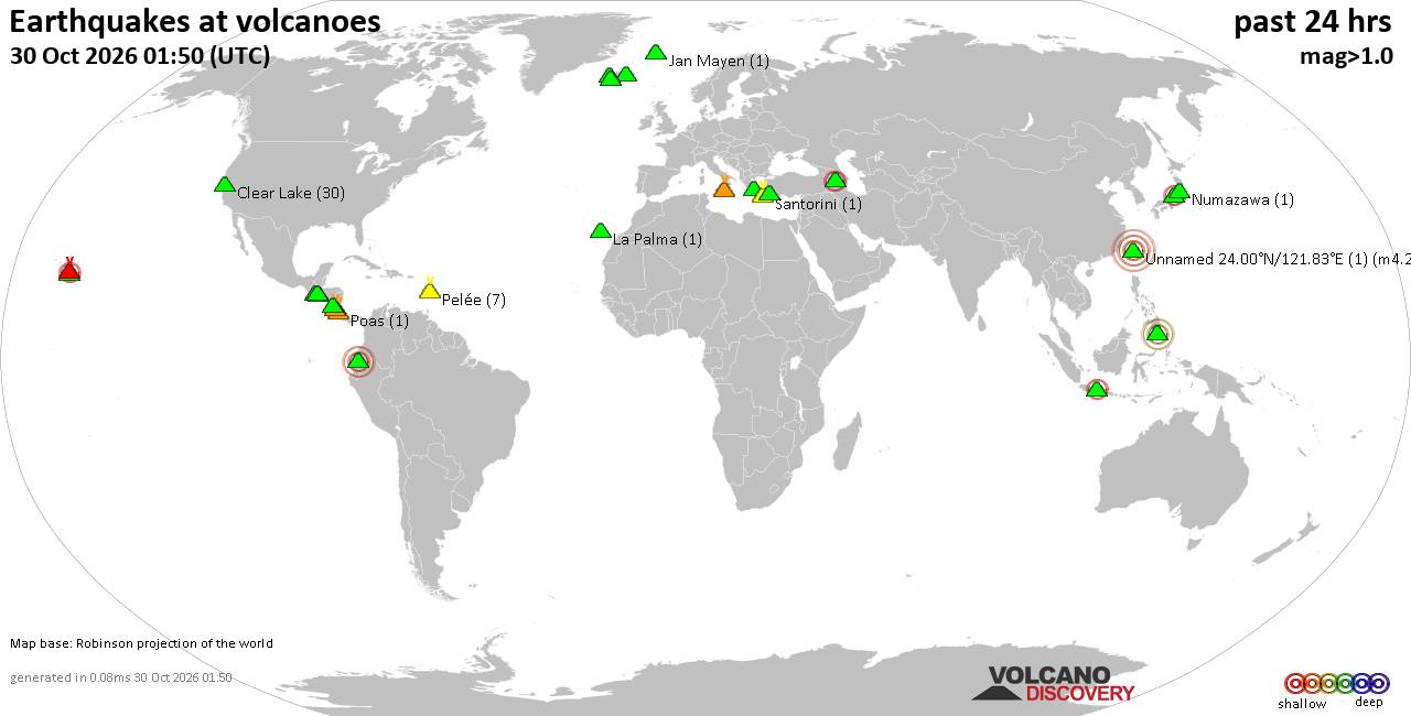
Volcano earthquake report for Friday, 30 October 2026
• M 0.7 - 2 km SE of Loma Linda, CA
• M 0.7 - 2 km SE of Loma Linda, CA
• M 4.6 - 64 km SSW of Shikotan, Russia
• M 4.7 - 98 km S of Encounter Bay, Australia
• M 0.2 - 8 km NW of The Geysers, CA
• M 0.9 - 3 km SE of Loma Linda, CA
|
|
|
Joined: Feb 2001
Posts: 678,977
Launch Director
|
|
Launch Director
Joined: Feb 2001
Posts: 678,977 |
SPC Oct 30, 2026 0730 UTC Day 3 Severe Thunderstorm OutlookSPC 0730Z Day 3 Outlook 
Day 3 Convective Outlook
NWS Storm Prediction Center Norman OK
0230 AM CDT Fri Oct 30 2026

Valid 011200Z - 021200Z

...THERE IS A MARGINAL RISK OF SEVERE THUNDERSTORMS OVER MUCH OF
CENTRAL AND EASTERN NEW MEXICO...AND SMALL PARTS OF WESTERN TEXAS...

...SUMMARY...
A few severe storms are anticipated from central New Mexico into
parts of western Texas late Sunday into Sunday night.

...Discussion...
An amplified upper trough will move across the Great Basin on
Sunday, while another wave to the south moves across northern Baja
CA and into AZ. By late in the day, gusty south winds will increase
across the Rockies and into the southern High Plains, as low
pressure develops over WY through 00Z.

During the late evening and overnight, a prominent cold front will
move out of AZ and into NM as the parent wave aloft continues
northeastward across NM and into the central to southern High
Plains. The surface low is forecast to deepen overnight into CO,
with a surface trough into eastern NM and western TX through 12Z
Monday.

After a full day of heating, low-level lapse rates will be steep,
and gusty winds overnight should maintain relatively warm
temperatures ahead of the cold front. Dewpoints from the upper 40s
to mid 50s F should also be maintained ahead of the front, with
thunderstorms developing near the cold front after about 03-06Z.
Deep-layer shear will be strong, with supercell wind profiles.
Instability will be marginal over central NM, perhaps supporting
locally severe gusts or marginal hail, with a potentially greater
concentration of severe storms into eastern NM where low-level
moisture will be more abundant with MUCAPE over 1000 J/kg. The
strongest cooling aloft will spread over northern NM and into the TX
Panhandle, and this is where a potentially greater hail and wind
threat could develop. Both cellular and possibly QLCS storm mode
will be possible, with storms tied to the cold front. A small
corridor of higher severe probabilities could be added in later
outlooks as trends warrant.

..Jewell.. 10/30/2026
Read morehttps://www.spc.noaa.gov/products/outlook/day3otlk_0730.html
|
|



CMS The Best Conveyancing solicitors conveyancing quotes throughout the UK
For any webhosting enquiries please email webmaster@aus-city.com
|
|
Entire Thread
|

 SPC Oct 30, 2026 0730 UTC Day 3 Severe Thunderstorm Outlook |
Webmaster
|
3 hours ago
|
|
Forums60
Topics902,014
Posts936,811
Members2,960
| |
Most Online102,106
Jul 10th, 2026
|
|
|
|
|

|









































