|
|
|
0 members (),
1,445
guests, and
35
robots. |
|
Key:
Admin,
Global Mod,
Mod
|
|
S |
M |
T |
W |
T |
F |
S |
|
|
|
|
|
1
|
2
|
3
|
|
4
|
5
|
6
|
7
|
8
|
9
|
10
|
|
11
|
12
|
13
|
14
|
15
|
16
|
17
|
|
18
|
19
|
20
|
21
|
22
|
23
|
24
|
|
25
|
26
|
27
|
28
|
29
|
30
|
31
|
|
There are no members with birthdays on this day. |
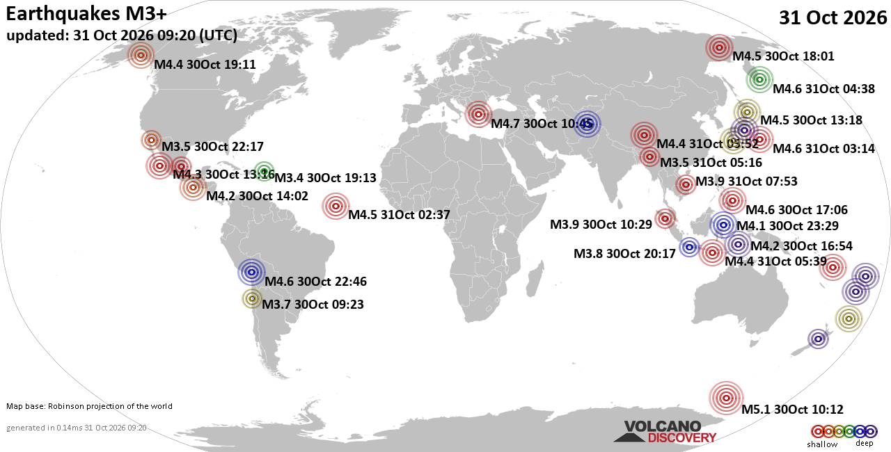
World Earthquake Report for Saturday, 31 October 2026
• M 1.4 - 49 km SSW of Skwentna, Alaska
• M 2.3 - 7 km ENE of Moose Pass, Alaska
• M 0.9 - 88 km NNW of Karluk, Alaska
• M 3.3 - 44 km SSW of Nikolski, Alaska
• M 2.2 - 64 km SE of Denali National Park, Alaska
|
|
|
Joined: Feb 2001
Posts: 678,977
Launch Director
|
|
Launch Director
Joined: Feb 2001
Posts: 678,977 |
SPC Oct 31, 2026 0600 UTC Day 2 Convective OutlookSPC 0600Z Day 2 Outlook 
Day 2 Convective Outlook
NWS Storm Prediction Center Norman OK
1233 AM CDT Sat Oct 31 2026

Valid 011200Z - 021200Z

...THERE IS A MARGINAL RISK OF SEVERE THUNDERSTORMS FROM CENTRAL NEW
MEXICO INTO THE TEXAS PANHANDLE...

...SUMMARY...
A few severe storms are anticipated from parts of central New Mexico
into parts of western Texas late Sunday into Sunday night, with at
least isolated damaging gusts possible.

...Discussion...
A deep upper trough and low will move quickly across the Great
Basin, as a southern stream disturbance moves from northern Baja CA
across AZ during the day and into NM overnight. At the surface, high
pressure will exist over much of the East, with southerly surface
winds increasing late in the day and into the overnight from the
High Plains into the Rockies in advance of the phasing upper system.


Low pressure will deepen from WY into CO overnight, with a cold
front moving into western NM late in the day. With the approaching
upper trough, pre-frontal winds are likely to remain gusty over NM
into the night which will keep the boundary layer a bit
warmer/mixed. With 50s F dewpoints, instability should be sufficient
for at least isolated severe storms as the cold front moves through.
The RRFS soundings shows around 500 MLCAPE at KABQ between 00-02Z
preceding the wind shift, with strong shear profiles including 55 kt
effective shear and effective SRH over 200 m2/s2. Also depicted is a
high reflectively line with various bowing structures within,
possibly developing over west-central NM by 00Z. Locally severe
gusts will be the most likely threat from central NM during the
evening into eastern NM and the TX Panhandle overnight.

Depending on how organized any convective line becomes along the
cold front, some QLCS-type tornado potential could materialize.
Instability/time of day will be a limiting factor, but a low-end
threat corridor may become more apparent in later updates.

..Jewell.. 10/31/2026
Read morehttps://www.spc.noaa.gov/products/outlook/day2otlk_0600.html
|
|



CMS The Best Conveyancing solicitors conveyancing quotes throughout the UK
For any webhosting enquiries please email webmaster@aus-city.com
|
|
Entire Thread
|

 SPC Oct 31, 2026 0600 UTC Day 2 Convective Outlook |
Webmaster
|
4 hours ago
|
|
Forums60
Topics903,826
Posts938,623
Members2,960
| |
Most Online102,106
Jul 10th, 2026
|
|
|
|
|

|









































