|
0 members (),
1,505
guests, and
26
robots. |
|
Key:
Admin,
Global Mod,
Mod
|
|
S |
M |
T |
W |
T |
F |
S |
|
1
|
2
|
3
|
4
|
5
|
6
|
7
|
|
8
|
9
|
10
|
11
|
12
|
13
|
14
|
|
15
|
16
|
17
|
18
|
19
|
20
|
21
|
|
22
|
23
|
24
|
25
|
26
|
27
|
28
|
|
29
|
30
|
|
|
|
|
|
|
There are no members with birthdays on this day. |
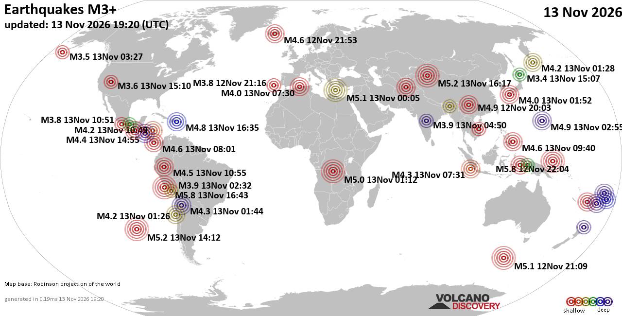
World Earthquake Report for Friday, 13 November 2026
• M 0.5 Other Event - 62 km ENE of Pedro Bay, Alaska
• M 0.5 Other Event - 64 km ENE of Pedro Bay, Alaska
• M 0.4 Other Event - 65 km ENE of Pedro Bay, Alaska
• M 4.5 - Mid-Indian Ridge
• M 0.4 Other Event - 63 km ENE of Pedro Bay, Alaska
• M 1.6 - 89 km NNW of Rachel, Nevada
|

#946180
Tue 03 Nov 2026 06:39:PM
|
Joined: Feb 2001
Posts: 800,656
Launch Director
|
|
Launch Director
Joined: Feb 2001
Posts: 800,656 |
SPC MD 2441MD 2441 CONCERNING SEVERE POTENTIAL...WATCH UNLIKELY FOR EAST TEXAS...NORTHWEST LOUISIANA...AND FAR SOUTHERN ARKANSAS 
Mesoscale Discussion 2441
NWS Storm Prediction Center Norman OK
1141 AM CST Tue Nov 03 2026

Areas affected...east Texas...northwest Louisiana...and far southern
Arkansas

Concerning...Severe potential...Watch unlikely

Valid 031741Z - 031915Z

Probability of Watch Issuance...20 percent

SUMMARY...A weak tornado threat may continue across northwest
Louisiana and vicinity.

DISCUSSION...A few weak supercells have evolved out of the cluster
of storms this morning across east Texas and northwest Louisiana.
These storms are north of the greater instability, but are within a
zone of more favorable low-level shear. These storms have been
sufficiently strong for a few radar confirmed tornadoes, despite
very weak (<20 knot) vRot based on KSHV SRV data. Therefore, while
the overall environment seems to limit the overall ability for
strong low-level mesoscyclones to develop, there does seem to be
sufficient low-level shear and stretching to produce tornadoes with
any supercells that develop.

Expect additional supercell development this afternoon as
heating/destabilization increases. However, the low-level jet is
expected to weaken through the afternoon which may bring an end to
the seemingly perfect balance for a few tornado producing storms
this morning. Due to this uncertainty in the continuation of the
threat, a tornado watch is not expected. However, if this trend of
storms being efficient tornado producers continues, a watch may be
needed.

..Bentley/Marsh.. 11/03/2026

...Please see www.spc.noaa.gov for graphic product...

ATTN...WFO...LZK...LCH...SHV...

LAT...LON   31909453 32579414 33429370 33529322 33309256 32779246
            32149269 31419308 31109376 31329443 31529465 31909453

MOST PROBABLE PEAK TORNADO INTENSITY...UP TO 90 MPH
MOST PROBABLE PEAK WIND GUST...UP TO 60 MPH
Read morehttps://www.spc.noaa.gov/products/md/md2441.html
|
|



CMS The Best Conveyancing solicitors conveyancing quotes throughout the UK
For any webhosting enquiries please email webmaster@aus-city.com
|
|
Entire Thread
|
 SPC MD 2441 |
Webmaster
|
Tue 03 Nov 2026 06:39:PM
|
|
Forums60
Topics926,339
Posts961,136
Members2,960
| |
Most Online102,106
Jul 10th, 2026
|
|
|









































