|
|
|
0 members (),
2,097
guests, and
41
robots. |
|
Key:
Admin,
Global Mod,
Mod
|
|
S |
M |
T |
W |
T |
F |
S |
|
1
|
2
|
3
|
4
|
5
|
6
|
7
|
|
8
|
9
|
10
|
11
|
12
|
13
|
14
|
|
15
|
16
|
17
|
18
|
19
|
20
|
21
|
|
22
|
23
|
24
|
25
|
26
|
27
|
28
|
|
29
|
30
|
|
|
|
|
|
|
There are no members with birthdays on this day. |
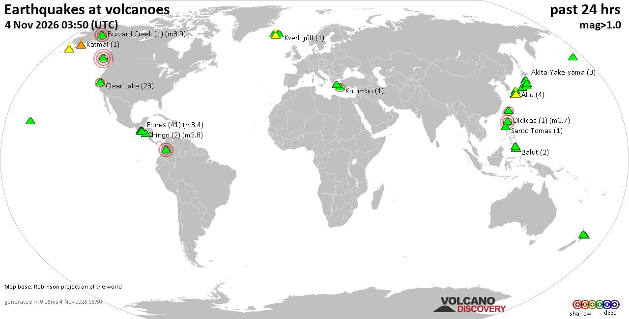
Volcano earthquake report for Wednesday, 4 November 2026
• M 3.2 - 3 km SE of Meno, Oklahoma
• M 1.9 - 10 km E of Pāhala, Hawaii
• M 1.5 - 37 km E of Clear, Alaska
• M 1.4 - 37 km E of Clear, Alaska
• M 4.4 - 2 km S of Cedro Arriba, Panama
|
|
|
Joined: Feb 2001
Posts: 678,977
Launch Director
|
|
Launch Director
Joined: Feb 2001
Posts: 678,977 |
SPC Nov 4, 2026 0100 UTC Day 1 Convective OutlookSPC 0100Z Day 1 Outlook 
Day 1 Convective Outlook
NWS Storm Prediction Center Norman OK
0637 PM CST Tue Nov 03 2026

Valid 040100Z - 041200Z

...THERE IS A MARGINAL RISK OF SEVERE THUNDERSTORMS ACROSS PARTS OF
THE LOWER TO MID MISSISSIPPI VALLEY...

...SUMMARY...
Thunderstorms with potential for isolated severe wind gusts and
perhaps a brief tornado will be possible this evening and tonight
across the lower to mid Mississippi Valley.

...Lower to Mid Mississippi Valley...
The latest water vapor imagery shows an upper-level low in the mid
Missouri Valley with a trough extending southward into the eastern
part of the southern Plains. Cyclonic mid-level southwesterly flow
is located ahead of the trough in the lower to mid Mississippi
Valley. Within this flow, a broad band of precipitation is ongoing
from central Illinois southward to Louisiana. Scattered
thunderstorms are occurring on the southern end of the band. Ahead
of this band, instability is generally weak except in the lower
Mississippi Valley, where surface dewpoints in the 70s F are
contributing to moderate instability. Although moderate deep-layer
shear is present across much of the lower to mid Mississippi Valley,
low-level lapse rates are very poor. In spite of this, strong
low-level shear coupled with the instability could be enough for an
isolated potential for severe wind gusts and perhaps a tornado.
However, any severe threat will remain marginal this evening and
tonight.

..Broyles.. 11/04/2026
Read morehttps://www.spc.noaa.gov/products/outlook/day1otlk_0100.html
|
|



CMS The Best Conveyancing solicitors conveyancing quotes throughout the UK
For any webhosting enquiries please email webmaster@aus-city.com
|
|
Entire Thread
|

 SPC Nov 4, 2026 0100 UTC Day 1 Convective Outlook |
Webmaster
|
7 hours ago
|
|
Forums60
Topics910,326
Posts945,123
Members2,960
| |
Most Online102,106
Jul 10th, 2026
|
|
|
|
|

|









































