|
0 members (),
2,467
guests, and
27
robots. |
|
Key:
Admin,
Global Mod,
Mod
|
|
S |
M |
T |
W |
T |
F |
S |
|
1
|
2
|
3
|
4
|
5
|
6
|
7
|
|
8
|
9
|
10
|
11
|
12
|
13
|
14
|
|
15
|
16
|
17
|
18
|
19
|
20
|
21
|
|
22
|
23
|
24
|
25
|
26
|
27
|
28
|
|
29
|
30
|
|
|
|
|
|
|
There are no members with birthdays on this day. |
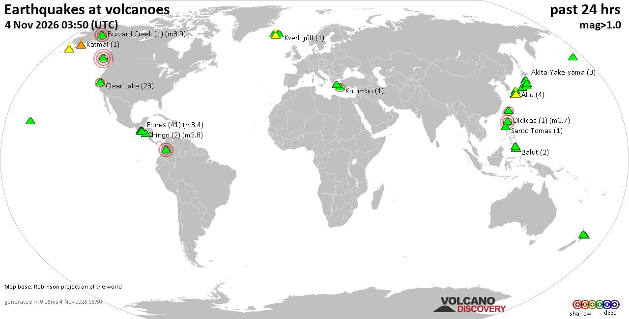
Volcano earthquake report for Wednesday, 4 November 2026
• M 3.0 - 55 km ENE of Pedro Bay, Alaska
• M 2.5 - 6 km NW of Pine Valley, CA
• M 0.9 - 5 km WNW of The Geysers, CA
• M 0.8 - 7 km SE of Lake Henshaw, CA
• M 2.2 - 19 km WNW of Ferndale, CA
|
|
|
Joined: Feb 2001
Posts: 678,977
Launch Director
|
|
Launch Director
Joined: Feb 2001
Posts: 678,977 |
Eastern Pacific Tropical Weather Outlook


217
ABPZ20 KNHC 040502
TWOEP
Tropical Weather Outlook
NWS National Hurricane Center Miami FL
1000 PM PST Tue Nov 3 2026
For the eastern and central North Pacific east of 180 longitude:
Well Southeast of the Hawaiian Islands (EP95):
A broad area of low pressure located over the western portion of the
East Pacific basin is producing some disorganized shower and
thunderstorm activity. Environmental conditions appear conducive for
gradual development of this system, and a tropical depression is
likely to form over the Central Pacific basin during the next few
days while it moves westward to west-northwestward at 10 to 15 mph.
* Formation chance through 48 hours...medium...50 percent.
* Formation chance through 7 days...high...70 percent.
Eastern East Pacific:
An elongated trough of low pressure is producing a large area of
disorganized showers and thunderstorms offshore of the coast of
Central America. Gradual development of this system is possible
during the next several days, and a tropical depression could form
by this weekend while the low drifts northward. Regardless of
development, this system could bring areas of heavy rain to portions
of Central America later this week and over the weekend.
* Formation chance through 48 hours...low...20 percent.
* Formation chance through 7 days...medium...40 percent.
$$
Forecaster Reinhart
|
|



CMS The Best Conveyancing solicitors conveyancing quotes throughout the UK
For any webhosting enquiries please email webmaster@aus-city.com
|
|
Entire Thread
|

 Eastern Pacific Tropical Weather Outlook |
Webmaster
|
10 hours ago
|
|
Forums60
Topics910,568
Posts945,365
Members2,960
| |
Most Online102,106
Jul 10th, 2026
|
|
|









































