|
|
|
0 members (),
2,890
guests, and
28
robots. |
|
Key:
Admin,
Global Mod,
Mod
|
|
S |
M |
T |
W |
T |
F |
S |
|
1
|
2
|
3
|
4
|
5
|
6
|
7
|
|
8
|
9
|
10
|
11
|
12
|
13
|
14
|
|
15
|
16
|
17
|
18
|
19
|
20
|
21
|
|
22
|
23
|
24
|
25
|
26
|
27
|
28
|
|
29
|
30
|
|
|
|
|
|
|
There are no members with birthdays on this day. |
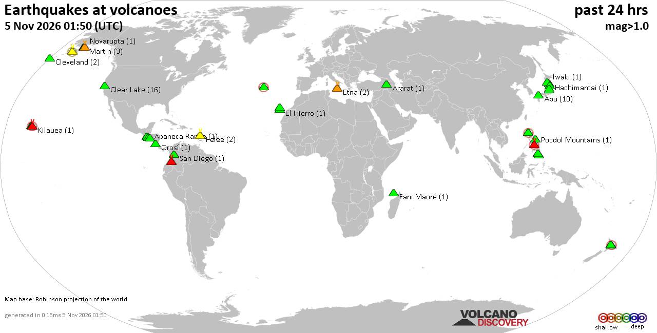
Volcano earthquake report for Thursday, 5 November 2026
• M 5.1 - 19 km NNW of Masumbwe, Tanzania
• M 1.3 - 21 km W of Progreso, B.C., MX
• M 2.5 - 10 km N of Lake Pillsbury, CA
• M 1.3 - 13 km NW of The Geysers, CA
• M 2.6 - 61 km SW of Akhiok, Alaska
|
|
|
Joined: Feb 2001
Posts: 800,656
Launch Director
|
|
Launch Director
Joined: Feb 2001
Posts: 800,656 |
Central Pacific Tropical Weather Outlook


000
ACPN50 PHFO 051146
TWOCP
Tropical Weather Outlook
NWS Central Pacific Hurricane Center Honolulu HI
Issued by NWS National Hurricane Center Miami FL
200 AM HST Thu Nov 05 2026
For the central North Pacific...between 140W and 180W:
Well Southeast of the Hawaiian Islands (CP95):
Showers and thunderstorms continue to show signs of organization in
association with an area of low pressure located over the eastern
portion of the Central Pacific basin. While earlier satellite wind
data suggested the system does not yet have a well-defined
circulation, environmental conditions appear conducive for
additional development. A tropical depression is now likely to form
over the next day or so while the system moves westward to
west-northwestward at 10 to 15 mph, passing well south of the
Hawaiian Islands.
* Formation chance through 48 hours...high...80 percent.
* Formation chance through 7 days...high...80 percent.
$$
Forecaster Papin
NNNN
|
|



CMS The Best Conveyancing solicitors conveyancing quotes throughout the UK
For any webhosting enquiries please email webmaster@aus-city.com
|
|
Entire Thread
|

 Central Pacific Tropical Weather Outlook |
Webmaster
|
38 minutes ago
|
|
Forums60
Topics912,192
Posts946,989
Members2,960
| |
Most Online102,106
Jul 10th, 2026
|
|
|
|
|

|









































