|
|
|
0 members (),
3,669
guests, and
19
robots. |
|
Key:
Admin,
Global Mod,
Mod
|
|
S |
M |
T |
W |
T |
F |
S |
|
1
|
2
|
3
|
4
|
5
|
6
|
7
|
|
8
|
9
|
10
|
11
|
12
|
13
|
14
|
|
15
|
16
|
17
|
18
|
19
|
20
|
21
|
|
22
|
23
|
24
|
25
|
26
|
27
|
28
|
|
29
|
30
|
|
|
|
|
|
|
There are no members with birthdays on this day. |
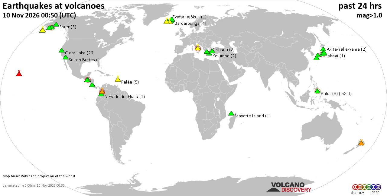
Volcano earthquake report for Tuesday, 10 November 2026
• M -0.6 - 63 km ENE of Pedro Bay, Alaska
• M 0.6 - 47 km ENE of Adak, Alaska
• M 2.3 - 54 km ENE of Susitna North, Alaska
• M 1.4 - 60 km WNW of Nikiski, Alaska
• M 1.1 - 109 km S of McCarthy, Alaska
|

#954235
Sun 08 Nov 2026 07:06:PM
|
Joined: Feb 2001
Posts: 800,656
Launch Director
|
|
Launch Director
Joined: Feb 2001
Posts: 800,656 |
SPC Nov 8, 2026 1930 UTC Day 3 Severe Thunderstorm OutlookSPC 1930Z Day 3 Outlook 
Day 3 Convective Outlook
NWS Storm Prediction Center Norman OK
0105 PM CST Sun Nov 08 2026

Valid 101200Z - 111200Z

...NO SEVERE THUNDERSTORM AREAS FORECAST...

...SUMMARY...
There appears little risk for severe thunderstorm activity across
the U.S. Tuesday through Tuesday night.

...Discussion...
Latest model output continues to indicate substantive further
amplification within the stronger westerlies across the mid-latitude
Pacific through this period. This is forecast to include building
mid-level ridging within the split downstream regime, across the
Great Basin through western Canadian Prairies.  As this occurs, it
appears that several shorter wavelength perturbations to the east
will dig and begin to consolidate into larger-scale mid-level
troughing across Manitoba/Ontario through the middle and lower
Missouri Valley by late Tuesday night.  However, the larger-scale
pattern east of the Rockies through the Atlantic Seaboard is likely
to remain at least broadly confluent, with an embedded
lower-latitude perturbation becoming increasingly sheared across
central Texas through the Gulf Coast states.

In association with this evolving regime, low probabilities for
thunderstorms may lingering near inverted surface troughing near,
but generally offshore of, lower/middle Texas coastal areas.
Otherwise, generally stable conditions are likely to prevail across
most of the nation through at least 12Z Wednesday.

..Kerr.. 11/08/2026
Read morehttps://www.spc.noaa.gov/products/outlook/day3otlk_1930.html
|
|



CMS The Best Conveyancing solicitors conveyancing quotes throughout the UK
For any webhosting enquiries please email webmaster@aus-city.com
|
|
Entire Thread
|
 SPC Nov 8, 2026 1930 UTC Day 3 Severe Thunderstorm Outlook |
Webmaster
|
Sun 08 Nov 2026 07:06:PM
|
|
Forums60
Topics919,598
Posts954,395
Members2,960
| |
Most Online102,106
Jul 10th, 2026
|
|
|
|
|

|









































