|
1 members (Alisa),
3,724
guests, and
24
robots. |
|
Key:
Admin,
Global Mod,
Mod
|
|
S |
M |
T |
W |
T |
F |
S |
|
1
|
2
|
3
|
4
|
5
|
6
|
7
|
|
8
|
9
|
10
|
11
|
12
|
13
|
14
|
|
15
|
16
|
17
|
18
|
19
|
20
|
21
|
|
22
|
23
|
24
|
25
|
26
|
27
|
28
|
|
29
|
30
|
|
|
|
|
|
|
There are no members with birthdays on this day. |
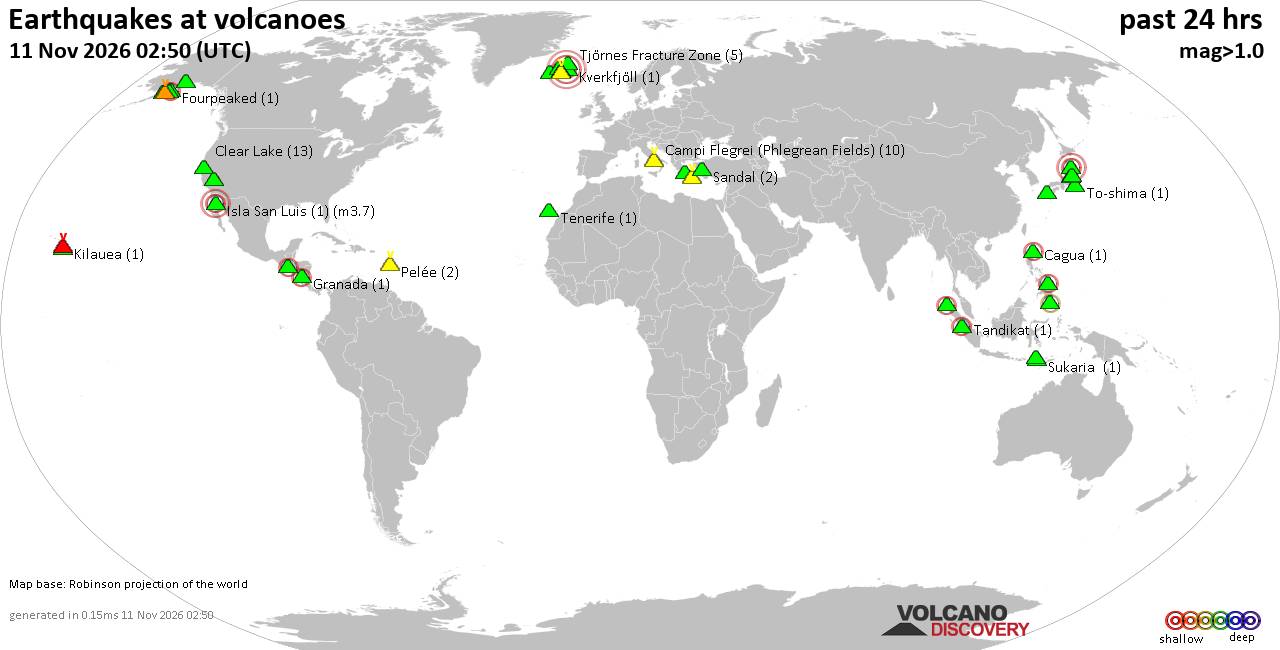
Volcano earthquake report for Wednesday, 11 November 2026
• M 2.5 - 39 km SW of Karluk, Alaska
• M 1.5 - 12 km ESE of Mammoth Lakes, CA
• M 2.2 - 88 km SE of Akutan, Alaska
• M 1.8 - 14 km E of Pearsall, Texas
• M 2.1 - 28 km SSW of Larsen Bay, Alaska
• M 1.6 - 64 km NW of Tatitlek, Alaska
|
|
|
Joined: Feb 2001
Posts: 800,656
Launch Director
|
|
Launch Director
Joined: Feb 2001
Posts: 800,656 |
SPC Day 2 Fire Weather OutlookSPC Day 2 Fire Weather Outlook 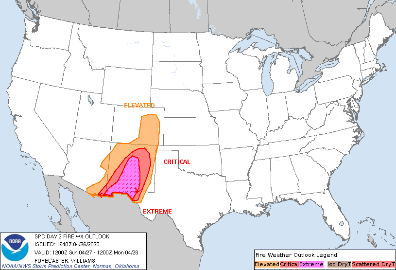
Day 2 Fire Weather Outlook
NWS Storm Prediction Center Norman OK
0135 PM CST Wed Nov 11 2026

Valid 121200Z - 131200Z

...Portions of the Southeast...
Elevated fire weather highlights were introduced stretching from the
FL Panhandle into much of central/southern GA and southwest SC. A
deepening surface low will move into the Mid Atlantic by late
Thursday while a trailing cold front continues to sweep across the
Deep South and Southeast. Mean boundary layer westerly flow
approaching 30 mph is expected in advance of a cold front which is
anticipated to move through the Southeast Thursday afternoon and
evening. Winds will veer to the northwest in a drier, post-frontal
environment by late afternoon and early evening resulting in a
corridor of RH values of 30-40%. The low RH coupled with west to
northwest winds of 10-20 mph with higher gusts to around 30 mph will
yield an enhanced fire weather environment.

A complicating factor will be preceding light rainfall currently
moving over the highlighted area, exiting towards the SC by
Wednesday evening. However, rainfall amounts have been minimal with
this event, generally less 0.05" resulting in a reduced impact to
fuels below denser canopied landscapes. Modification of the elevated
highlights are likely in future forecast updates based on final
rainfall distribution across the area, with expected enhanced winds
being the primary fire concern.

..Williams.. 11/11/2026

.PREV DISCUSSION... /ISSUED 1136 PM CST Tue Nov 10 2026/

...Synopsis...
The upper-level pattern over the CONUS will remain amplified on Day
2/Thursday with a deep trough over the eastern US, ridging over the
Intermountain West, and troughing moving onto West Coast. A cold
front will sweep southeast through the Southeast as a surface
cyclone moves off the Mid-Atlantic coast.

Dry and breezy post-frontal conditions will develop across portions
of the Southeast, and locally elevated conditions are likely from
the Lower Mississippi Valley into portions of the Carolinas.
Northwest-west sustained winds of 10-18 mph amid minimum RH of
25-40% are forecast from the Lower Mississippi Valley extending east
through the Deep South into the Carolinas. Forecast burning index
values may exceed the 80th percentile and approach the 90th
percentile in portions of this area. If the forecast continues to
trend towards little to no pre-frontal rainfall and better alignment
of dry/breezy conditions with modestly receptive fuels, an elevated
area may be warranted. Additionally, this is the type of scenario
where forecast guidance can under predict winds and over predict RH.

...Please see www.spc.noaa.gov/fire for graphic product...
Read morehttps://www.spc.noaa.gov/products/fire_wx/fwdy2.html
|
|



CMS The Best Conveyancing solicitors conveyancing quotes throughout the UK
For any webhosting enquiries please email webmaster@aus-city.com
|
|
Entire Thread
|

 SPC Day 2 Fire Weather Outlook |
Webmaster
|
2 hours ago
|
|
Forums60
Topics922,651
Posts957,448
Members2,960
| |
Most Online102,106
Jul 10th, 2026
|
|
|









































