|
|
|
0 members (),
1,230
guests, and
23
robots. |
|
Key:
Admin,
Global Mod,
Mod
|
|
S |
M |
T |
W |
T |
F |
S |
|
1
|
2
|
3
|
4
|
5
|
6
|
7
|
|
8
|
9
|
10
|
11
|
12
|
13
|
14
|
|
15
|
16
|
17
|
18
|
19
|
20
|
21
|
|
22
|
23
|
24
|
25
|
26
|
27
|
28
|
|
29
|
30
|
|
|
|
|
|
|
There are no members with birthdays on this day. |
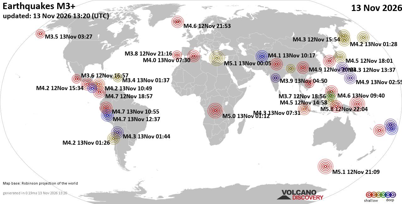
World Earthquake Report for Friday, 13 November 2026
• M 1.1 - 64 km ENE of Pedro Bay, Alaska
• M 4.1 - Fiji region
• M 1.7 - 59 km W of Cantwell, Alaska
• M 4.4 - 54 km WSW of Balangonan, Philippines
• M 1.8 - 16 km S of Kettleman City, CA
|
|
|
Joined: Feb 2001
Posts: 800,656
Launch Director
|
|
Launch Director
Joined: Feb 2001
Posts: 800,656 |
SPC Nov 13, 2026 1300 UTC Day 1 Convective OutlookSPC 1300Z Day 1 Outlook 
Day 1 Convective Outlook
NWS Storm Prediction Center Norman OK
0649 AM CST Fri Nov 13 2026

Valid 131300Z - 141200Z

...NO SEVERE THUNDERSTORM AREAS FORECAST...

...SUMMARY...
Organized severe thunderstorms are not expected across the U.S.
today or tonight.

...Southwest States including southern Arizona...
A southern-stream shortwave trough near the SoCal/northern Baja
coast will continue generally eastward along the international
border, while a more prominent upper trough amplifies a bit more
along the West Coast toward the Great Basin. Ahead of the southern
stream trough, isolated thunderstorm development will become more
probable by late morning into the afternoon across southern Arizona
as forcing for ascent overspreads a modestly moist/unstable boundary
layer.

A few stronger low-topped storms could develop/spread
north-northeastward into south-central/southeast Arizona by around
mid-afternoon. Some small hail and/or gusty winds are plausible, but
current thinking is that organized severe thunderstorm potential
will be curbed by a trend of weakening low/mid-tropospheric flow
into this afternoon (effective shear 25 kt or less), along with the
relatively cool thermal profiles and perceived limitations on
downdraft intensity. A bit later in the day, a somewhat stronger
combination of deep-layer winds and lapse rates/buoyancy could also
contribute to some stronger storm potential toward the Rio Grande
River valley of southern New Mexico and far west Texas, but overall
severe potential should remain low.

Across northern California, while lightning flash potential will
likely remain limited, some convective enhancement to the
inland-spreading precipitation may influence some stronger
near-coastal wind gusts. Additional low-topped convection is
expected as lapse rates steepen within the post-frontal environment
later today for near-coastal areas and possibly parts of the
interior valley.

..Guyer/Mead.. 11/13/2026
Read morehttps://www.spc.noaa.gov/products/outlook/day1otlk_1300.html
|
|



CMS The Best Conveyancing solicitors conveyancing quotes throughout the UK
For any webhosting enquiries please email webmaster@aus-city.com
|
|
Entire Thread
|

 SPC Nov 13, 2026 1300 UTC Day 1 Convective Outlook |
Webmaster
|
1 hour ago
|
|
Forums60
Topics925,849
Posts960,646
Members2,960
| |
Most Online102,106
Jul 10th, 2026
|
|
|
|
|

|









































