|
|
|
0 members (),
1,776
guests, and
23
robots. |
|
Key:
Admin,
Global Mod,
Mod
|
|
S |
M |
T |
W |
T |
F |
S |
|
1
|
2
|
3
|
4
|
5
|
6
|
7
|
|
8
|
9
|
10
|
11
|
12
|
13
|
14
|
|
15
|
16
|
17
|
18
|
19
|
20
|
21
|
|
22
|
23
|
24
|
25
|
26
|
27
|
28
|
|
29
|
30
|
|
|
|
|
|
|
There are no members with birthdays on this day. |
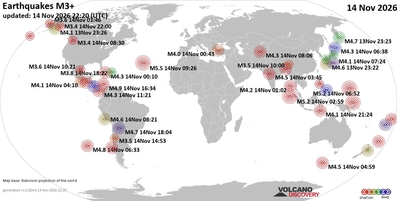
World Earthquake Report for Saturday, 14 November 2026
• M 1.7 - 17 km E of Little Lake, CA
• M 1.3 - 8 km ESE of Cloverdale, CA
• M 3.4 - 37 km ESE of Chenega, Alaska
• M 3.4 - 37 km ESE of Chenega, Alaska
• M 3.1 - 49 km WNW of Nanwalek, Alaska
|
|
|
Joined: Feb 2001
Posts: 800,656
Launch Director
|
|
Launch Director
Joined: Feb 2001
Posts: 800,656 |
SPC Nov 14, 2026 2000 UTC Day 1 Convective OutlookSPC 2000Z Day 1 Outlook 
Day 1 Convective Outlook
NWS Storm Prediction Center Norman OK
0159 PM CST Sat Nov 14 2026

Valid 142000Z - 151200Z

...THERE IS A MARGINAL RISK OF SEVERE THUNDERSTORMS THIS AFTERNOON
AND EVENING OVER PARTS OF WEST TEXAS...

...SUMMARY...
A few strong thunderstorms capable of hail are possible this
afternoon and evening over a small part of West Texas.

...20Z Update...
The forecast remains on track, and minimal changes were needed with
this update. Thunderstorms are expected to gradually increase in
coverage and intensity along/north of a stationary front draped
across the TX South Plains this afternoon -- aided by ascent in the
left exit region of an approaching mid/upper-level jet streak
(evident in WV imagery). The latest high-resolution guidance shows
the onset of this activity between 22-01Z, and persisting into
tonight. Given the expectation for storms to be mostly elevated atop
the frontal surface, hail remains the primary concern.

..Weinman.. 11/14/2026

.PREV DISCUSSION... /ISSUED 1021 AM CST Sat Nov 14 2026/

...West TX...
A shortwave trough over central NM this morning will track eastward
into west TX this afternoon.  As this occurs, scattered showers and
thunderstorms will develop across eastern NM/west TX in a marginally
unstable air mass.  Visible satellite imagery continues to show
considerable cloud cover, suggesting convection will likely be
elevated.  Nevertheless, steep mid level lapse rates, cold
temperatures aloft, and strong deep layer shear will support
occasional supercell structures capable of hail - mainly in the
Lubbock vicinity.  A consensus of morning CAMS and ML guidance also
agree on this limited threat.  Therefore have opted for a small MRGL
risk area for this afternoon and early evening.
Read morehttps://www.spc.noaa.gov/products/outlook/day1otlk_2000.html
|
|



CMS The Best Conveyancing solicitors conveyancing quotes throughout the UK
For any webhosting enquiries please email webmaster@aus-city.com
|
|
Entire Thread
|

 SPC Nov 14, 2026 2000 UTC Day 1 Convective Outlook |
Webmaster
|
Yesterday at 08:02 PM
|
|
Forums60
Topics927,996
Posts962,793
Members2,960
| |
Most Online102,106
Jul 10th, 2026
|
|
|
|
|

|









































