|
|
|
0 members (),
2,324
guests, and
25
robots. |
|
Key:
Admin,
Global Mod,
Mod
|
|
S |
M |
T |
W |
T |
F |
S |
|
1
|
2
|
3
|
4
|
5
|
6
|
7
|
|
8
|
9
|
10
|
11
|
12
|
13
|
14
|
|
15
|
16
|
17
|
18
|
19
|
20
|
21
|
|
22
|
23
|
24
|
25
|
26
|
27
|
28
|
|
29
|
30
|
|
|
|
|
|
|
There are no members with birthdays on this day. |
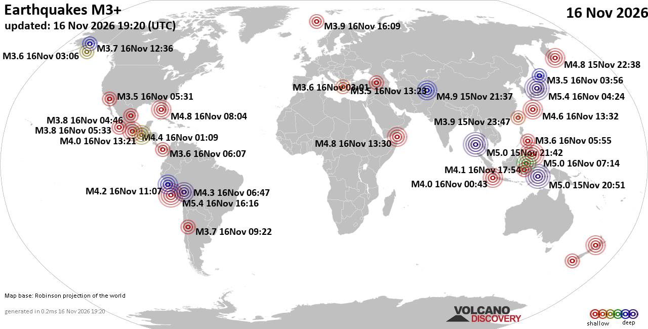
World Earthquake Report for Monday, 16 November 2026
• Moderate mag. 4.5 earthquake - 160 km northwest of Kavieng, New Ireland Pro...
• M 4.4 - off the coast of Oregon
• M 2.3 - 14 km ESE of Clam Gulch, Alaska
• M 3.9 - Rat Islands, Aleutian Islands, Alaska
• M 1.8 - 8 km NW of Round Valley, CA
• M 0.7 - 9 km S of Idyllwild, CA
|
|
|
Joined: Feb 2001
Posts: 800,656
Launch Director
|
|
Launch Director
Joined: Feb 2001
Posts: 800,656 |
SPC Nov 16, 2026 1730 UTC Day 2 Convective OutlookSPC 1730Z Day 2 Outlook 
Day 2 Convective Outlook
NWS Storm Prediction Center Norman OK
1110 AM CST Mon Nov 16 2026

Valid 171200Z - 181200Z

...NO SEVERE THUNDERSTORM AREAS FORECAST...

...SUMMARY...
Severe thunderstorms are unlikely Tuesday.

...Synopsis...
Thunderstorms are expected across portions of the Florida Peninsula
and the greater Four Corners region tomorrow through tomorrow
evening. Latest water-vapor imagery depicts an upper wave and
attendant convection moving across the central and northern Gulf.
This wave will migrate eastward towards the FL peninsula through
tomorrow as it de-amplifies. Seasonal moisture in place across
southern FL may support a few deeper/stronger cells, but with
stronger forcing for ascent displaced over the Gulf, the expectation
is that the most intense convection will remain off the southwest
coast. This activity may impact the westernmost Keys, but poor lapse
rates with eastward extent should modulate overall storm intensity.
Further north, modest moisture return along Florida's Atlantic coast
may support a few thunderstorms by late Tuesday afternoon, but this
activity should remain below severe limits.

Across the West, an upper wave approaching CA will continue eastward
over the next 48 hours, overspreading the Four Corners during peak
heating Tuesday afternoon. Despite strong mid-level flow, buoyancy
profiles are expected to remain too shallow and modest to support
deep/robust convection. 12z guidance suggests gusty winds may
accompany the stronger cells, but convective wind gusts should be
comparable to background pressure gradient-driven gusts within the
higher terrain.

..Moore.. 11/16/2026
Read morehttps://www.spc.noaa.gov/products/outlook/day2otlk_1730.html
|
|



CMS The Best Conveyancing solicitors conveyancing quotes throughout the UK
For any webhosting enquiries please email webmaster@aus-city.com
|
|
Entire Thread
|

 SPC Nov 16, 2026 1730 UTC Day 2 Convective Outlook |
Webmaster
|
3 hours ago
|
|
Forums60
Topics930,716
Posts965,513
Members2,960
| |
Most Online102,106
Jul 10th, 2026
|
|
|
|
|

|









































