|
|
|
0 members (),
2,668
guests, and
24
robots. |
|
Key:
Admin,
Global Mod,
Mod
|
|
S |
M |
T |
W |
T |
F |
S |
|
1
|
2
|
3
|
4
|
5
|
6
|
7
|
|
8
|
9
|
10
|
11
|
12
|
13
|
14
|
|
15
|
16
|
17
|
18
|
19
|
20
|
21
|
|
22
|
23
|
24
|
25
|
26
|
27
|
28
|
|
29
|
30
|
|
|
|
|
|
|
There are no members with birthdays on this day. |
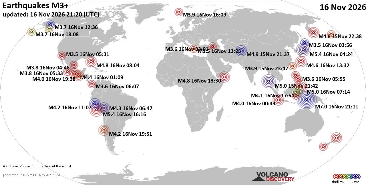
World Earthquake Report for Monday, 16 November 2026
• M 6.6 - 151 km WSW of Tual, Indonesia
• M 0.6 - 18 km ESE of Anza, CA
• M 1.3 - 23 km ENE of San Ardo, CA
• M 2.1 - 17 km SE of Leilani Estates, Hawaii
• M 1.9 - 96 km N of Yakutat, Alaska
• M 1.7 - 17 km SSW of Newport Beach, CA
|
|
|
Joined: Feb 2001
Posts: 800,656
Launch Director
|
|
Launch Director
Joined: Feb 2001
Posts: 800,656 |
SPC Nov 16, 2026 2000 UTC Day 1 Convective OutlookSPC 2000Z Day 1 Outlook 
Day 1 Convective Outlook
NWS Storm Prediction Center Norman OK
0147 PM CST Mon Nov 16 2026

Valid 162000Z - 171200Z

...NO SEVERE THUNDERSTORM AREAS FORECAST...

...SUMMARY...
Severe thunderstorms are not expected through tonight.

...20Z Update...
No changes were made with this update. The deeper convection and
related lightning potential has generally remained off the Pacific
Northwest Coast, where a north/south-oriented stationary boundary
and several embedded MCVs are present. Some of this activity may
move onshore later today as the upper trough and accompanying
surface boundary shift inland, though thunderstorm coverage should
remain isolated. See the previous discussion below for more
information.

..Weinman.. 11/16/2026

.PREV DISCUSSION... /ISSUED 1002 AM CST Mon Nov 16 2026/

...Synopsis...
An upper trough off the CA Coast this morning will gradually amplify
as it moves inland, approaching the Great Basin and Southwest by
early Tuesday morning. Cold temperatures aloft, with 500 mb
temperatures around -25 to -30 C, may support occasional lightning
flashes with low-topped convection across the coastal Pacific
Northwest and northern/central CA today. As large-scale ascent
associated with the upper trough spreads eastward and lapse rates
diurnally steepen, isolated thunderstorms could develop into parts
of the Great Basin and lower CO River Valley late this afternoon
into tonight. Overall, modest low-level moisture and related weak
instability are expected to greatly limit severe potential.
Read morehttps://www.spc.noaa.gov/products/outlook/day1otlk_2000.html
|
|



CMS The Best Conveyancing solicitors conveyancing quotes throughout the UK
For any webhosting enquiries please email webmaster@aus-city.com
|
|
Entire Thread
|

 SPC Nov 16, 2026 2000 UTC Day 1 Convective Outlook |
Webmaster
|
Yesterday at 07:50 PM
|
|
Forums60
Topics930,953
Posts965,750
Members2,960
| |
Most Online102,106
Jul 10th, 2026
|
|
|
|
|

|









































