|
|
|
0 members (),
3,740
guests, and
26
robots. |
|
Key:
Admin,
Global Mod,
Mod
|
|
S |
M |
T |
W |
T |
F |
S |
|
1
|
2
|
3
|
4
|
5
|
6
|
7
|
|
8
|
9
|
10
|
11
|
12
|
13
|
14
|
|
15
|
16
|
17
|
18
|
19
|
20
|
21
|
|
22
|
23
|
24
|
25
|
26
|
27
|
28
|
|
29
|
30
|
|
|
|
|
|
|
There are no members with birthdays on this day. |
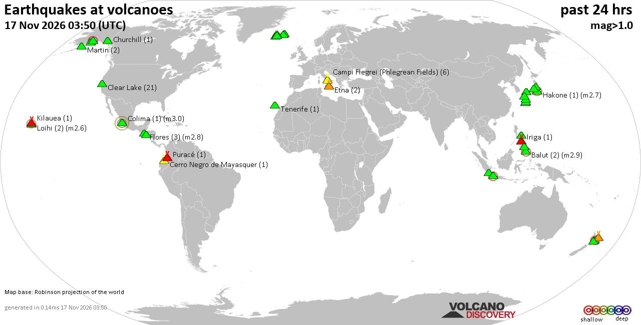
Volcano earthquake report for Tuesday, 17 November 2026
• M 5.1 - 205 km NW of Port-Olry, Vanuatu
• M 1.2 - 67 km NE of Nikolski, Alaska
• M 6.0 - 64 km SSE of Shima, Japan
• M 2.4 - 9 km SSE of Maria Antonia, Puerto Rico
• M 6.6 - 148 km WSW of Tual, Indonesia
|
|
|
Joined: Feb 2001
Posts: 800,656
Launch Director
|
|
Launch Director
Joined: Feb 2001
Posts: 800,656 |
SPC Nov 17, 2026 0600 UTC Day 1 Convective OutlookSPC 1200Z Day 1 Outlook 
Day 1 Convective Outlook
NWS Storm Prediction Center Norman OK
1154 PM CST Mon Nov 16 2026

Valid 171200Z - 181200Z

...NO SEVERE THUNDERSTORM AREAS FORECAST...

...SUMMARY...
Severe thunderstorms are not forecast in the U.S. today and tonight.

...DISCUSSION...
At mid-levels, a ridge will build northeastward into the Mississippi
and Great Lakes region today as a trough moves across the Gulf.
Ahead of the trough, a moist airmass will be in place from near the
trough eastward across the Florida Peninsula. A large cluster of
thunderstorms will develop ahead of the trough over the eastern Gulf
this afternoon. Ahead of this large cluster, isolated storms are
expected to develop during the mid to late afternoon across parts of
the western Florida Peninsula. The eastern edge of the large complex
will likely affect parts of western Florida during the evening.
Although a strong wind gust or two will be possible, no appreciable
severe weather threat is forecast.

In the western U.S., an upper-level trough will approach the West
Coast today. Ahead of this system, isolated storms will be possible
along the coasts of northern California and far southwest Oregon.
Scattered storms will also be possible across parts of the
Intermountain West. Instability in these two areas is expected to be
too weak for a severe threat. Elsewhere across the continental U.S.,
thunderstorms are not forecast today and tonight.

..Broyles/Chalmers.. 11/17/2026
Read morehttps://www.spc.noaa.gov/products/outlook/day1otlk_1200.html
|
|



CMS The Best Conveyancing solicitors conveyancing quotes throughout the UK
For any webhosting enquiries please email webmaster@aus-city.com
|
|
Entire Thread
|

 SPC Nov 17, 2026 0600 UTC Day 1 Convective Outlook |
Webmaster
|
1 hour ago
|
|
Forums60
Topics931,470
Posts966,267
Members2,960
| |
Most Online102,106
Jul 10th, 2026
|
|
|
|
|

|









































