|
|
|
0 members (),
2,700
guests, and
22
robots. |
|
Key:
Admin,
Global Mod,
Mod
|
|
S |
M |
T |
W |
T |
F |
S |
|
1
|
2
|
3
|
4
|
5
|
6
|
7
|
|
8
|
9
|
10
|
11
|
12
|
13
|
14
|
|
15
|
16
|
17
|
18
|
19
|
20
|
21
|
|
22
|
23
|
24
|
25
|
26
|
27
|
28
|
|
29
|
30
|
|
|
|
|
|
|
There are no members with birthdays on this day. |
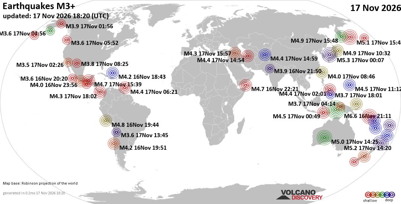
World Earthquake Report for Tuesday, 17 November 2026
• M 2.0 - 18 km ENE of Tilden, Texas
• M 1.0 - 6 km ENE of Calumet, Oklahoma
• M 0.3 - 3 km NNW of The Geysers, CA
• M 1.6 - 15 km NNE of Milford, Utah
• M 1.5 - 15 km NNE of Milford, Utah
|
|
|
Joined: Feb 2001
Posts: 800,656
Launch Director
|
|
Launch Director
Joined: Feb 2001
Posts: 800,656 |
SPC Nov 17, 2026 1300 UTC Day 1 Convective OutlookSPC 1300Z Day 1 Outlook 
Day 1 Convective Outlook
NWS Storm Prediction Center Norman OK
0650 AM CST Tue Nov 17 2026

Valid 171300Z - 181200Z

...NO SEVERE THUNDERSTORM AREAS FORECAST...

...SUMMARY...
Severe thunderstorms are not expected across the U.S. today or
tonight.

...Western States...
A northeastward-progressive shortwave trough over southern
California and lower Colorado River valley early this morning will
reach the central Rockies tonight. Sufficient moisture/instability
and ample forcing for ascent have contributed to isolated
thunderstorms in the predawn hours across Nevada and lower Colorado
River valley, including some sustained linear bands of convection
ongoing across northwest Arizona.

Diurnal heating and maximized destabilization, albeit rather weak
overall (a couple hundred J/kg MUCAPE at most), and the anticipated
timing of the cold front and forcing for ascent, imply some
potential for strong storms into this afternoon across eastern
Arizona near the Rim/highlands, northward into the Four Corners
region. While some hail and/or convectively enhanced gusty winds
could occur, current thinking is that organized severe storm
potential should remain low in the presence of minimal overall
buoyancy.

...South Florida...
An aggregate complex of ongoing convection over the east Gulf should
continue to slowly shift/refocus southward today. While a
moist/modestly unstable air mass resides across south Florida, in
conjunction with low-level easterly flow, current thinking is that
the ongoing offshore storms will tend to remain to the west and
south over the open Gulf waters, with seemingly limited severe storm
potential inland.

..Guyer/Mead.. 11/17/2026
Read morehttps://www.spc.noaa.gov/products/outlook/day1otlk_1300.html
|
|



CMS The Best Conveyancing solicitors conveyancing quotes throughout the UK
For any webhosting enquiries please email webmaster@aus-city.com
|
|
Entire Thread
|

 SPC Nov 17, 2026 1300 UTC Day 1 Convective Outlook |
Webmaster
|
6 hours ago
|
|
Forums60
Topics932,300
Posts967,097
Members2,960
| |
Most Online102,106
Jul 10th, 2026
|
|
|
|
|

|









































