|
|
|
0 members (),
1,780
guests, and
27
robots. |
|
Key:
Admin,
Global Mod,
Mod
|
|
S |
M |
T |
W |
T |
F |
S |
|
1
|
2
|
3
|
4
|
5
|
6
|
7
|
|
8
|
9
|
10
|
11
|
12
|
13
|
14
|
|
15
|
16
|
17
|
18
|
19
|
20
|
21
|
|
22
|
23
|
24
|
25
|
26
|
27
|
28
|
|
29
|
30
|
|
|
|
|
|
|
There are no members with birthdays on this day. |
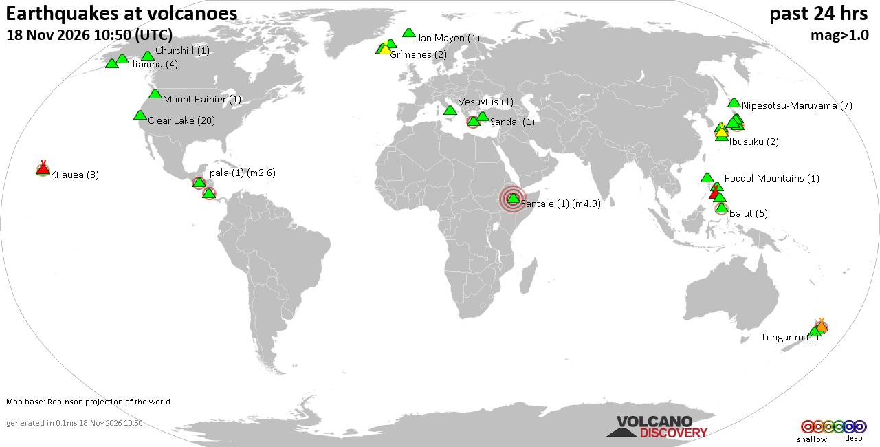
Volcano earthquake report for Wednesday, 18 November 2026
• M 2.4 - 6 km W of Cleveland, North Carolina
• M 4.9 - 43 km NW of Oxford, New Zealand
• M 5.3 - 16 km ESE of Comandău, Romania
• M 4.4 - 6 km ENE of Bachajón, Mexico
• M 1.8 - 8 km S of Pāhala, Hawaii
|
|
|
Joined: Feb 2001
Posts: 800,656
Launch Director
|
|
Launch Director
Joined: Feb 2001
Posts: 800,656 |
SPC Nov 18, 2026 0700 UTC Day 2 Convective OutlookSPC 0700Z Day 2 Outlook 
Day 2 Convective Outlook
NWS Storm Prediction Center Norman OK
1259 AM CST Wed Nov 18 2026

Valid 191200Z - 201200Z

...THERE IS A MARGINAL RISK OF SEVERE THUNDERSTORMS ACROSS THE
CENTRAL VALLEY OF CALIFORNIA...

...SUMMARY...
Isolated strong to severe thunderstorms are possible over portions
of California with damaging gusts and a brief tornado possible.
Additional non-severe storms are possible across the Great Basin,
and into the Southeast Thursday and Thursday night.

...CA Central Valley...
A deep upper low and embedded shortwave will move inland over the
northern/central CA coast early Thursday. Attendant to the upper
low, very strong westerly flow aloft will overspread a modestly
moist air mass (dewpoints in the upper 40s to low 50s F) south of a
weak surface low over the Central Valley. A narrow convective band
is forecast to move inland during the morning with modest clearing
in its wake. Mid-level temperatures near -25C will steepen lapse
rates (7-7.5 C/km) amid weak diurnal heating, supporting
destabilization with MLCAPE of 250-500 J/kg through the lowest 6-7
km.

Concurrent with the shallow unstable profiles, terrain-enhanced
southerly winds are expected across the valley. Elongated and
modestly curved hodographs may support some stronger storms in the
form of organized low-topped clusters or transient supercells. A
low-end risk for damaging gusts and perhaps a brief tornado is
possible across parts of the Central Valley through the morning and
early afternoon. Thereafter, the arrival of the surface cold front
and veering  winds will favor cooler surface temperatures and
weakening buoyancy.

Farther northeast into the Great Basin, more limited surface
moisture is forecast across NV and western UT. Strong ascent from
the approaching upper low will still support modest buoyancy
favoring scattered thunderstorms. However, the weak buoyancy should
preclude much severe risk.

...Southeast...
A weak upper low over the Gulf will continue to diminish as diffuse
surface cyclones moves from the central Gulf and off the eastern FL
coast. Strengthening low-level flow will continue to promote
isolated to perhaps scattered thunderstorms across the region. Weak
flow aloft through much of the CAPE-bearing layer will limit the
potential for severe convection, but sporadic gusts remain possible.

..Lyons.. 11/18/2026
Read morehttps://www.spc.noaa.gov/products/outlook/day2otlk_0700.html
|
|



CMS The Best Conveyancing solicitors conveyancing quotes throughout the UK
For any webhosting enquiries please email webmaster@aus-city.com
|
|
Entire Thread
|

 SPC Nov 18, 2026 0700 UTC Day 2 Convective Outlook |
Webmaster
|
6 hours ago
|
|
Forums60
Topics933,619
Posts968,416
Members2,960
| |
Most Online102,106
Jul 10th, 2026
|
|
|
|
|

|









































