|
0 members (),
1,509
guests, and
24
robots. |
|
Key:
Admin,
Global Mod,
Mod
|
|
S |
M |
T |
W |
T |
F |
S |
|
1
|
2
|
3
|
4
|
5
|
6
|
7
|
|
8
|
9
|
10
|
11
|
12
|
13
|
14
|
|
15
|
16
|
17
|
18
|
19
|
20
|
21
|
|
22
|
23
|
24
|
25
|
26
|
27
|
28
|
|
29
|
30
|
|
|
|
|
|
|
There are no members with birthdays on this day. |
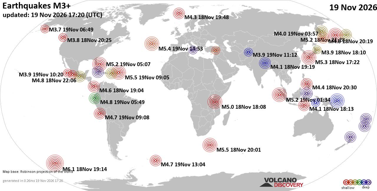
World Earthquake Report for Thursday, 19 November 2026
• M 1.8 - 23 km WSW of Ackerly, Texas
• M 0.7 - 2 km N of The Geysers, CA
• M 1.9 - 23 km E of Beluga, Alaska
• M 1.3 - 1 km E of The Geysers, CA
• M 1.2 - 14 km NNE of Milford, Utah
• M 4.4 - off the coast of Oregon
|
|
|
Joined: Feb 2001
Posts: 800,656
Launch Director
|
|
Launch Director
Joined: Feb 2001
Posts: 800,656 |
SPC MD 2458MD 2458 CONCERNING SEVERE POTENTIAL...WATCH UNLIKELY FOR CENTRAL SAN JOAQUIN VALLEY AND SIERRA FOOTHILLS 
Mesoscale Discussion 2458
NWS Storm Prediction Center Norman OK
1241 PM CST Thu Nov 19 2026

Areas affected...central San Joaquin Valley and Sierra Foothills

Concerning...Severe potential...Watch unlikely

Valid 191841Z - 192145Z

Probability of Watch Issuance...20 percent

SUMMARY...A few storms are expected to develop over the next few
hours across the central San Joaquin Valley, and into the foothills
of the Sierra. Some storms may produce hail and/or a brief/weak
tornado.

DISCUSSION...A cold midlevel trough is moving into central CA, with
500 mb temperatures at or below -25 C. Visible imagery shows pockets
of heating across the valley from Merced to Hanford, where southeast
surface winds are gusting to over 20 kt and temperatures are
approaching 60 F.

While instability is generally low in magnitude, modest heating,
steep lapse rates aloft and PWAT around 0.75" should be sufficient
for isolated strong to severe cells later this afternoon.
Indications are that activity near the cold front may strengthen as
it translates southward, intersecting the foothills. The latest HNX
VWP shows 0-1 km SRH near 150 m2/s2, and otherwise favorable
deep-layer shear to support small supercells producing hail
(possibly substantial amounts of small hail), and perhaps a brief
tornado.

..Jewell/Gleason.. 11/19/2026

...Please see www.spc.noaa.gov for graphic product...

ATTN...WFO...HNX...STO...MTR...

LAT...LON   37301946 36781887 36381851 36101848 36011863 36081920
            36382061 36732113 37052131 37392092 37652066 38022043
            37982021 37611983 37301946

MOST PROBABLE PEAK TORNADO INTENSITY...UP TO 90 MPH
MOST PROBABLE PEAK WIND GUST...UP TO 60 MPH
MOST PROBABLE PEAK HAIL SIZE...UP TO 1.25 IN
Read morehttps://www.spc.noaa.gov/products/md/md2458.html
|
|



CMS The Best Conveyancing solicitors conveyancing quotes throughout the UK
For any webhosting enquiries please email webmaster@aus-city.com
|
|
Entire Thread
|

 SPC MD 2458 |
Webmaster
|
1 hour ago
|
|
Forums60
Topics935,961
Posts970,758
Members2,960
| |
Most Online102,106
Jul 10th, 2026
|
|
|









































