|
|
|
0 members (),
1,768
guests, and
31
robots. |
|
Key:
Admin,
Global Mod,
Mod
|
|
S |
M |
T |
W |
T |
F |
S |
|
1
|
2
|
3
|
4
|
5
|
6
|
7
|
|
8
|
9
|
10
|
11
|
12
|
13
|
14
|
|
15
|
16
|
17
|
18
|
19
|
20
|
21
|
|
22
|
23
|
24
|
25
|
26
|
27
|
28
|
|
29
|
30
|
|
|
|
|
|
|
There are no members with birthdays on this day. |
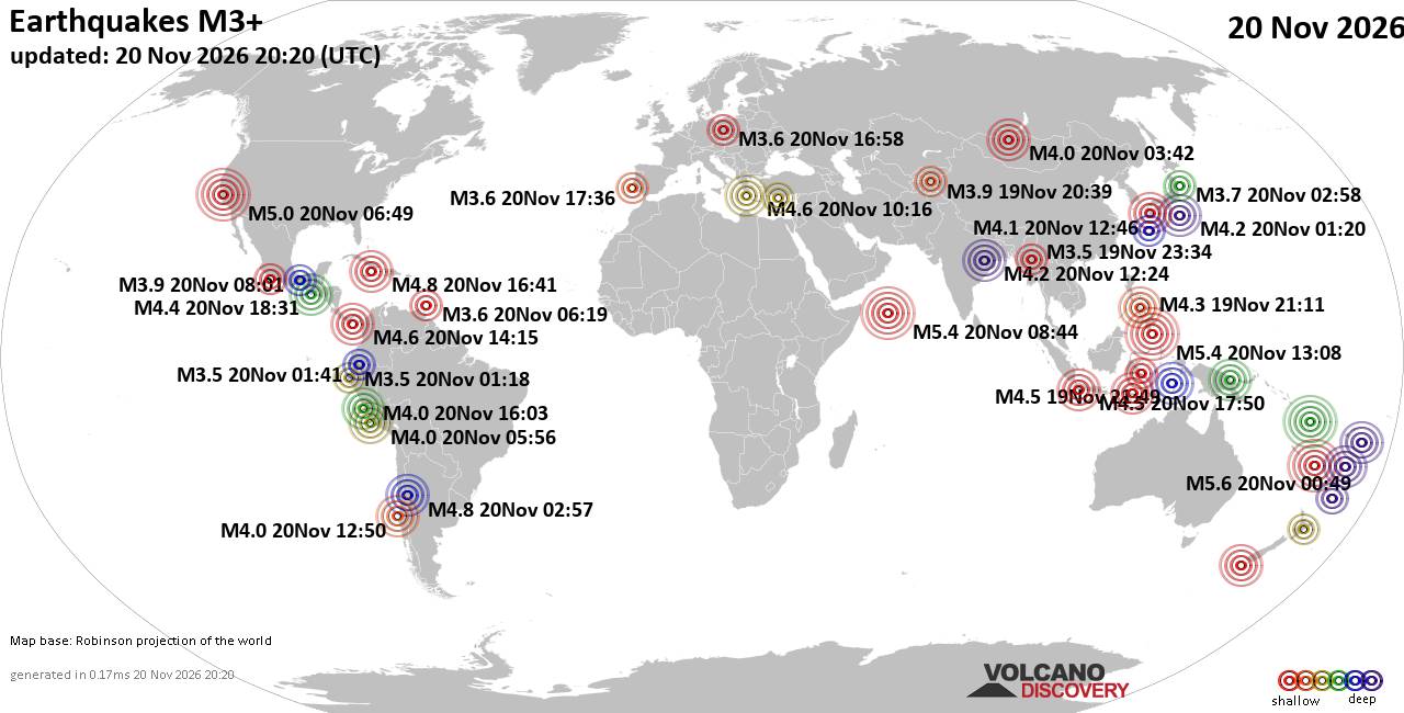
World Earthquake Report for Friday, 20 November 2026
• M 1.6 - 8 km NW of The Geysers, CA
• M 4.4 - 109 km NNE of Lospalos, Timor Leste
• M 3.9 - 1 km NW of Commerce, CA
• M 2.0 - 8 km NE of Aguanga, CA
• M 1.5 - 28 km NNE of Montecito, CA
|
|
|
Joined: Feb 2001
Posts: 800,656
Launch Director
|
|
Launch Director
Joined: Feb 2001
Posts: 800,656 |
SPC Nov 20, 2026 1930 UTC Day 3 Severe Thunderstorm OutlookSPC 1930Z Day 3 Outlook 
Day 3 Convective Outlook
NWS Storm Prediction Center Norman OK
0130 PM CST Fri Nov 20 2026

Valid 221200Z - 231200Z

...NO SEVERE THUNDERSTORM AREAS FORECAST...

...SUMMARY...
Scattered thunderstorms are possible over parts of the middle and
lower Mississippi Valley Sunday.

...Synopsis...
A shortwave trough over Oklahoma early Sunday morning will continue
eastward. With time, this feature will lose amplitude and mid-level
winds will be on a weakening trend through the day. At the surface,
a cold front will push eastward along with the trough. Southward
progress into South Texas is expected, though the front could tend
to slow with the trough remaining much farther northeast.

...Central Arkansas into northern Louisiana...
Despite the deamplifying shortwave trough and weakening mid-level
winds with time, temperatures aloft will remain cold (around -15 C
at 500 mb). Where surface heating is maximized, 500-750 J/kg MLCAPE
is possible. With sufficient shear for marginal supercell
structures, the strongest storms could be capable of small hail.
Given modest mid-level lapse rates and a downward trend in
shear/mid-level ascent with time, confidence in severe hail remains
low.

...South Texas...
Rich surface moisture will remain in place ahead of the cold front.
Though no notable shortwave trough/forcing will be present aloft, a
belt of stronger mid-level winds within a weak subtropical jet will
exist across the region. The degree of surface heating will be
questionable given the expected cloud cover present. Convergence
along the front may be enough to initiate thunderstorms during the
afternoon. A stronger storm or two could be possible, but modest
mid-level lapse rates and uncertain frontal progression precludes
probabilities.

..Wendt.. 11/20/2026
Read morehttps://www.spc.noaa.gov/products/outlook/day3otlk_1930.html
|
|



CMS The Best Conveyancing solicitors conveyancing quotes throughout the UK
For any webhosting enquiries please email webmaster@aus-city.com
|
|
Entire Thread
|

 SPC Nov 20, 2026 1930 UTC Day 3 Severe Thunderstorm Outlook |
Webmaster
|
1 hour ago
|
|
Forums60
Topics937,862
Posts972,659
Members2,960
| |
Most Online102,106
Jul 10th, 2026
|
|
|
|
|

|









































