|
|
|
0 members (),
1,472
guests, and
25
robots. |
|
Key:
Admin,
Global Mod,
Mod
|
|
S |
M |
T |
W |
T |
F |
S |
|
1
|
2
|
3
|
4
|
5
|
6
|
7
|
|
8
|
9
|
10
|
11
|
12
|
13
|
14
|
|
15
|
16
|
17
|
18
|
19
|
20
|
21
|
|
22
|
23
|
24
|
25
|
26
|
27
|
28
|
|
29
|
30
|
|
|
|
|
|
|
There are no members with birthdays on this day. |
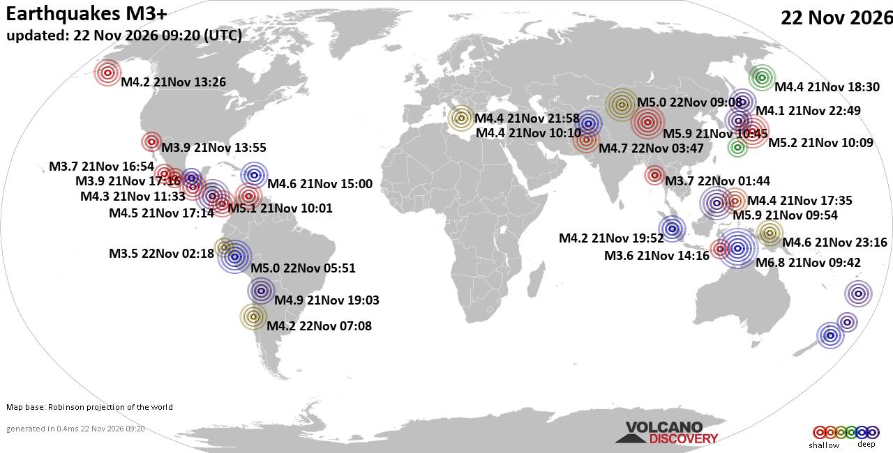
World Earthquake Report for Sunday, 22 November 2026
• M 2.8 - 152 km S of Cordova, Alaska
• M 5.4 - 159 km E of Masohi, Indonesia
• M 4.2 - south of the Fiji Islands
• M 0.7 - 5 km WNW of The Geysers, CA
• Strong mag. 5.0 earthquake - 47 km southeast of Ürümqi, Xinjiang, China, ...
|
|
|
Joined: Feb 2001
Posts: 800,656
Launch Director
|
|
Launch Director
Joined: Feb 2001
Posts: 800,656 |
SPC Nov 22, 2026 0100 UTC Day 1 Convective OutlookSPC 0100Z Day 1 Outlook 
Day 1 Convective Outlook
NWS Storm Prediction Center Norman OK
0656 PM CST Sat Nov 21 2026

Valid 220100Z - 221200Z

...THERE IS A MARGINAL RISK OF SEVERE THUNDERSTORMS FOR PARTS OF
SOUTHEAST FL...AND ALSO FOR WESTERN/NORTHERN OK AND VICINITY...

...SUMMARY...
Storms capable of a tornado or two and locally strong gusts remain
possible this evening across parts of south Florida. Strong to
locally severe storms remain possible across western Oklahoma and
vicinity later this evening.

...South Florida...
Supercells with occasional low-level rotation are ongoing this
evening across parts of south Florida. Rich moisture, moderate
MLCAPE, and some enlargement of low-level hodographs (with 0-1 km
SRH 100-200 m2/s2 per the 00Z MFL sounding and regional VWPs) will
continue to support a threat of a tornado or two before convection
weakens and/or moves offshore by late evening. See MCD 2461 and WW
706 for more information.

...Western/northern OK and vicinity...
Convection has been rather weak thus far across the southern Plains,
but increasing elevated moisture beneath relatively cool
temperatures aloft will eventually contribute to MUCAPE in the
500-1000 J/kg range. Storm coverage will increase with time this
evening as a shortwave trough approaches the region from the
southern Rockies. Effective shear will become sufficient for modest
storm organization, and isolated hail and strong gusts may accompany
the strongest storms as they move across northern/western OK and
vicinity.

..Dean.. 11/22/2026
Read morehttps://www.spc.noaa.gov/products/outlook/day1otlk_0100.html
|
|



CMS The Best Conveyancing solicitors conveyancing quotes throughout the UK
For any webhosting enquiries please email webmaster@aus-city.com
|
|
Entire Thread
|

 SPC Nov 22, 2026 0100 UTC Day 1 Convective Outlook |
Webmaster
|
10 hours ago
|
|
Forums60
Topics940,015
Posts974,812
Members2,960
| |
Most Online102,106
Jul 10th, 2026
|
|
|
|
|

|









































