|
|
|
0 members (),
1,472
guests, and
25
robots. |
|
Key:
Admin,
Global Mod,
Mod
|
|
S |
M |
T |
W |
T |
F |
S |
|
1
|
2
|
3
|
4
|
5
|
6
|
7
|
|
8
|
9
|
10
|
11
|
12
|
13
|
14
|
|
15
|
16
|
17
|
18
|
19
|
20
|
21
|
|
22
|
23
|
24
|
25
|
26
|
27
|
28
|
|
29
|
30
|
|
|
|
|
|
|
There are no members with birthdays on this day. |
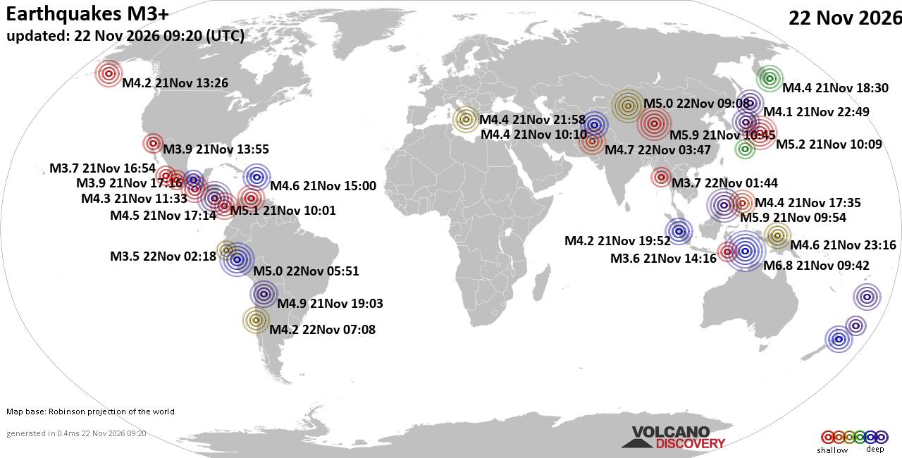
World Earthquake Report for Sunday, 22 November 2026
• M 2.8 - 152 km S of Cordova, Alaska
• M 5.4 - 159 km E of Masohi, Indonesia
• M 4.2 - south of the Fiji Islands
• M 0.7 - 5 km WNW of The Geysers, CA
• Strong mag. 5.0 earthquake - 47 km southeast of Ürümqi, Xinjiang, China, ...
|
|
|
Joined: Feb 2001
Posts: 800,656
Launch Director
|
|
Launch Director
Joined: Feb 2001
Posts: 800,656 |
SPC Nov 22, 2026 0700 UTC Day 2 Convective OutlookSPC 0700Z Day 2 Outlook 
Day 2 Convective Outlook
NWS Storm Prediction Center Norman OK
1254 AM CST Sun Nov 22 2026

Valid 231200Z - 241200Z

...NO SEVERE THUNDERSTORM AREAS FORECAST...

...SUMMARY...
Severe storms are unlikely Monday.

...Synopsis...
Mid-level troughing is forecast to intensify over the eastern Great
Lakes and Northeastern US, dragging a strong cold front through the
Gulf and off the Atlantic coast. To the west, a secondary, weaker
trough will move from the Southwest into the Trans-Pecos. Between
the two waves, transient mid-level ridging will reinforce strong
surface high pressure in the post-frontal air mass over the central
US.

As the front continues offshore across the northern Gulf Coast,
isentropic ascent may support isolated thunderstorms for a few hours
across parts of southern LA/MS and AL. However this will be short
lived through the first part of the day as available moisture will
quickly be scoured southward with the advancing front. Similar
conditions may briefly develop across far south TX. Given the weak
buoyancy and shear, severe storms are unlikely.

Isolated thunderstorms are also possible with the secondary trough
across NM into far west TX. Cool mid-level temperatures, but very
modest moisture may support occasional lightning through the
overnight hours. Severe storms are not expected.

..Lyons.. 11/22/2026
Read morehttps://www.spc.noaa.gov/products/outlook/day2otlk_0700.html
|
|



CMS The Best Conveyancing solicitors conveyancing quotes throughout the UK
For any webhosting enquiries please email webmaster@aus-city.com
|
|
Entire Thread
|

 SPC Nov 22, 2026 0700 UTC Day 2 Convective Outlook |
Webmaster
|
3 hours ago
|
|
Forums60
Topics940,015
Posts974,812
Members2,960
| |
Most Online102,106
Jul 10th, 2026
|
|
|
|
|

|









































