|
|
|
0 members (),
1,472
guests, and
25
robots. |
|
Key:
Admin,
Global Mod,
Mod
|
|
S |
M |
T |
W |
T |
F |
S |
|
1
|
2
|
3
|
4
|
5
|
6
|
7
|
|
8
|
9
|
10
|
11
|
12
|
13
|
14
|
|
15
|
16
|
17
|
18
|
19
|
20
|
21
|
|
22
|
23
|
24
|
25
|
26
|
27
|
28
|
|
29
|
30
|
|
|
|
|
|
|
There are no members with birthdays on this day. |
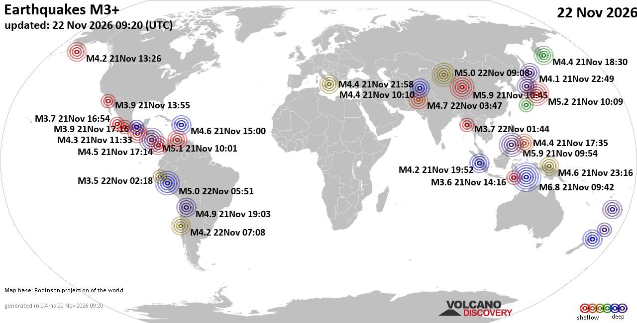
World Earthquake Report for Sunday, 22 November 2026
• M 2.8 - 152 km S of Cordova, Alaska
• M 5.4 - 159 km E of Masohi, Indonesia
• M 4.2 - south of the Fiji Islands
• M 0.7 - 5 km WNW of The Geysers, CA
• Strong mag. 5.0 earthquake - 47 km southeast of Ürümqi, Xinjiang, China, ...
|
|
|
Joined: Feb 2001
Posts: 800,656
Launch Director
|
|
Launch Director
Joined: Feb 2001
Posts: 800,656 |
SPC Nov 22, 2026 0830 UTC Day 3 Severe Thunderstorm OutlookSPC 0830Z Day 3 Outlook 
Day 3 Convective Outlook
NWS Storm Prediction Center Norman OK
0230 AM CST Sun Nov 22 2026

Valid 241200Z - 251200Z

...NO SEVERE THUNDERSTORM AREAS FORECAST...

...SUMMARY...
Isolated thunderstorms are possible over parts of the Gulf Coast and
West Coast Tuesday. Severe storms are not expected.

...Synopsis...
An upper trough over the southern Plains is forecast to intensify as
it moves southeastward across TX toward the Gulf Coast Tuesday and
Tuesday night. In the wake of a prior cold front, low-level moisture
will remain confined near the Gulf Coast across TX and into the
Southeast. Scattered thunderstorms are expected along typical sea
breeze corridors across the FL Peninsula during the day. Strong
mid-level ascent from the approaching trough and a weak surface
low/inverted surface trough over the Gulf may also support an
elevated band of showers and isolated thunderstorms over parts of
MS/AL Tuesday night into early Wednesday.

To the west, an approaching Pacific trough and cold front are
forecast to move inland across northern CA into early Wednesday.
Onshore flow may support weak buoyancy along the coast, with a
narrow band of shallow convection potentially supporting occasional
lightning flashes into Wednesday morning. Given the weak overall
buoyancy and poor overlap with strong vertical shear, severe storms
are not expected.

..Lyons.. 11/22/2026
Read morehttps://www.spc.noaa.gov/products/outlook/day3otlk_0830.html
|
|



CMS The Best Conveyancing solicitors conveyancing quotes throughout the UK
For any webhosting enquiries please email webmaster@aus-city.com
|
|
Entire Thread
|

 SPC Nov 22, 2026 0830 UTC Day 3 Severe Thunderstorm Outlook |
Webmaster
|
2 hours ago
|
|
Forums60
Topics940,015
Posts974,812
Members2,960
| |
Most Online102,106
Jul 10th, 2026
|
|
|
|
|

|









































