|
0 members (),
2,115
guests, and
24
robots. |
|
Key:
Admin,
Global Mod,
Mod
|
|
S |
M |
T |
W |
T |
F |
S |
|
1
|
2
|
3
|
4
|
5
|
6
|
7
|
|
8
|
9
|
10
|
11
|
12
|
13
|
14
|
|
15
|
16
|
17
|
18
|
19
|
20
|
21
|
|
22
|
23
|
24
|
25
|
26
|
27
|
28
|
|
29
|
30
|
|
|
|
|
|
|
There are no members with birthdays on this day. |

Volcano earthquake report for Sunday, 22 November 2026
• M 3.1 - 11 km WSW of Dyersburg, Tennessee
• M 0.5 - 23 km ENE of Ashford, Washington
• M 2.3 - 4 km S of Hope, Alaska
• Moderate mag. 4.3 earthquake - Estado de Oaxaca, Mexico, on Sunday, Nov 22,...
• M 2.8 - 168 km NNE of Yakutat, Alaska
|
|
|
Joined: Feb 2001
Posts: 800,656
Launch Director
|
|
Launch Director
Joined: Feb 2001
Posts: 800,656 |
SPC Day 2 Fire Weather OutlookSPC Day 2 Fire Weather Outlook 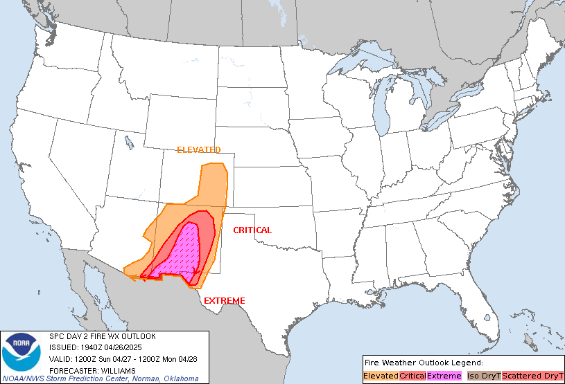
Day 2 Fire Weather Outlook
NWS Storm Prediction Center Norman OK
0135 PM CST Sun Nov 22 2026

Valid 231200Z - 241200Z

...NO CRITICAL AREAS...

Dry, post-frontal flow will push into the Mid-Mississippi Valley and
Southern Plains on D2/Monday. North to northeast winds of 10-15 mph
and RH in the 25-30% range are likely across the Mid-Mississippi
Valley and ArkLaTex regions. Although rainfall associated with the
cold front has been limited along and south of the Red River of the
South into the ArkLaTex region, much cooler temperatures with highs
in the 40s and 50s F, good overnight RH recoveries along with
marginal fuels will limit a broader fire weather threat for Monday.

..Williams.. 11/22/2026

.PREV DISCUSSION... /ISSUED 1142 PM CST Sat Nov 21 2026/

...Synopsis...
A mid-level trough will overspread the Northeast while a second
upper trough will eject into the southern Plains tomorrow (Monday).
Surface high pressure and associated cooler temperatures will
overspread nearly the entire CONUS through the day, limiting
wildfire-spread potential over most locales. One exception may be
portions of the Mid-Mississippi Valley region, where RH may dip to
30 percent amid 10-15 mph gusts. Fuels are dry over this region, but
precipitation accumulations are possible on Day 1, which would
reduce the potential for wildfire spread. Therefore, fire weather
highlights have been withheld for now.

...Please see www.spc.noaa.gov/fire for graphic product...
Read morehttps://www.spc.noaa.gov/products/fire_wx/fwdy2.html
|
|



CMS The Best Conveyancing solicitors conveyancing quotes throughout the UK
For any webhosting enquiries please email webmaster@aus-city.com
|
|
Entire Thread
|

 SPC Day 2 Fire Weather Outlook |
Webmaster
|
1 hour ago
|
|
Forums60
Topics940,553
Posts975,350
Members2,960
| |
Most Online102,106
Jul 10th, 2026
|
|
|









































