|
|
|
0 members (),
1,765
guests, and
27
robots. |
|
Key:
Admin,
Global Mod,
Mod
|
|
S |
M |
T |
W |
T |
F |
S |
|
1
|
2
|
3
|
4
|
5
|
6
|
7
|
|
8
|
9
|
10
|
11
|
12
|
13
|
14
|
|
15
|
16
|
17
|
18
|
19
|
20
|
21
|
|
22
|
23
|
24
|
25
|
26
|
27
|
28
|
|
29
|
30
|
|
|
|
|
|
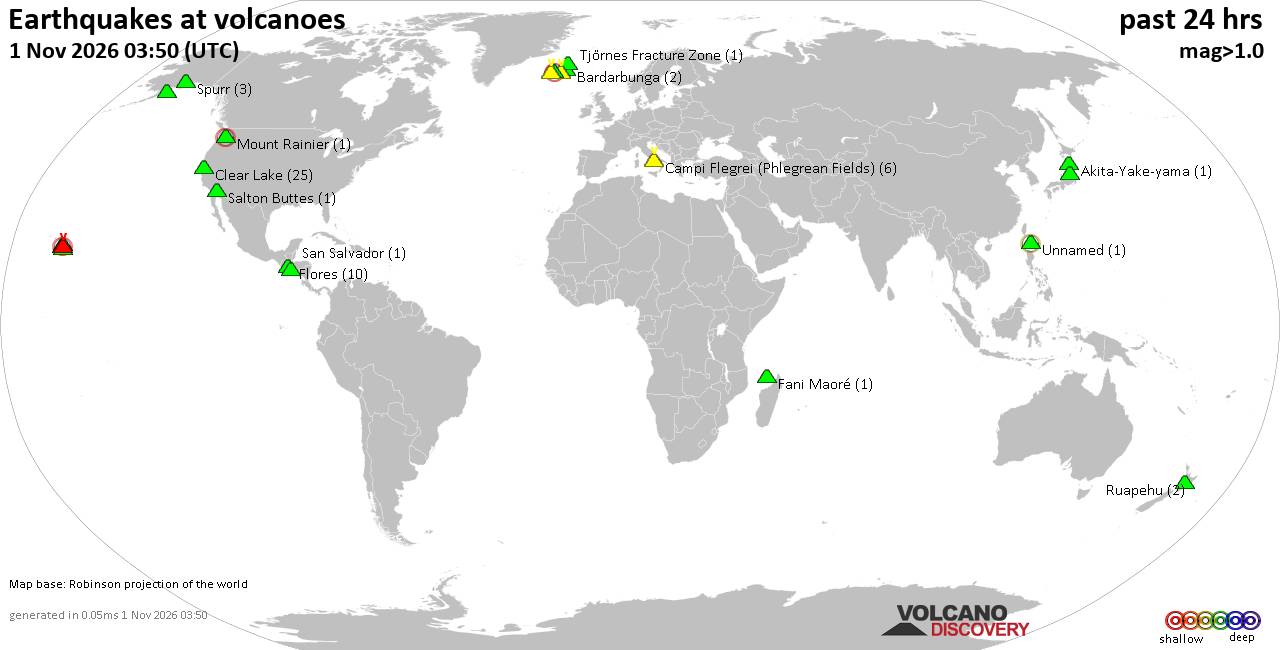
Volcano earthquake report for Sunday, 1 November 2026
• Light mag. 3.9 earthquake - Provincia de El Loa, Region de Antofagasta, Chi...
• M 2.2 - 20 km NNW of Skwentna, Alaska
• M 4.7 - 78 km SSE of Yonakuni, Japan
• M 4.7 - 78 km SSE of Yonakuni, Japan
• M 4.7 - 78 km SSE of Yonakuni, Japan
|

#134362
Sat 08 Dec 2012 04:57:PM
|
Joined: Feb 2001
Posts: 678,977
Launch Director
|
|
Launch Director
Joined: Feb 2001
Posts: 678,977 |
5.1 mb - NEAR S COAST OF NEW GUINEA, PNG.
Preliminary Earthquake Report
Magnitude 5.1 mb
Date-Time
8 Dec 2012 06:16:55 UTC
8 Dec 2012 16:16:55 near epicenter
7 Dec 2012 22:16:55 standard time in your timezone
Location 7.248S 143.930E
Depth 21 km
Distances
161 km (100 miles) SSW (193 degrees) of Mount Hagen, New Guinea, PNG
209 km (130 miles) SW (232 degrees) of Goroka, New Guinea, PNG
218 km (136 miles) WNW (292 degrees) of Kerema, New Guinea, PNG
343 km (213 miles) W (261 degrees) of Lae, New Guinea, PNG
436 km (271 miles) NW (304 degrees) of PORT MORESBY, Papua New Guinea
Location Uncertainty Horizontal: 18.2 km; Vertical 3.1 km
Parameters Nph = 79; Dmin = 689.8 km; Rmss = 0.96 seconds; Gp = 41�
M-type = mb; Version = C
Event ID us c000e6dh
David Cottle
UBB Owner & Administrator
|
|



CMS The Best Conveyancing solicitors conveyancing quotes throughout the UK
For any webhosting enquiries please email webmaster@aus-city.com
|
|
Forums60
Topics905,422
Posts940,219
Members2,960
| |
Most Online102,106
Jul 10th, 2026
|
|
|
|
|

|









































