|
|
|
0 members (),
1,910
guests, and
31
robots. |
|
Key:
Admin,
Global Mod,
Mod
|
|
S |
M |
T |
W |
T |
F |
S |
|
1
|
2
|
3
|
4
|
5
|
6
|
7
|
|
8
|
9
|
10
|
11
|
12
|
13
|
14
|
|
15
|
16
|
17
|
18
|
19
|
20
|
21
|
|
22
|
23
|
24
|
25
|
26
|
27
|
28
|
|
29
|
30
|
31
|
|
|
|
|
|
There are no members with birthdays on this day. |

#686153
Sat 01 Apr 2023 09:04:AM
|
Joined: Feb 2001
Posts: 381,904
Launch Director
|
OP

Launch Director
Joined: Feb 2001
Posts: 381,904 |
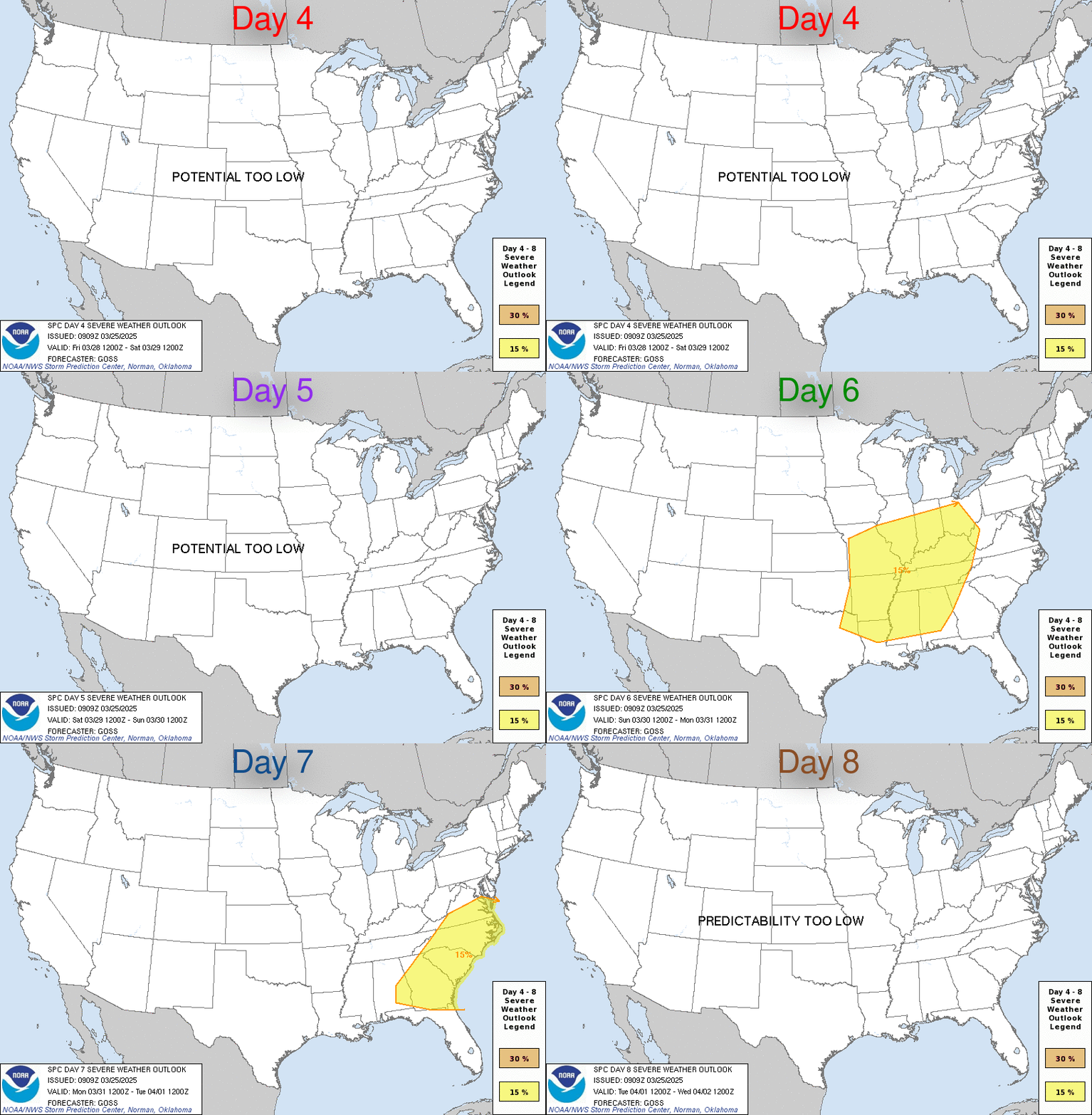
SPC Apr 1, 2023 Day 4-8 Severe Weather OutlookDay 4-8 Outlook 
Day 4-8 Convective Outlook
NWS Storm Prediction Center Norman OK
0402 AM CDT Sat Apr 01 2023

Valid 041200Z - 091200Z

...DISCUSSION...
Medium-range models continue to indicate that the westerlies will
become rather amplified across the mid-latitude Pacific into western
North America by late next week into next weekend.  It appears that
this will include building mid-level ridging centered near the
Pacific coast, with downstream developments a bit more unclear.
However, beneath at least a broadly confluent mid/upper flow, cold
surface ridging may tend to prevail east of the Rockies, with
generally low severe weather potential.

Prior to these developments, strong surface cyclogenesis is forecast
to proceed across the central Great Plains into the Upper Midwest
Tuesday through Tuesday night, in response to a significant short
trough emerging from the Intermountain West.  It still appears that,
as the center of the deepening cyclone migrates from the north
central Kansas vicinity through eastern Nebraska and western Iowa
during the late afternoon and early evening, a trailing dryline
advancing across the Missouri/Kansas border vicinity might provide
one focus for intense thunderstorm initiation.

There remains at least some signal within the various model output
that convection may initiate earlier within the open warm sector to
the east, and it remains unclear what influence this might have on
subsequent thunderstorm development.  Barring this complication, a
period of sustained, long track discrete supercell development may
be possible, as strong southwesterly deep-layer mean flow advects
cells away from the dryline through the moist warm sector.  This
probably would be accompanied by potential for strong tornadoes and
large hail.  Thereafter, as a trailing cold front overtakes the
dryline and surges eastward across the lower Missouri/middle
Mississippi Valleys, an organizing squall line may be accompanied by
strong, damaging wind gusts and a few tornadoes.

As the occluding surface cyclone continues across and northeast of
the Upper Midwest/Great Lakes region on Wednesday, there may be at
least some continuing risk for severe thunderstorm development
across parts of the lower Great Lakes/upper Ohio Valley and perhaps
parts of the northern Mid Atlantic. However, due to a number of
lingering uncertainties, this remains much more unclear at the
present time.
Read morehttps://www.spc.noaa.gov/products/exper/day4-8/
|
|


CMS The Best Conveyancing solicitors conveyancing quotes throughout the UK
For any webhosting enquiries please email webmaster@aus-city.com
|
|
Forums60
Topics766,620
Posts801,378
Members2,958
| |
Most Online17,963
Jan 15th, 2026
|
|
|
|
|
Copyright 1996 - 2026 by David Cottle. Designed by David Bate Jr. All Rights Reserved.
By using this forum, the user agrees not to transfer any data or technical information received under the agreement, to any other entity without the express approval of the AUS-CITY Forum Admins and/or authors of individual posts (Forum Admins and DoD/USSPACECOM for the analysis of satellite tracking data).
Two-line elements (TLE) and all other satellite data presented and distributed via this forum and e-mail lists of AUS-CITY are distributed with permission from DoD/USSTRATCOM.


Reprise Hosting


|

|