|
|
|
0 members (),
1,344
guests, and
24
robots. |
|
Key:
Admin,
Global Mod,
Mod
|
|
S |
M |
T |
W |
T |
F |
S |
|
|
|
|
|
1
|
2
|
3
|
|
4
|
5
|
6
|
7
|
8
|
9
|
10
|
|
11
|
12
|
13
|
14
|
15
|
16
|
17
|
|
18
|
19
|
20
|
21
|
22
|
23
|
24
|
|
25
|
26
|
27
|
28
|
29
|
30
|
31
|
|
There are no members with birthdays on this day. |
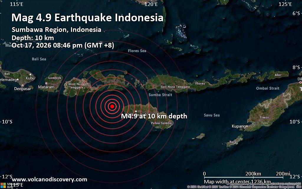
Moderate magnitude 4.9 earthquake reported 74 km west of Tambolaka, Indonesia
• M 1.6 - 9 km NW of Redwood Valley, CA
• Volcano earthquake report for Saturday, 17 October 2026
• Light mag. 3.9 earthquake - Kabupaten Manggarai, East Nusa Tenggara, Indone...
• M 1.5 - 48 km SSE of Silver Peak, Nevada
• Moderate mag. 4.9 earthquake - Indian Ocean, 78 km west of Tambolaka, Indon...
|

#688014
Sun 07 May 2023 08:56:AM
|
Joined: Feb 2001
Posts: 678,977
Launch Director
|
|
Launch Director
Joined: Feb 2001
Posts: 678,977 |
SPC May 7, 2023 Day 4-8 Severe Weather OutlookDay 4-8 Outlook 
Day 4-8 Convective Outlook
NWS Storm Prediction Center Norman OK
0353 AM CDT Sun May 07 2023

Valid 101200Z - 151200Z

...DISCUSSION...
...Wednesday/Day 4 and Thursday/Day 5...
An upper-level ridge is forecast to move slowly eastward across the
northern and eastern U.S. during the midweek, as an upper-level
trough moves through the Desert Southwest. Moisture advection will
likely take place well ahead of the trough in the Great Plains from
Wednesday into Thursday. Thunderstorm development will be possible
in the High Plains both Wednesday and Thursday afternoon on the
western edge of a somewhat moist airmass. A severe threat may
develop each day, but the greater threat is forecast for Thursday as
the upper-level low approaches the central Plains. Confidence is
greater in the ECMWF solution, which has an axis of instability from
the eastern Texas Panhandle into western Kansas and southwest
Nebraska late Thursday afternoon, where a severe threat area has
been added on Day 5.

...Friday/Day 6 to Sunday/Day 8...
The upper-level low is forecast to move into the central High Plains
on Friday, and into the northern Plains on Saturday. Thunderstorms
will be possible each day in and around the vicinity of the
upper-level low. Although a severe threat may develop in the
northern Plains on either Friday or Saturday, confidence concerning
instability remain low. If later runs show more instability in the
northern Plains, then a threat area may need to be considered on Day
6 or Day 7.

On Sunday, model forecasts show a diffuse pattern across much of the
central U.S., with an upper-level trough in the northeastern U.S.
This combined with a generally large spread in model solutions,
suggests that predictability is low at the end of the Day 4 to 8
period.
Read morehttps://www.spc.noaa.gov/products/exper/day4-8/
|
|



CMS The Best Conveyancing solicitors conveyancing quotes throughout the UK
For any webhosting enquiries please email webmaster@aus-city.com
|
|
Forums60
Topics880,113
Posts914,910
Members2,960
| |
Most Online102,106
Jul 10th, 2026
|
|
|
|
|

|









































