|
0 members (),
2,518
guests, and
27
robots. |
|
Key:
Admin,
Global Mod,
Mod
|
|
S |
M |
T |
W |
T |
F |
S |
|
|
|
1
|
2
|
3
|
4
|
5
|
|
6
|
7
|
8
|
9
|
10
|
11
|
12
|
|
13
|
14
|
15
|
16
|
17
|
18
|
19
|
|
20
|
21
|
22
|
23
|
24
|
25
|
26
|
|
27
|
28
|
29
|
30
|
|
|
|
|
There are no members with birthdays on this day. |
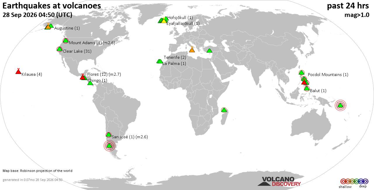
Volcano earthquake report for Monday, 28 September 2026
• M 5.4 - north of Svalbard
• M 2.4 - 70 km SSW of Nikolski, Alaska
• M 4.1 - 105 km SSW of Nikolski, Alaska
• M 1.3 - 11 km SSE of Portola Valley, CA
• M 1.5 - 28 km WNW of Enoch, Utah
|

#693180
Wed 12 Jul 2023 07:18:AM
|
Joined: Feb 2001
Posts: 678,977
Launch Director
|
|
Launch Director
Joined: Feb 2001
Posts: 678,977 |
SPC Jul 12, 2023 0730 UTC Day 3 Severe Thunderstorm OutlookSPC 0730Z Day 3 Outlook 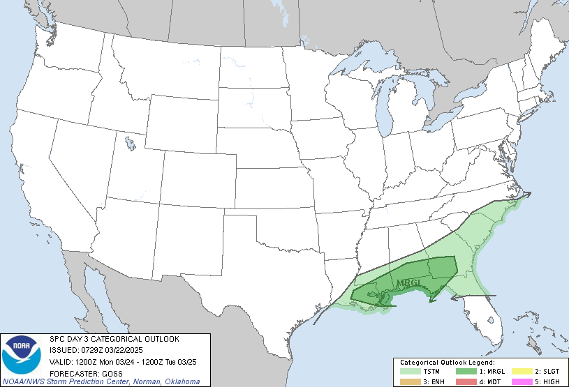
Day 3 Convective Outlook
NWS Storm Prediction Center Norman OK
0216 AM CDT Wed Jul 12 2023

Valid 141200Z - 151200Z

...THERE IS A SLIGHT RISK OF SEVERE THUNDERSTORMS ACROSS PARTS OF
THE CENTRAL PLAINS...

...SUMMARY...
Thunderstorms associated with large hail and wind damage will be
possible across parts of the central Plains on Friday. Marginally
severe storms could also occur outside of the Slight Risk in parts
of the central U.S., and from the Mid-Atlantic into southern New
England.

...Central Plains/Ozarks/Mid Mississippi Valley...
An upper-level trough is forecast to move eastward through the
central U.S. on Friday, as a cold front advances southward through
the central Plains. Along and to the south of the front, surface
dewpoints in the upper 60s to near 70 F will contribute to the
development of moderate instability in areas that heat up the most.
Thunderstorms are expected to form along and near the front, with
convection moving southeastward across southern Kansas during the
late afternoon and early evening. NAM forecast soundings from near
and just south of the front late Friday afternoon have MLCAPE
peaking in the 3000 to 3500 J/kg range, with 0-6 km shear between 35
and 40 knots. Surface temperature-dewpoint spreads are forecast to
be large, which will result in high-based storms with wind-damage
potential. Isolated large hail could also occur. The severe threat
is expected to be maximized during the late afternoon as low-level
lapse rates become the steepest. Although there is uncertainty at
this range, both the 00Z NAM and 00Z ECMWF have a maximum in CAPE
over southern Kansas late Friday afternoon. Both solutions suggest
that MCS development will be possible in southern Kansas on Friday.
Also, the last several runs of the NAM have been consistent with the
front position at 00Z/Saturday. For this reason, confidence is high
enough to introduce a Slight Risk over southern Kansas for this
outlook.

Further to the east-southeast into the Ozarks and mid Mississippi
Valley, surface dewpoints in the upper 60s and lower 70s F will
contribute to the development of moderate instability in areas that
heat up the most. Thunderstorms that form in the late afternoon,
when low-level lapse rates are steepest, may have potential for
marginally severe winds.

...Mid-Atlantic/Southern New England...
A subtle shortwave trough is forecast to move northeastward into the
Northeast on Friday. A moist airmass is forecast from the Carolinas
northward into southern New England. Moderate instability may
develop along parts of this corridor by afternoon. Scattered
thunderstorms will likely form in the Appalachian foothills around
midday and move eastward toward the coast during mid to late
afternoon. Steep low-level lapse rates will likely contribute to a
potential for marginally severe wind gusts. Hail will also be
possible with cells that form near the strongest instability.

..Broyles.. 07/12/2023
Read morehttps://www.spc.noaa.gov/products/outlook/day3otlk_0730.html
|
|



CMS The Best Conveyancing solicitors conveyancing quotes throughout the UK
For any webhosting enquiries please email webmaster@aus-city.com
|
|
Forums60
Topics844,570
Posts879,365
Members2,960
| |
Most Online102,106
Jul 10th, 2026
|
|
|





































