|
0 members (),
1,611
guests, and
21
robots. |
|
Key:
Admin,
Global Mod,
Mod
|
|
S |
M |
T |
W |
T |
F |
S |
|
|
|
1
|
2
|
3
|
4
|
5
|
|
6
|
7
|
8
|
9
|
10
|
11
|
12
|
|
13
|
14
|
15
|
16
|
17
|
18
|
19
|
|
20
|
21
|
22
|
23
|
24
|
25
|
26
|
|
27
|
28
|
29
|
30
|
|
|
|
|
There are no members with birthdays on this day. |
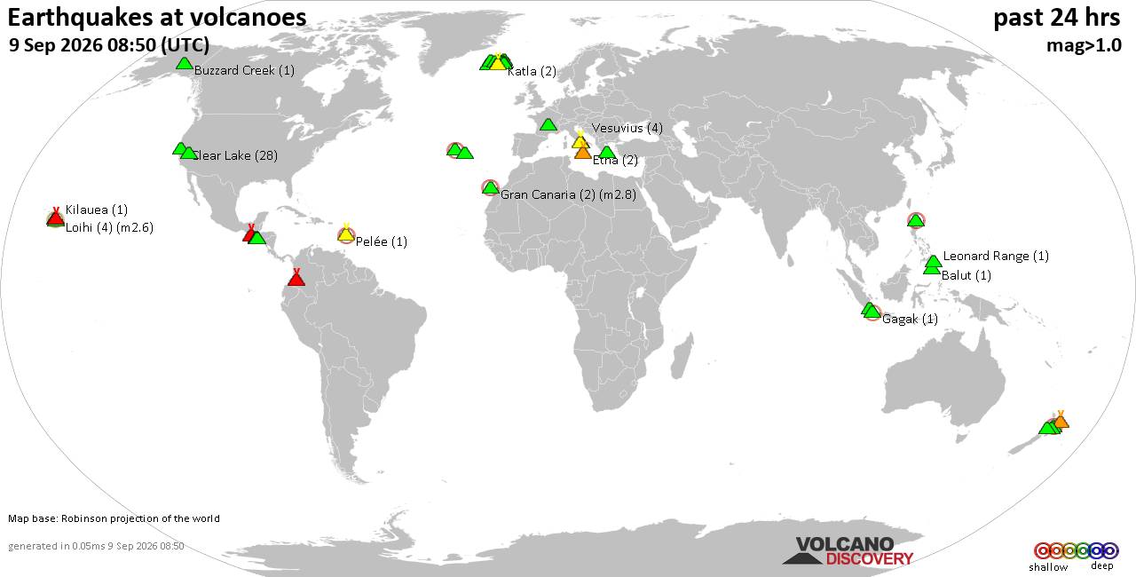
Volcano earthquake report for Wednesday, 9 September 2026
• World Earthquake Report for Wednesday, 9 September 2026
• Strong mag. 5.0 earthquake - Celebes Sea, 49 km north of Tahuna, Indonesia,...
• Moderate mag. 4.7 earthquake - Philippine Sea, 135 km southeast of Shima, M...
• The 10 most powerful earthquakes in the world since 1900
• Moderate mag. 4.0 earthquake - Indian Ocean, 80 km southwest of Labuan, Kab...
|

#695608
Thu 03 Aug 2023 08:31:AM
|
Joined: Feb 2001
Posts: 678,977
Launch Director
|
|
Launch Director
Joined: Feb 2001
Posts: 678,977 |
SPC Aug 3, 2023 Day 4-8 Severe Weather OutlookDay 4-8 Outlook 
Day 4-8 Convective Outlook
NWS Storm Prediction Center Norman OK
0328 AM CDT Thu Aug 03 2023

Valid 061200Z - 111200Z

...DISCUSSION...
...Days 4-5/Sun-Mon -- Mid-MS/OH Valley east to NY/PA/MD/VA...

A rather potent mid/upper shortwave trough for this time of year
will develop eastward from the Mid/Upper MS Valley to the
Northeast/Mid-Atlantic vicinity Sunday and Monday. At the surface, a
deepening low will move across IA and WI/MI on Sunday, before
lifting east/northeast across Ontario and Quebec on Monday. A
trailing cold front will sweep across the Midwest and likely be
approaching the I-95 corridor by Tuesday morning. Enhanced midlevel
southwesterly flow associated with upper trough atop a very
moist/unstable boundary layer will set the stage for a multi-day
severe weather episode ahead of the eastward-advancing cold front.

All severe hazards appear possible on Sunday from portions of
eastern IA through southern WI/MI into much of IL/IN, northern KY,
and western OH, as a linear convective system moves east across the
region. Tornado potential likely will be focused closer to the
surface low track, and along a warm front extending from the low
east/southeast across parts of southern WI/MI into northern IL/IN.

The system will continue east on Monday, impacting portions of the
upper OH Valley/Lower Great Lakes/central Appalachians vicinity. The
surface low will be shifting further northeast into Canada.
Nevertheless, large-scale ascent associated with the upper trough,
and moderate vertical shear atop very moist and unstable boundary
layer will continue to support severe convection ahead of the
eastward advancing cold front. Damaging winds will likely be the
greatest concern on Monday.

...Day 6/Tue -- Northeast and the Central Plains...

An upper trough and surface cold front will continue to move across
New England on Tuesday. Some severe potential could continue across
the region ahead of the front. However, uncertainty in timing of
these features, along with potential detrimental impacts for
widespread showers/cloudiness ahead of the front, preclude 15
percent severe probabilities at this time.

Further west, 40 kt northwesterly flow will overspread the central
Plains. While large-scale ascent appears somewhat nebulous, a moist
and unstable airmass will be in place. Any modest vorticity maxima
floating across the Rockies amid southeasterly upslope flow could
support at least isolated severe thunderstorm potential. However,
confidence in this scenario is too low to include 15 percent
probabilities at this time.

...Days 7-8/Wed-Thu -- MO Valley to OH Valley vicinity...

Forecast guidance suggest another amplified upper trough will track
east across central portions of the CONUS at the end of the period.
This could bring another bout of severe storms to portions of the
MO/MS/OH Valley vicinity. Enough spread exists in guidance to
preclude severe probabilities at this time, but trends will be
monitored and probabilities may become necessary is later outlooks.
Read morehttps://www.spc.noaa.gov/products/exper/day4-8/
|
|



CMS The Best Conveyancing solicitors conveyancing quotes throughout the UK
For any webhosting enquiries please email webmaster@aus-city.com
|
|
Forums60
Topics822,541
Posts857,334
Members2,960
| |
Most Online102,106
Jul 10th, 2026
|
|
|





































