


Perseverance is deep within the ongoing Margin Unit campaign, where orbital signatures of carbonate minerals appear strongest. After collection of a drilled rock core from the Margin Unit, followed by 20 Sols (Martian days) parked at our current workspace, Perseverance had ample time to explore the rocks adjacent to the rover and perform long distance multispectral imaging of the Jezero Crater Rim with the Mastcam-Z instrument.
The science team has been working around the clock to understand the origin, composition and alteration history of massive, dark-toned rocks in the Margin Unit. Challenges abound, however, as many of these exposed rocks are covered in a thick, crusty dust layer that partially obscures our ability to understand their true composition.
Perseverance is approaching a small, ~50-m-wide impact crater that has created a natural cross-section of rock layers of the Margin unit, potentially providing new views of deeper bedrock. The team is eagerly awaiting images of the interior of this small crater, which could reveal information about the emplacement of the upper Margin Unit.
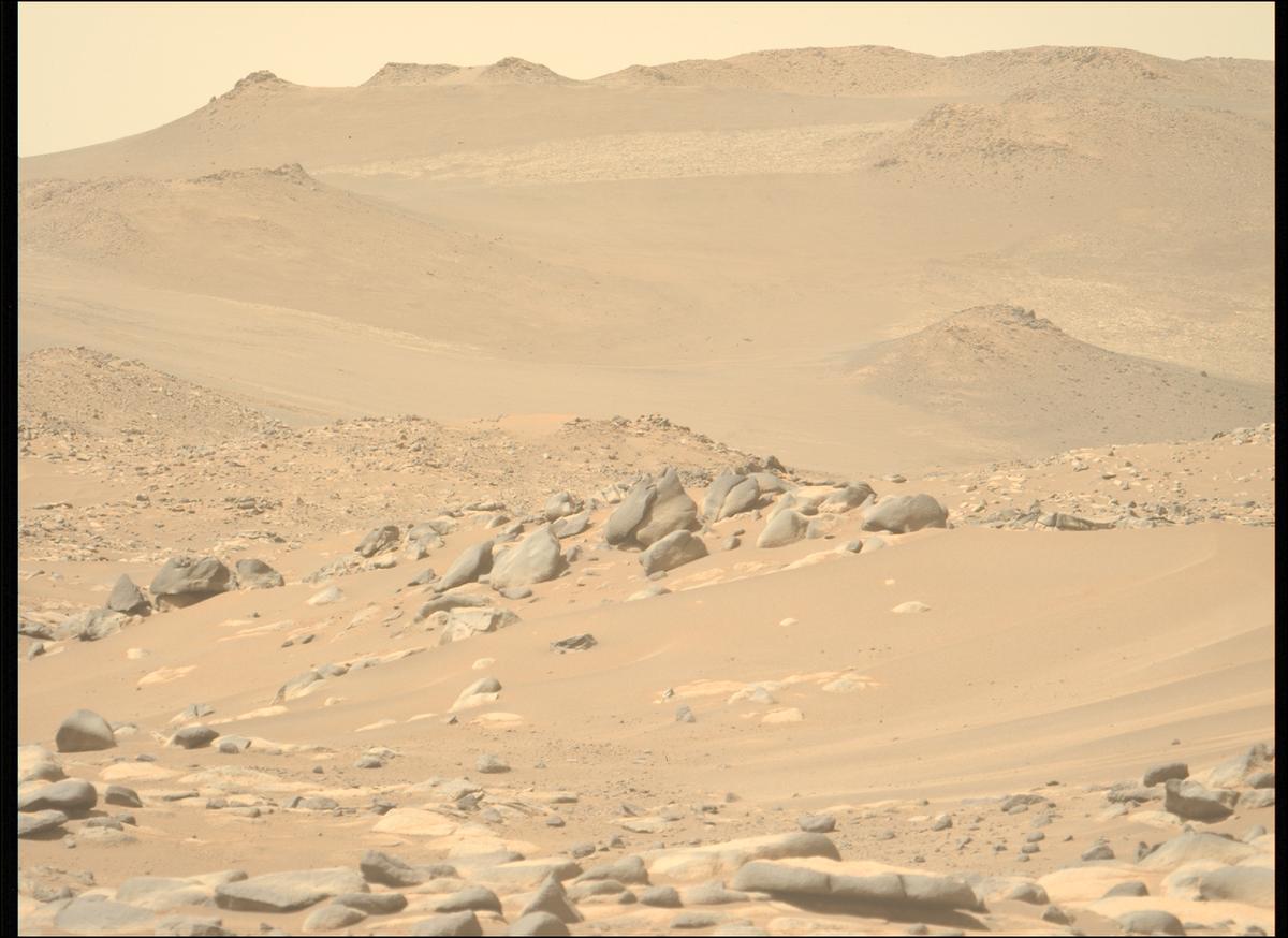
In the upcoming rover traverse, Perseverance will climb up onto the Jezero Crater Rim after a stop in Neretva Vallis, a deep channel that appears to have once fed water and sediments into Jezero Crater. The first long-distance glimpse of this uncharted territory did not disappoint!
Based on orbital satellite images, rock layers near the Jezero Crater Rim are thought to be among the oldest rocks that could be explored by a rover on Mars. Therefore, the light-toned rock layers pictured here could represent much older strata than has yet been explored by Perseverance - possibly dating back to the Noachian (approximately 3.7 - 4.1 billion years ago). Exploration of these terrains could provide unprecedented insight into the climate and environmental habitability during earlier and possibly wetter periods in Mars’ history.
In anticipation of Perseverance’s upcoming Crater Rim traverse, the team has been working to use orbital images to create a high-resolution map of geological features throughout the Crater Rim, including the light-toned bedrock in the image. These geological maps will be used to plan the upcoming traverse of the Crater Rim and for outlining the highest-priority rock units for collection of drilled rock core samples that could one day be returned to Earth.
Written by
Adrian Broz
Postdoctoral Scientist at Purdue University/University of Oregon


 - Click image for larger picture.")


