|
|
|
0 members (),
897
guests, and
23
robots. |
|
Key:
Admin,
Global Mod,
Mod
|
|
S |
M |
T |
W |
T |
F |
S |
|
|
|
|
1
|
2
|
3
|
4
|
|
5
|
6
|
7
|
8
|
9
|
10
|
11
|
|
12
|
13
|
14
|
15
|
16
|
17
|
18
|
|
19
|
20
|
21
|
22
|
23
|
24
|
25
|
|
26
|
27
|
28
|
29
|
30
|
|
|
|
There are no members with birthdays on this day. |

#712874
Fri 23 Feb 2024 08:27:AM
|
Joined: Feb 2001
Posts: 381,904
Launch Director
|
OP

Launch Director
Joined: Feb 2001
Posts: 381,904 |
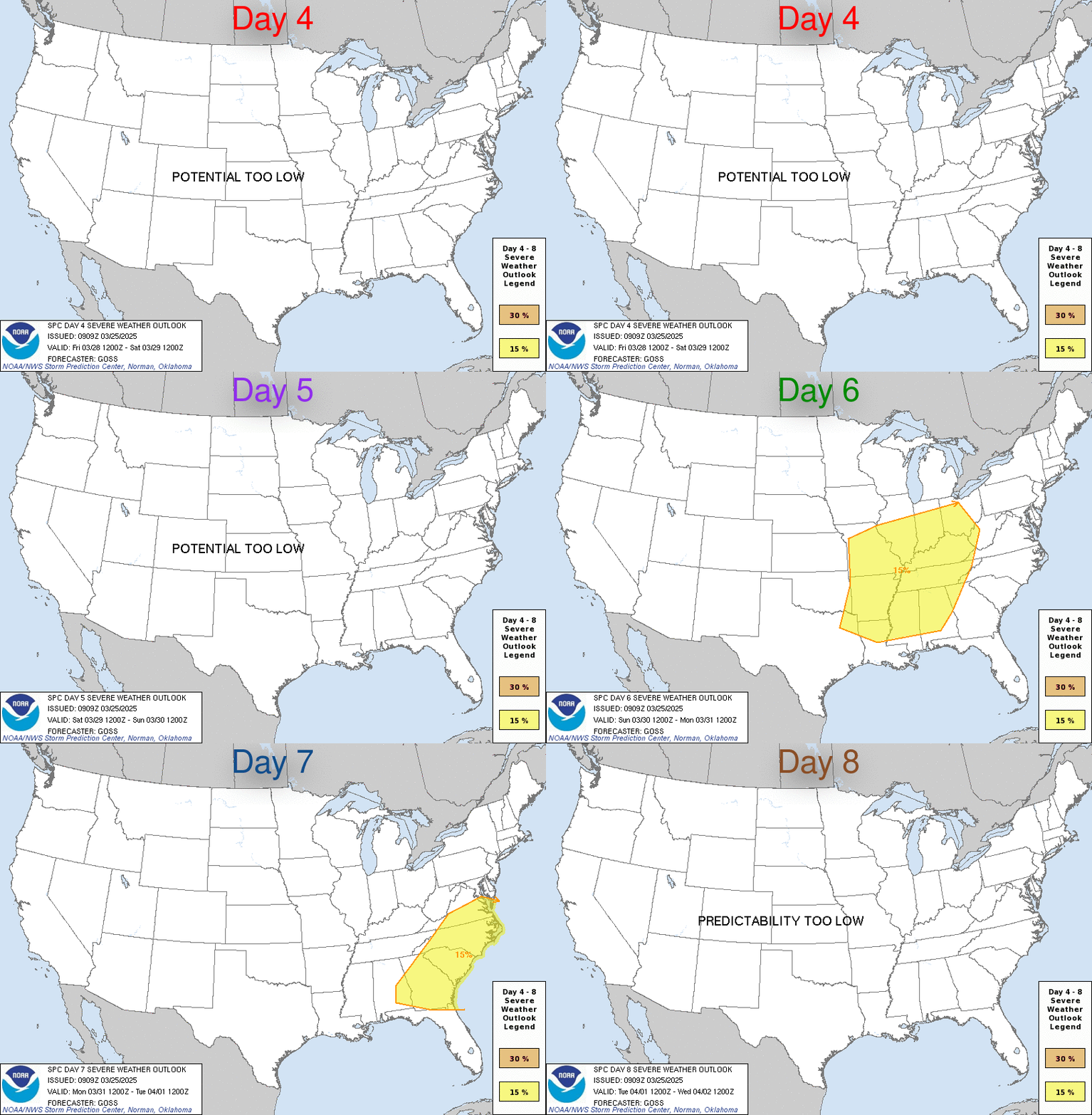
SPC Feb 23, 2024 Day 4-8 Severe Weather OutlookDay 4-8 Outlook 
Day 4-8 Convective Outlook
NWS Storm Prediction Center Norman OK
0224 AM CST Fri Feb 23 2024

Valid 261200Z - 021200Z

...DISCUSSION...
Strong southern stream westerly upper-level flow will extend from
northwest Mexico through the southern half of the U.S. on Day 4/Mon.
In northern stream flow, a strong upper trough will develop
east/southeast from the Pacific Northwest toward the
northern/central High Plains. Deepening surface low pressure over
the northern Plains, with a surface trough extending southward
through the southern Plains, will result in increasing southerly
low-level flow across the Gulf of Mexico northward to the Mid-MS
Valley. This will allow for substantial airmass modification ahead
of the western upper trough and southeastward-advancing surface cold
front through Day 6/Wed.

By Day 5/Tue afternoon, improved boundary-layer moisture (50s to low
60s F dewpoints) is forecast to arrive across the Ozark Plateau and
the Mid-MS and Lower OH Valley vicinity. At the same time, an EML
with a plume of steep midlevel lapse rates shifting east from the
Plains will overspread the central U.S. vicinity. This should allow
for at least modest destabilization, though quality of surface-based
instability remains in question given marginal low-level moisture.
Nevertheless, favorable vertical shear and strong forcing associated
with a surging cold front will support organized thunderstorms with
an attendant severe risk across a broad region of the central U.S.

Uncertainty has increased heading into Day 6/Wed as this system
shifts east across OH/TN Valley toward the Appalachians. The last
couple of cycles from the ECMWF have the surface cold front surging
east much faster than the GFS. While the operational GFS remains
much slower, the GEFS ensemble guidance overall has trended faster.
Given the combination of uncertainty and overall trends, severe
probabilities will be maintained for Day 6/Wed, but trimmed. It is
likely this delineated area will continue to change in the coming
days given higher uncertainty.

Beyond Day 6/Wed, spread in forecast guidance continues to increase
and predictability is low.
Read morehttps://www.spc.noaa.gov/products/exper/day4-8/
|
|


CMS The Best Conveyancing solicitors conveyancing quotes throughout the UK
For any webhosting enquiries please email webmaster@aus-city.com
|
|
Forums60
Topics768,025
Posts802,789
Members2,958
| |
Most Online17,963
Jan 15th, 2026
|
|
|
|
|
Copyright 1996 - 2026 by David Cottle. Designed by David Bate Jr. All Rights Reserved.
By using this forum, the user agrees not to transfer any data or technical information received under the agreement, to any other entity without the express approval of the AUS-CITY Forum Admins and/or authors of individual posts (Forum Admins and DoD/USSPACECOM for the analysis of satellite tracking data).
Two-line elements (TLE) and all other satellite data presented and distributed via this forum and e-mail lists of AUS-CITY are distributed with permission from DoD/USSTRATCOM.


Reprise Hosting


|

|