|
|
|
1 members (Alisa),
2,656
guests, and
53
robots. |
|
Key:
Admin,
Global Mod,
Mod
|
|
S |
M |
T |
W |
T |
F |
S |
|
|
|
|
|
|
|
1
|
|
2
|
3
|
4
|
5
|
6
|
7
|
8
|
|
9
|
10
|
11
|
12
|
13
|
14
|
15
|
|
16
|
17
|
18
|
19
|
20
|
21
|
22
|
|
23
|
24
|
25
|
26
|
27
|
28
|
29
|
|
30
|
31
|
|
|
|
|
|
|
There are no members with birthdays on this day. |
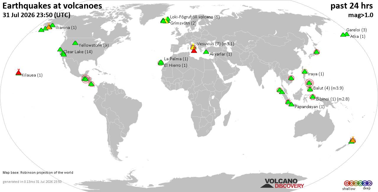
Volcano earthquake report for Friday, 31 Jul 2026
• World Earthquake Report for Friday, 31 July 2026
• Light mag. 3.9 earthquake - Philippine Sea, 57 km east of Sulangan, Philipp...
• Small tremor of magnitude 3.1 just reported 10 km southwest of Naples, Ital...
• Seismic-like event, possible earthquake, reported few minutes ago near Napl...
• Strong mag. 5.0 earthquake - 65 km northeast of Pu'er, Yunnan Sheng, China,...
|

#727650
Mon 01 Jul 2024 01:09:AM
|
Joined: Feb 2001
Posts: 678,976
Launch Director
|
OP

Launch Director
Joined: Feb 2001
Posts: 678,976 |
SPC Jul 1, 2024 0100 UTC Day 1 Convective OutlookSPC 0100Z Day 1 Outlook 
Day 1 Convective Outlook
NWS Storm Prediction Center Norman OK
0805 PM CDT Sun Jun 30 2024

Valid 010100Z - 011200Z

...THERE IS A SLIGHT RISK OF SEVERE THUNDERSTORMS FOR PORTIONS OF
THE MID-ATLANTIC AND PARTS OF CENTRAL/EASTERN MONTANA AND FAR
WESTERN NORTH DAKOTA...

...SUMMARY...
Scattered storms capable of wind damage will continue for a few more
hours in parts of the Mid-Atlantic. Isolated large hail and
severe/damaging winds remain possible this evening in parts of
central/eastern Montana into perhaps far western North Dakota.

...Mid-Atlantic...
Convection has largely moved offshore, though scattered storms still
remain across parts of the Mid-Atlantic. Modest mid-level lapse
rates and around 35-40 kts of effective shear (sampled by the 00Z
IAD sounding) suggest damaging wind gusts and isolated large hail
will remain possible into at least the mid evening.

...Montana/western North Dakota...
A mid-level trough continues to move across the northern Rockies.
Convection continues to develop within the terrain areas of western
Montana. Storms have generally struggled to maintain intensity,
however. MLCIN remains present in eastern Montana and western North
Dakota. The overall longevity of convection, as well as coverage,
remains uncertain. An increase in the low-level jet this evening
could help maintain some activity into the mid/late evening.
Severe/damaging winds and isolated large hail are the main risks.

...Central High Plains Vicinity...
Continued stronger flow across the Rockies around the upper-level
ridge will continue to foster scattered strong to severe storms this
evening. The strongest storms will likely be in parts of eastern
Colorado where low 60s F dewpoints remain. Large hail and severe
winds are possible with this activity.

...Arizona...
Scattered storms have developed within an area of strong heating in
southeastern Arizona. An MCV evident on visible satellite also has
likely aided in convective development and modest organization this
afternoon/evening. A few strong/severe wind gusts remain possible.
Convection/outflow may try to push westward toward Phoenix where
temperatures remain in the low 100s F.

..Wendt.. 07/01/2024
Read morehttps://www.spc.noaa.gov/products/outlook/day1otlk_0100.html
|
|



CMS The Best Conveyancing solicitors conveyancing quotes throughout the UK
For any webhosting enquiries please email webmaster@aus-city.com
|
|
Forums60
Topics793,578
Posts828,362
Members2,960
| |
Most Online102,106
Jul 10th, 2026
|
|
|
|
|
Copyright 1996 - 2026 by David Cottle. Designed by David Bate Jr. All Rights Reserved.
By using this forum, the user agrees not to transfer any data or technical information received under this agreement to any other entity without the express approval of the AUS-CITY Forum Admins and/or authors of individual posts (Forum Admins and DoD/USSPACECOM for the analysis of satellite tracking data).
Two-line elements (TLE) and all other satellite data presented and distributed via this forum and AUS-CITY mailing lists are distributed with permission from DoD/USSTRATCOM.

|

|