|
0 members (),
1,581
guests, and
40
robots. |
|
Key:
Admin,
Global Mod,
Mod
|
|
S |
M |
T |
W |
T |
F |
S |
|
|
|
|
|
|
|
1
|
|
2
|
3
|
4
|
5
|
6
|
7
|
8
|
|
9
|
10
|
11
|
12
|
13
|
14
|
15
|
|
16
|
17
|
18
|
19
|
20
|
21
|
22
|
|
23
|
24
|
25
|
26
|
27
|
28
|
29
|
|
30
|
31
|
|
|
|
|
|
|
There are no members with birthdays on this day. |
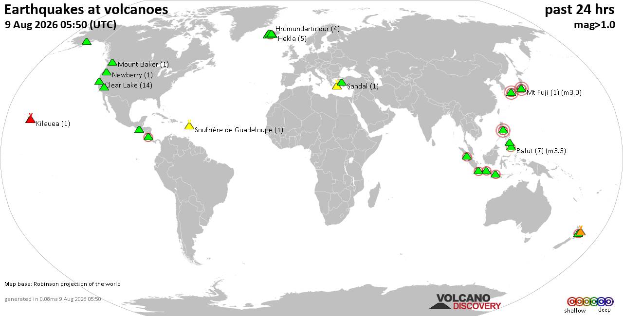
Volcano earthquake report for Sunday, 9 Aug 2026
• World Earthquake Report for Sunday, 9 August 2026
• Moderate mag. 4.0 earthquake - Northern Sumatra, Indonesia, on Sunday, Aug ...
• Moderate mag. 4.6 earthquake - New Zealand on Monday, Aug 10, 2026, at 01:0...
• Strong mag. 5.2 earthquake - Galapagos Triple Junction Region on Sunday, Au...
• World Earthquake Report for Sunday, 9 August 2026
|

#731057
Mon 12 Aug 2024 08:32:PM
|
Joined: Feb 2001
Posts: 678,976
Launch Director
|
OP

Launch Director
Joined: Feb 2001
Posts: 678,976 |
SPC Day 3-8 Fire Weather OutlookSPC Day 3-8 Fire Weather Outlook 
Day 3-8 Fire Weather Outlook
NWS Storm Prediction Center Norman OK
0327 PM CDT Mon Aug 12 2024

Valid 141200Z - 201200Z

The potential for widespread critical fire weather conditions
remains low through the extended period. Long-range ensemble
guidance continues to suggest mean troughing will become established
along the West Coast with upper ridging over the southern and
central CONUS through the work week and into next weekend. This
synoptic regime will favor widespread rain/thunderstorm chances for
much of the country with the exception of NV/CA and portions of
central TX.

...D4/Thursday - Pacific Northwest...
The evolving synoptic regime will favor multiple weak upper
disturbances propagating across the northern Great Basin as an upper
low slowly amplifies off the West Coast through the work week and
into the upcoming weekend. Multiple runs from the GFS/ECMWF/Canadian
model families (and associated ensembles) have shown a consistent
signal for convection across portions of OR on D4/Thursday as one
such disturbances moves across the region. While the probability for
convection is somewhat meager (around 40% based on blended ensemble
guidance), forecast PWAT values and QPF probabilities suggest that
thunderstorms that do development may be dry and pose a fire weather
concern given antecedent dry fuels and recent lighting starts across
this region. Low (10%) risk highlights have been introduced to
address this concern.

...Great Basin...
The evolving synoptic regime will favor multiple weak upper
disturbances propagating across the northern Great Basin as an upper
low slowly amplifies off the West Coast through the work week and
into the upcoming weekend. This will support multiple days of breezy
conditions across the Great Basin - primarily across NV - where
conditions should remain dry (RH in the low teens to low 20s) within
a persistent downslope flow regime off the Sierra Nevada. Areas of
elevated fire weather conditions appear possible each day, but the
synoptic regime will favor weak low-level mass responses and modest
surface winds.

...Texas...
Ensemble guidance continues to show a strong signal for dry
conditions and afternoon high temperatures returning into the low
100s through the upcoming weekend. These hot/dry conditions will
support drying most fuels, especially grasses across west to
northwest TX where the hottest conditions are expected. The building
upper ridge will limit the potential for widespread, strong gradient
winds, but trends forecast wind speeds and fuels will be monitored.

..Moore.. 08/12/2024

...Please see www.spc.noaa.gov/fire for graphic product...
Read morehttps://www.spc.noaa.gov/products/exper/fire_wx/
|
|



CMS The Best Conveyancing solicitors conveyancing quotes throughout the UK
For any webhosting enquiries please email webmaster@aus-city.com
|
|
Forums60
Topics795,864
Posts830,653
Members2,960
| |
Most Online102,106
Jul 10th, 2026
|
|
|





































