|
0 members (),
1,375
guests, and
22
robots. |
|
Key:
Admin,
Global Mod,
Mod
|
|
S |
M |
T |
W |
T |
F |
S |
|
|
|
|
|
1
|
2
|
3
|
|
4
|
5
|
6
|
7
|
8
|
9
|
10
|
|
11
|
12
|
13
|
14
|
15
|
16
|
17
|
|
18
|
19
|
20
|
21
|
22
|
23
|
24
|
|
25
|
26
|
27
|
28
|
29
|
30
|
31
|
|
There are no members with birthdays on this day. |
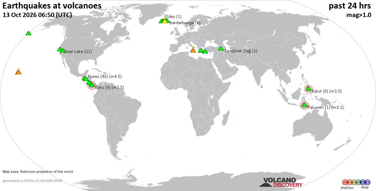
Volcano earthquake report for Tuesday, 13 October 2026
• M 1.4 - 26 km S of Cantwell, Alaska
• M 2.0 - 111 km N of Yakutat, Alaska
• M 1.7 - 4 km N of Kalifornsky, Alaska
• M 1.0 - 7 km SW of Salton City, CA
• M 1.3 - 15 km NE of Milford, Utah
|

#735699
Tue 10 Sep 2024 07:00:AM
|
Joined: Feb 2001
Posts: 678,977
Launch Director
|
|
Launch Director
Joined: Feb 2001
Posts: 678,977 |
SPC Day 1 Fire Weather OutlookSPC Day 1 Fire Weather Outlook 
Day 1 Fire Weather Outlook
NWS Storm Prediction Center Norman OK
0159 AM CDT Tue Sep 10 2024

Valid 101200Z - 111200Z

...Synopsis...
Broad troughing over the Northwest will gradually intensify later
today and tonight, as a stronger shortwave and mid-level jet
approach from the eastern Pacific. Increasing flow aloft will move
inland, supporting the potential for strong surface winds and low
humidity over parts of the Northwest and Great Basin. Elevated to
near-critical fire-weather conditions are likely.

...Great Basin...
As the upper trough shifts east, mid-level flow should strengthen
over parts of the western Great Basin. Gusty downslope winds are
likely in the lee of the Sierra and across parts of southern NV and
western UT. Surface winds of 15-25 mph should overlap with RH below
15%, and within areas of dry fuels this afternoon. Elevated to
near-critical fire-weather conditions are likely across much of NV
and into portions of northern CA, southern ID and far western UT.
Confidence in the development of nearly to briefly critical
meteorological conditions is highest over parts of southern NV where
winds are expected to be slightly stronger. However, fuels here are
also slightly less receptive, and the overlap of favorable wind/RH
may also be briefer. Thus, confidence remains too low for critical
highlights currently.

...Cascades and Columbia Gorge...
Increasing mid-level winds will combine with a strong onshore
pressure gradient behind the departing cold front to drive 15-20 mph
winds through Cascade Gaps and into the western Columbia Basin.
While cooler and more moderate, pockets of RH below 25% should
overlap with the stronger winds. The duration of these breezy and
somewhat dry conditions may be somewhat limited, but elevated to
briefly critical fire weather conditions are possible within dry
fuels.

..Lyons.. 09/10/2024

...Please see www.spc.noaa.gov/fire for graphic product...
Read morehttps://www.spc.noaa.gov/products/fire_wx/fwdy1.html
|
|



CMS The Best Conveyancing solicitors conveyancing quotes throughout the UK
For any webhosting enquiries please email webmaster@aus-city.com
|
|
Forums60
Topics872,992
Posts907,788
Members2,960
| |
Most Online102,106
Jul 10th, 2026
|
|
|









































