|
|
|
0 members (),
586
guests, and
23
robots. |
|
Key:
Admin,
Global Mod,
Mod
|
|
S |
M |
T |
W |
T |
F |
S |
|
1
|
2
|
3
|
4
|
5
|
6
|
7
|
|
8
|
9
|
10
|
11
|
12
|
13
|
14
|
|
15
|
16
|
17
|
18
|
19
|
20
|
21
|
|
22
|
23
|
24
|
25
|
26
|
27
|
28
|
|
29
|
30
|
31
|
|
|
|
|
|
There are no members with birthdays on this day. |

#747094
Fri 06 Dec 2024 09:39:AM
|
Joined: Feb 2001
Posts: 381,904
Launch Director
|
|
Launch Director
Joined: Feb 2001
Posts: 381,904 |
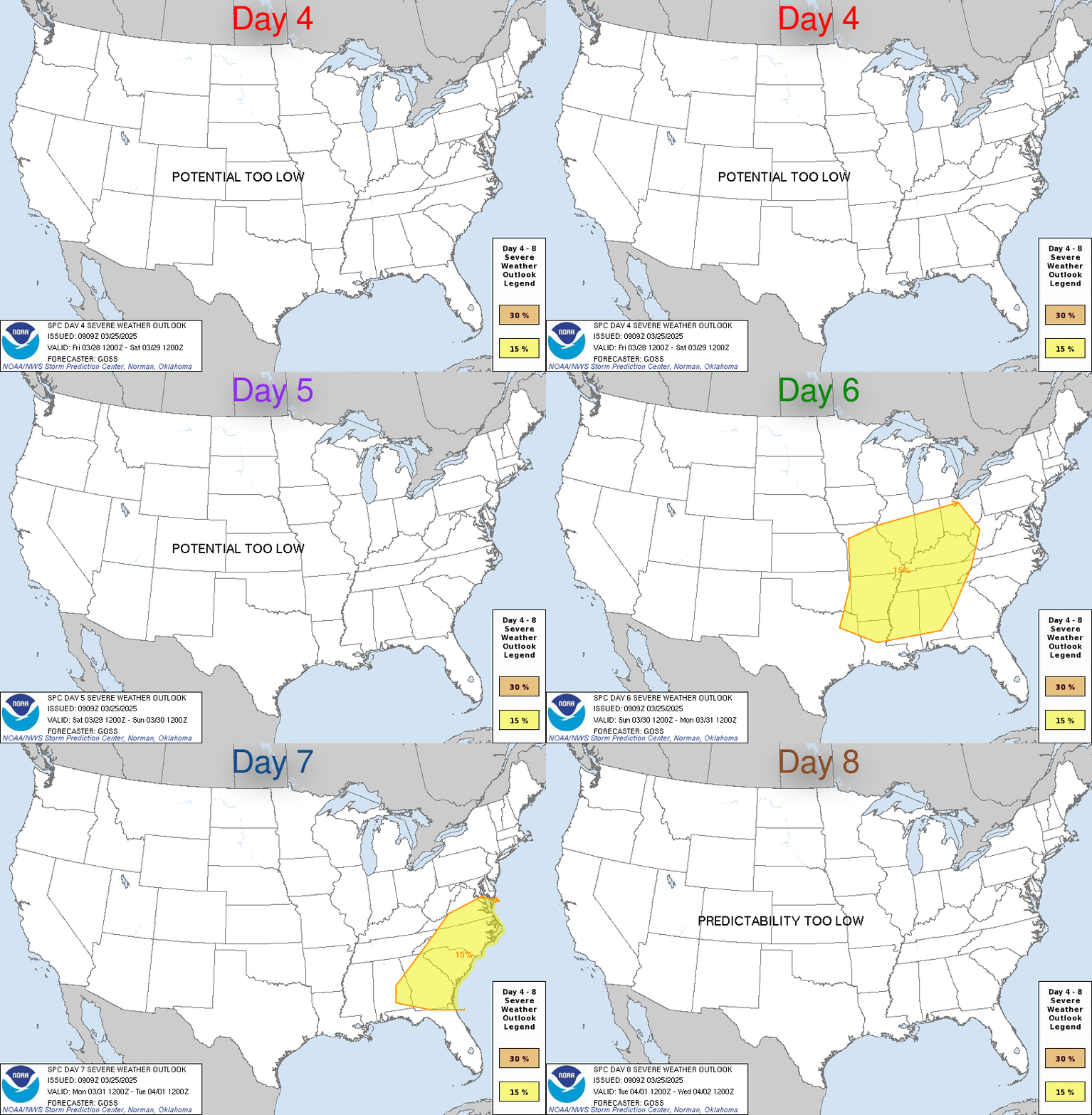
SPC Dec 6, 2024 Day 4-8 Severe Weather OutlookDay 4-8 Outlook 
Day 4-8 Convective Outlook
NWS Storm Prediction Center Norman OK
0336 AM CST Fri Dec 06 2024

Valid 091200Z - 141200Z

...DISCUSSION...
Medium-range guidance is in relatively good agreement that
significant amplification of the upper pattern will take place next
week as a strong and deep upper trough traverses the CONUS. The
initial development of this upper trough is forecast to begin on
D4/Monday as a shortwave trough moves through the Great Basin into
the Southwest while another moves from the Upper Midwest across the
Upper Great Lakes and Ontario. By early D5/Tuesday, evolution of
these systems will have likely resulted in broad and deep upper
troughing across much of the central North America. This trough is
then expected to continue eastward as a shortwave trough progresses
through its base, helping to sharpen the trough and strengthening
mid-level flow. Consensus within the guidance places a 120 kt 500 mb
jet streak from AL through the central Appalachians on D6/Wednesday.
The embedded shortwave is forecast to continue quickly
eastward/northeastward across the Southeast and Mid-Atlantic on
D6/Wednesday, helping to induce a more negative tilt to the parent
upper troughing.

A strong cold front will likely accompany this system, progressing
eastward through the Plains on D4/Monday, the MS and OH Valleys and
Southeast on D5/Tuesday, and off the East Coast on D6/Wednesday.
Favorable low-level moisture may be in place ahead of this front
across the Southeast on D5/Tuesday. However, a front-parallel
orientation of the deep-layer shear is anticipated, and buoyancy
will likely remain modest, limiting severe potential. Favorable
low-level moisture may exist ahead of the front across the
Mid-Atlantic on D6/Wednesday as well, with strengthening deep-layer
vertical shear and large-scale ascent anticipated across the region
as well. As a result, some severe appears possible, but uncertainty
regarding frontal position limits predictability.
Read morehttps://www.spc.noaa.gov/products/exper/day4-8/
|
|


CMS The Best Conveyancing solicitors conveyancing quotes throughout the UK
For any webhosting enquiries please email webmaster@aus-city.com
|
|
Forums60
Topics711,380
Posts745,996
Members2,957
| |
Most Online4,158
Jun 21st, 2024
|
|
|
|
|
Copyright 1996 - 2024 by David Cottle. Designed by David Bate Jr. All Rights Reserved.
By using this forum, the user agrees not to transfer any data or technical information received under the agreement, to any other entity without the express approval of the AUS-CITY Forum Admins and/or authors of individual posts (Forum Admins and DoD/USSPACECOM for the analysis of satellite tracking data).
Two-line elements (TLE) and all other satellite data presented and distributed via this forum and e-mail lists of AUS-CITY are distributed with permission from DoD/USSTRATCOM.


Reprise Hosting


|

|