|
|
|
0 members (),
547
guests, and
21
robots. |
|
Key:
Admin,
Global Mod,
Mod
|
|
S |
M |
T |
W |
T |
F |
S |
|
1
|
2
|
3
|
4
|
5
|
6
|
7
|
|
8
|
9
|
10
|
11
|
12
|
13
|
14
|
|
15
|
16
|
17
|
18
|
19
|
20
|
21
|
|
22
|
23
|
24
|
25
|
26
|
27
|
28
|
|
29
|
30
|
31
|
|
|
|
|
|
There are no members with birthdays on this day. |

#747633
Mon 16 Dec 2024 07:19:PM
|
Joined: Feb 2001
Posts: 381,904
Launch Director
|
|
Launch Director
Joined: Feb 2001
Posts: 381,904 |
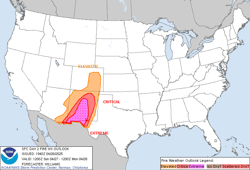
SPC Day 2 Fire Weather OutlookSPC Day 2 Fire Weather Outlook 
Day 2 Fire Weather Outlook
NWS Storm Prediction Center Norman OK
0117 PM CST Mon Dec 16 2024

Valid 171200Z - 181200Z

Minimal changes were made to the outlook to account for recent
guidance. Available high-resolution guidance continues to suggest
fairly low probability of sustained critical conditions on Tuesday.
The 12Z HRRR is the lone piece of guidance with more aggressive RH
reductions Tuesday night. Even so, there is some potential for
near-critical to locally critical fire weather briefly during
Tuesday afternoon and again late Tuesday night into Wednesday
morning. The most likely area for these conditions will be portions
of the Santa Clara River Valley and Oxnard Plain. Trends in guidance
will continue to be monitored for potential need of critical
highlights.

..Wendt.. 12/16/2024

.PREV DISCUSSION... /ISSUED 0150 AM CST Mon Dec 16 2024/

...Synopsis...
Quasi zonal mid-level flow is expected to quickly amplify as ridging
develops over the Western US D2/Tues. In the wake of a cold front
moving across the central US the day prior, surface high pressure
will quickly build over the Great Basin. The high pressure will
allow for moderate offshore winds and elevated to near-critical
fire-weather concerns over portions of southern CA.

...Southern California...
As high pressure intensifies behind the cold front across the Great
Basin and interior West, moderate offshore flow is expected to
develop D2/Tues into D3/Wed. Santa Ana winds of 15-25 mph will
overlap with low RH values of 10-20% across parts of Los Angeles and
Ventura counties for several hours. Elevated to near-critical
fire-weather conditions appear likely amid dry fuels across portions
of southern CA, particularly overnight D2/Tues into D3/Wed. Some
uncertainty remains regarding the strength of the winds and minimum
RH values in the absence of stronger upper-level support. The best
overlap of strong winds and low RH is expected late D2/Tues into
early D3/Wed morning. However, if winds trend stronger and earlier
as some guidance suggests, critical highlights may be needed sooner.

...Please see www.spc.noaa.gov/fire for graphic product...
Read morehttps://www.spc.noaa.gov/products/fire_wx/fwdy2.html
|
|


CMS The Best Conveyancing solicitors conveyancing quotes throughout the UK
For any webhosting enquiries please email webmaster@aus-city.com
|
|
Forums60
Topics711,380
Posts745,996
Members2,957
| |
Most Online4,158
Jun 21st, 2024
|
|
|
|
|
Copyright 1996 - 2024 by David Cottle. Designed by David Bate Jr. All Rights Reserved.
By using this forum, the user agrees not to transfer any data or technical information received under the agreement, to any other entity without the express approval of the AUS-CITY Forum Admins and/or authors of individual posts (Forum Admins and DoD/USSPACECOM for the analysis of satellite tracking data).
Two-line elements (TLE) and all other satellite data presented and distributed via this forum and e-mail lists of AUS-CITY are distributed with permission from DoD/USSTRATCOM.


Reprise Hosting


|

|