|
|
|
0 members (),
273
guests, and
23
robots. |
|
Key:
Admin,
Global Mod,
Mod
|
|
S |
M |
T |
W |
T |
F |
S |
|
|
|
1
|
2
|
3
|
4
|
5
|
|
6
|
7
|
8
|
9
|
10
|
11
|
12
|
|
13
|
14
|
15
|
16
|
17
|
18
|
19
|
|
20
|
21
|
22
|
23
|
24
|
25
|
26
|
|
27
|
28
|
29
|
30
|
|
|
|
|
There are no members with birthdays on this day. |

#759615
Tue 01 Apr 2025 08:59:AM
|
Joined: Feb 2001
Posts: 381,904
Launch Director
|
OP

Launch Director
Joined: Feb 2001
Posts: 381,904 |
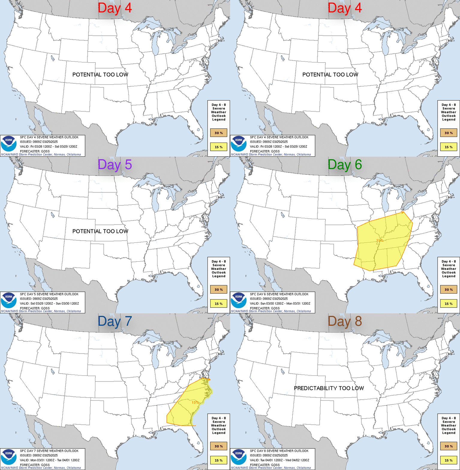
SPC Apr 1, 2025 Day 4-8 Severe Weather OutlookDay 4-8 Outlook 
Day 4-8 Convective Outlook
NWS Storm Prediction Center Norman OK
0357 AM CDT Tue Apr 01 2025

Valid 041200Z - 091200Z

...DISCUSSION...
Amplified mid-level flow and deep moisture south of a quasi
stationary frontal zone will persist over much of the central and
eastern CONUS through the first half of the extended forecast
period. Models are in generally good agreement with the progression
of the pattern and the potential for severe storms. However, some
key differences, and days of preceding convection will modulate
potential in the coming days.

...Day4/Friday...
The broad upper trough over the western US is forecast to gradually
deepen Friday into the weekend, as an upper low forms over northern
Mexico. Flow aloft will become increasingly southerly over the
southern Plains while it curves anticyclonically over the Mid South
and eastern US. A rich pool of deep moisture will continue to reside
along a quasi stationary frontal zone from the Red River to the OH
Valley. Several clusters of strong to severe storms appear possible
within the broadly favorable zone of weak ascent and large
buoyancy/shear. The surface picture remains very complicated due to
multiple preceding days of convective potential.

...Day5/Saturday...
The primary mid-level impulse will begin to eject across northern
Mexico, eventually reaching the lower/middle MS Valley D5/Saturday.
Model differences begin to emerge on the latitudinal extent of the
warm sector owing to differences in the timing/structure of the
ejecting upper cyclone. Regardless, continued southerly low-level
flow will replenish deep moisture over much of the ArkLaTex and
Southeastern US. A surface low and cold front will gradually
intensify across the Mid South, likely focusing severe potential
ahead of it. The intensity of the severe risk will likely be tied to
ongoing storms from the prior Day 4, but supercells are possible
from east TX into the MS Valley and parts of the Southeast into
Saturday night.

...Day6-8...
The cold front and low will continue to move eastward with the upper
trough through the end of the weekend and into early next week. Some
severe risk could emerge over parts of the Southeast/eastern US with
seasonably high moisture and instability. However, model differences
on the frontal timing and the potential for multiple rounds of
proceeding convection make severe potential very uncertain beyond
Day 5.
Read morehttps://www.spc.noaa.gov/products/exper/day4-8/
|
|


CMS The Best Conveyancing solicitors conveyancing quotes throughout the UK
For any webhosting enquiries please email webmaster@aus-city.com
|
|
Forums60
Topics723,162
Posts757,778
Members2,958
| |
Most Online4,158
Jun 21st, 2024
|
|
|
|
|
Copyright 1996 - 2024 by David Cottle. Designed by David Bate Jr. All Rights Reserved.
By using this forum, the user agrees not to transfer any data or technical information received under the agreement, to any other entity without the express approval of the AUS-CITY Forum Admins and/or authors of individual posts (Forum Admins and DoD/USSPACECOM for the analysis of satellite tracking data).
Two-line elements (TLE) and all other satellite data presented and distributed via this forum and e-mail lists of AUS-CITY are distributed with permission from DoD/USSTRATCOM.


Reprise Hosting


|

|