|
|
|
0 members (),
2,197
guests, and
25
robots. |
|
Key:
Admin,
Global Mod,
Mod
|
|
S |
M |
T |
W |
T |
F |
S |
|
1
|
2
|
3
|
4
|
5
|
6
|
7
|
|
8
|
9
|
10
|
11
|
12
|
13
|
14
|
|
15
|
16
|
17
|
18
|
19
|
20
|
21
|
|
22
|
23
|
24
|
25
|
26
|
27
|
28
|
|
29
|
30
|
|
|
|
|
|
|
There are no members with birthdays on this day. |

Volcano earthquake report for Sunday, 22 November 2026
• Moderate mag. 4.5 earthquake - 73 km north of Calama, Provincia de El Loa, ...
• Magnitude 5.2 earthquake strikes near Cerro de Pasco, Pasco Province, Depar...
• M 2.0 - 8 km NW of Pinnacles, CA
• M 2.7 - 26 km WNW of Yachats, Oregon
• M 5.0 - 15 km NNE of Carhuamayo, Peru
|

#764628
Mon 09 Jun 2025 12:00:PM
|
Joined: Feb 2001
Posts: 800,656
Launch Director
|
|
Launch Director
Joined: Feb 2001
Posts: 800,656 |
SPC Jun 9, 2025 1300 UTC Day 1 Convective OutlookSPC 1300Z Day 1 Outlook 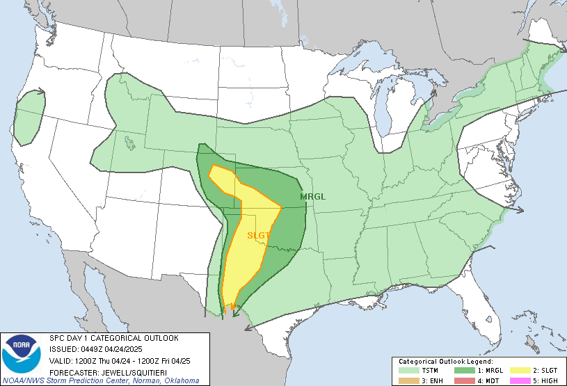
Day 1 Convective Outlook
NWS Storm Prediction Center Norman OK
0656 AM CDT Mon Jun 09 2025

Valid 091300Z - 101200Z

...THERE IS A SLIGHT RISK OF SEVERE THUNDERSTORMS THIS AFTERNOON
OVER PORTIONS OF THE GULF COAST STATES...SOUTHEAST...TN/OH
VALLEYS...AND OVER NORTHEAST NM...

...SUMMARY...
Scattered strong to severe thunderstorm development appears probable
today, particularly across parts of the Ohio Valley into
Appalachians, and east of the lower Mississippi Valley into eastern
Gulf Coast states.

No changes have been made to the ongoing forecast.

...Southeast States...
An upper low is centered this morning over MN/WI, with broad
cyclonic flow across much of the eastern US.  Several ongoing
clusters of thunderstorms are ongoing this morning across from east
TX into GA, with a risk of occasional gusty winds.  A few hours of
sunshine may be sufficient for intensification of one or more of
these clusters, with damaging wind being the main concern.

...TN/OH Valleys...
A similar regime is present this morning along a cold front from
northwest OH into IL.  Scattered strong thunderstorms may develop
anywhere along the front from central PA into southeast MO.  Forcing
is weak so most storms will remain somewhat disorganized.  However,
the strongest storms will pose a risk of locally damaging wind
gusts.

...NM...
Ample low-level moisture has advected westward into
southern/east-central NM.  This combined with strong daytime heating
will encourage thunderstorm development over the mountains by mid
afternoon.  Storms will spread into the adjacent Plains by early
evening.  Mid level winds will be only marginally favorable for a
few organized/rotating cells capable of hail and gusty winds.

..Hart/Bentley.. 06/09/2025
Read morehttps://www.spc.noaa.gov/products/outlook/day1otlk_1300.html
|
|



CMS The Best Conveyancing solicitors conveyancing quotes throughout the UK
For any webhosting enquiries please email webmaster@aus-city.com
|
|
Forums60
Topics940,686
Posts975,483
Members2,960
| |
Most Online102,106
Jul 10th, 2026
|
|
|
|
|

|









































