|
0 members (),
2,573
guests, and
23
robots. |
|
Key:
Admin,
Global Mod,
Mod
|
|
S |
M |
T |
W |
T |
F |
S |
|
|
|
|
|
|
1
|
2
|
|
3
|
4
|
5
|
6
|
7
|
8
|
9
|
|
10
|
11
|
12
|
13
|
14
|
15
|
16
|
|
17
|
18
|
19
|
20
|
21
|
22
|
23
|
|
24
|
25
|
26
|
27
|
28
|
29
|
30
|
|
31
|
|
|
|
|
|
|
|
There are no members with birthdays on this day. |
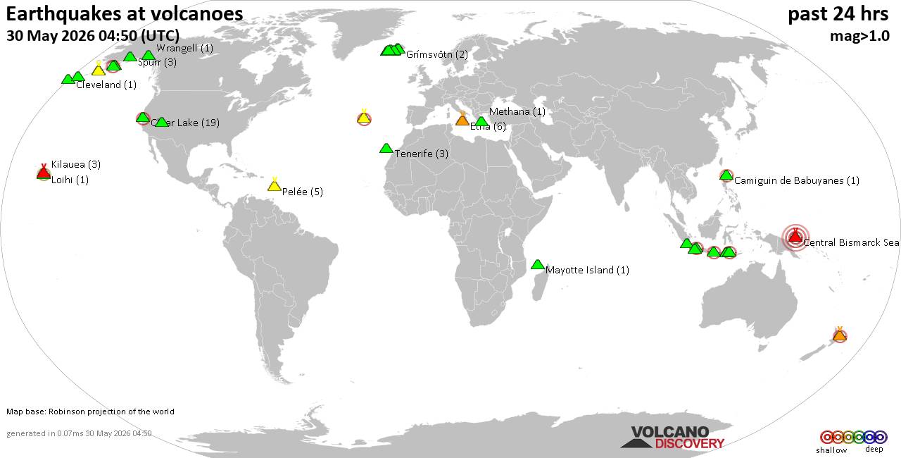
Volcano earthquake report for Saturday, 30 May 2026
• Light mag. 3.9 earthquake - 45 km northeast of Sitia, Lasithi, Crete, Greec...
• Moderate mag. 4.1 earthquake - Sea of Okhotsk, 53 km north of Shikotan Isla...
• Light mag. 3.9 earthquake - 304 km southwest of Yulara, Northern Territory,...
• Strong mag. 5.0 earthquake - South Atlantic Ocean, 18 km southeast of Brist...
• Moderate mag. 4.7 earthquake - Caribbean Sea, 73 km north of Gueiria, Sucre...
|

#766315
Fri 27 Jun 2025 10:05:PM
|
Joined: Feb 2001
Posts: 381,904
Launch Director
|
OP

Launch Director
Joined: Feb 2001
Posts: 381,904 |
SPC Day 3-8 Fire Weather OutlookSPC Day 3-8 Fire Weather Outlook 
Day 3-8 Fire Weather Outlook
NWS Storm Prediction Center Norman OK
0500 PM CDT Fri Jun 27 2025

Valid 291200Z - 051200Z

...Synopsis...
An mid-level trough will progress eastward into the Great Lakes
region early next week (Day 4/Monday) while a broad ridge builds
over the Intermountain West, the latter of which will supply much of
the West with above normal temperatures, aiding in fuel
curing/drying. An upper-level trough will bring a dry thunderstorm
threat to portions of northern California/south-central Oregon Days
4-5/Monday-Tuesday as well as aid in ushering in deeper monsoon
moisture from the south into much of the Intermountain West late
next week for Days 7-8/Thursday-Friday.

...Days 3-6/Sunday-Wednesday...
Primary fire weather concern lies over northeastern California and
interior portions of Oregon, along and east of the Cascades as the
upper-level trough impinges into the West Coast. Southerly flow
ahead of the trough will transport mid and upper-level moisture into
the region beginning on Day 3/Sunday, promoting increasing elevated
instability and steeper mid-level lapse rates. Above normal
temperatures through the weekend will further dry fuels aiding in
ignition efficiency for the Days 4-5/Monday-Tuesday events. A 10
percent critical area for dry thunderstorms was maintained with
thunderstorm threat shifting mainly into eastern Oregon by Tuesday.
As the trough axis moves east of the Cascades, a drier downslope
flow pattern emerges by Day 6/Wednesday, likely impacting potential
holdover fires.

...Days 7-8/Thursday-Friday...
Advancing monsoon moisture under the upper-level ridge and daytime
heating/instability will support daily showers and thunderstorms
over higher terrain across much of the Southwest and Intermountain
West through midweek. Residence time of monsoon moisture and
associated daytime showers and thunderstorms along the western
periphery of the deeper moisture plume could be limited giving rise
to dry thunderstorm/new ignition concerns over dry fuels, with
another potential upper-level trough coming into the Western U.S. by
the end of the week. Longer term ensemble model guidance does not
invoke high forecast certainty regarding monsoon moisture plume
evolution, precluding introduction of critical probabilities for
this time frame.

..Williams.. 06/27/2025

...Please see www.spc.noaa.gov/fire for graphic product...
Read morehttps://www.spc.noaa.gov/products/exper/fire_wx/
|
|



CMS The Best Conveyancing solicitors conveyancing quotes throughout the UK
For any webhosting enquiries please email webmaster@aus-city.com
|
|
Forums60
Topics777,565
Posts812,368
Members2,960
| |
Most Online22,463
May 9th, 2026
|
|
|