|
1 members (Webmaster),
1,575
guests, and
75
robots. |
|
Key:
Admin,
Global Mod,
Mod
|
|
S |
M |
T |
W |
T |
F |
S |
|
|
|
|
|
|
|
1
|
|
2
|
3
|
4
|
5
|
6
|
7
|
8
|
|
9
|
10
|
11
|
12
|
13
|
14
|
15
|
|
16
|
17
|
18
|
19
|
20
|
21
|
22
|
|
23
|
24
|
25
|
26
|
27
|
28
|
29
|
|
30
|
31
|
|
|
|
|
|
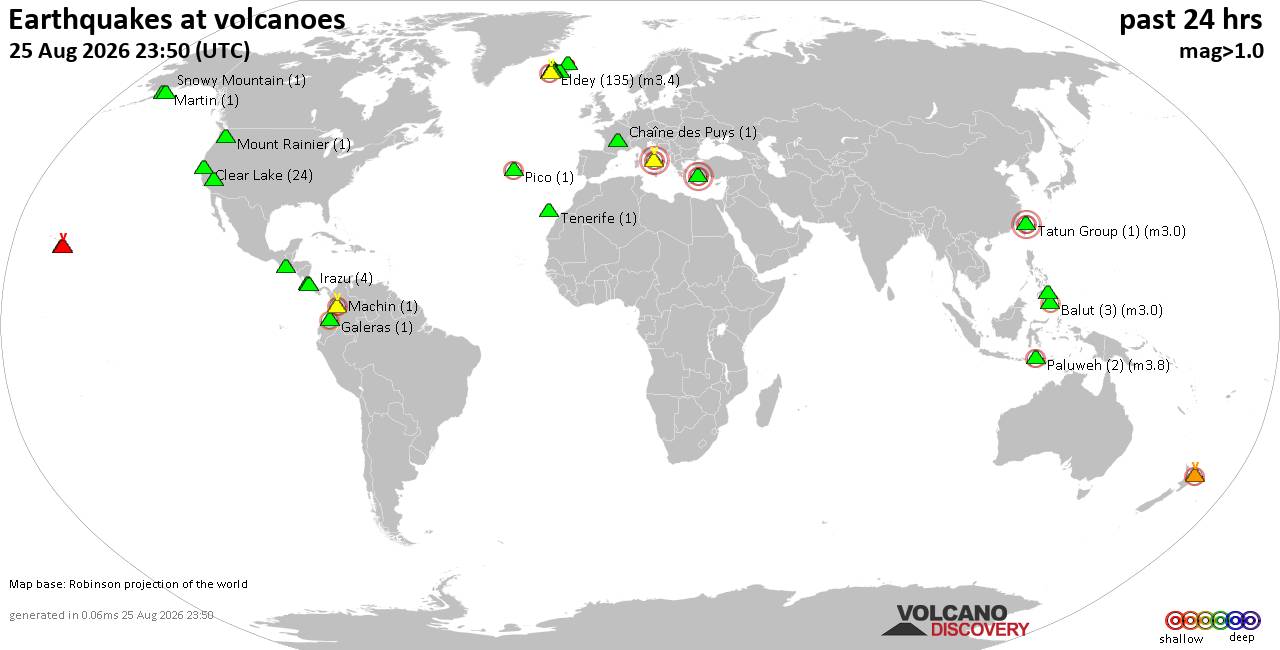
Volcano earthquake report for Tuesday, 25 Aug 2026
• M 2.1 - 61 km SW of Nanwalek, Alaska
• M 1.5 - 9 km WNW of The Geysers, CA
• M 0.3 - 4 km W of Cobb, CA
• M 4.8 - 76 km NNW of Ende, Indonesia
• M -0.2 - 10 km NW of The Geysers, CA
• M 0.3 - 7 km W of Cobb, CA
|

#774199
Tue 09 Sep 2025 08:00:PM
|
Joined: Feb 2001
Posts: 678,977
Launch Director
|
|
Launch Director
Joined: Feb 2001
Posts: 678,977 |
SPC Day 2 Fire Weather OutlookSPC Day 2 Fire Weather Outlook 
Day 2 Fire Weather Outlook
NWS Storm Prediction Center Norman OK
0259 PM CDT Tue Sep 09 2025

Valid 101200Z - 111200Z

...Washington State...
An upper-level trough moving into the western U.S. will support
another round of dry thunderstorms through tonight into the early
Day 2 period. Numerous new fire ignitions from overnight
thunderstorms occurred this morning across central WA. Cloud to
ground lightning and minimal rainfall outside thunderstorm rain
cores will continue to present an ignition threat in heavier,
drought stressed fuels across the WA Cascades, and north central WA,
particularly in the morning hours. Thunderstorm development will
shift primarily to higher terrain by Wednesday afternoon across
central WA.

...Eastern Great Basin and Western Utah...
A robust mid-level jet (50-60 knots) rounding the base of the
upper-level low over northern California combined with deep,
well-mixed boundary layer will support breezy south-southwest
surface winds of 15-25 mph Wednesday afternoon. The gusty winds
along with relative humidity in the 15-20% range will result in
elevated to locally critical fire weather conditions across
east-central NV into western UT. Although fuels are only marginally
dry, the stronger winds and low RH could contribute to wildfire
spread.

..Williams.. 09/09/2025

.PREV DISCUSSION... /ISSUED 1255 AM CDT Tue Sep 09 2025/

...Synopsis...
For Wednesday, not much change in the upper-level pattern is
expected from Tuesday. The upper-level trough in the West will shift
into more of the Great Basin and the mid-level jet will extend
farther northward. Showers and thunderstorms remain possible in the
Northwest and northern Rockies.

...Eastern Great Basin into Idaho/Wyoming...
Dry and breezy conditions appear likely during the afternoon. Winds
of 15-25 mph will be possible along with RH of 15-20%. Even with
these elevated to locally critical meteorological conditions, fuels
are not likely to become receptive enough to support more than a
locally elevated risk.

...Northwest/northern Rockies...
While thunderstorms will be possible in association with the upper
low, recent precipitation and substantial cloud cover should
generally limit the overall risk for lightning ignitions. A
continued downward trend in fuel receptiveness is expected
Wednesday. Highlights do not appear warranted at this time.

...Please see www.spc.noaa.gov/fire for graphic product...
Read morehttps://www.spc.noaa.gov/products/fire_wx/fwdy2.html
|
|



CMS The Best Conveyancing solicitors conveyancing quotes throughout the UK
For any webhosting enquiries please email webmaster@aus-city.com
|
|
Forums60
Topics813,200
Posts847,993
Members2,960
| |
Most Online102,106
Jul 10th, 2026
|
|
|





































