|
|
|
0 members (),
7,639
guests, and
24
robots. |
|
Key:
Admin,
Global Mod,
Mod
|
|
S |
M |
T |
W |
T |
F |
S |
|
|
|
|
|
1
|
2
|
3
|
|
4
|
5
|
6
|
7
|
8
|
9
|
10
|
|
11
|
12
|
13
|
14
|
15
|
16
|
17
|
|
18
|
19
|
20
|
21
|
22
|
23
|
24
|
|
25
|
26
|
27
|
28
|
29
|
30
|
31
|
|
There are no members with birthdays on this day. |
|
|
Joined: Feb 2001
Posts: 381,904
Launch Director
|
OP

Launch Director
Joined: Feb 2001
Posts: 381,904 |
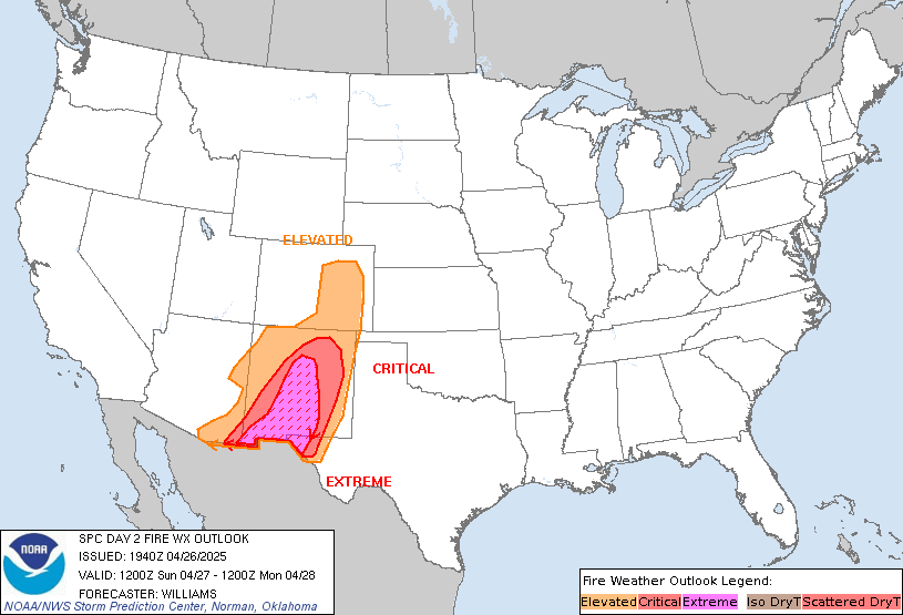
SPC Day 2 Fire Weather OutlookSPC Day 2 Fire Weather Outlook 
Day 2 Fire Weather Outlook
NWS Storm Prediction Center Norman OK
0122 PM CST Mon Jan 26 2026

Valid 271200Z - 281200Z

...NO CRITICAL AREAS...

Showers along a cold front will continue to progress southeastward
through tonight across southern FL. Post-frontal north winds of
10-15 mph and dry conditions with relative humidity falling into the
20-30 percent range should support an elevated fire weather for the
Southwest FL Coast Tuesday afternoon. Modified elevated highlights
to capture mitigating effects of recent rainfall, primarily south of
the Tampa Bay area.

..Williams.. 01/26/2026

.PREV DISCUSSION... /ISSUED 0139 AM CST Mon Jan 26 2026/

...Synopsis...
Dry post-frontal northwesterly flow across the western Florida
peninsula will bring a period of Elevated fire weather concerns on
D2/Tuesday. Relative humidity reductions to 20-30% will overlap
sustained winds 10-15 mph. There is a chance for some precipitation
across the region on D1/Monday, however, this is expected to remain
light. An Elevated area was maintained across portions of the
western Florida peninsula where the best chances of windy/dry
conditions overlap most receptive fuels and lowest precipitation
potential.

...Please see www.spc.noaa.gov/fire for graphic product...
Read morehttps://www.spc.noaa.gov/products/fire_wx/fwdy2.html
|
|


CMS The Best Conveyancing solicitors conveyancing quotes throughout the UK
For any webhosting enquiries please email webmaster@aus-city.com
|
|
Forums60
Topics758,842
Posts793,556
Members2,958
| |
Most Online17,963
Jan 15th, 2026
|
|
|
|
|
Copyright 1996 - 2026 by David Cottle. Designed by David Bate Jr. All Rights Reserved.
By using this forum, the user agrees not to transfer any data or technical information received under the agreement, to any other entity without the express approval of the AUS-CITY Forum Admins and/or authors of individual posts (Forum Admins and DoD/USSPACECOM for the analysis of satellite tracking data).
Two-line elements (TLE) and all other satellite data presented and distributed via this forum and e-mail lists of AUS-CITY are distributed with permission from DoD/USSTRATCOM.


Reprise Hosting


|

|