|
0 members (),
1,344
guests, and
24
robots. |
|
Key:
Admin,
Global Mod,
Mod
|
|
S |
M |
T |
W |
T |
F |
S |
|
|
|
|
|
1
|
2
|
3
|
|
4
|
5
|
6
|
7
|
8
|
9
|
10
|
|
11
|
12
|
13
|
14
|
15
|
16
|
17
|
|
18
|
19
|
20
|
21
|
22
|
23
|
24
|
|
25
|
26
|
27
|
28
|
29
|
30
|
31
|
|
There are no members with birthdays on this day. |
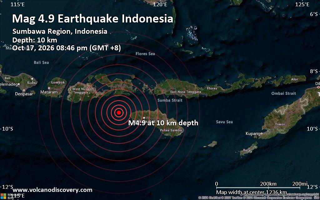
Moderate magnitude 4.9 earthquake reported 74 km west of Tambolaka, Indonesia
• M 1.6 - 9 km NW of Redwood Valley, CA
• Volcano earthquake report for Saturday, 17 October 2026
• Light mag. 3.9 earthquake - Kabupaten Manggarai, East Nusa Tenggara, Indone...
• M 1.5 - 48 km SSE of Silver Peak, Nevada
• Moderate mag. 4.9 earthquake - Indian Ocean, 78 km west of Tambolaka, Indon...
|

#811747
Mon 18 May 2026 05:41:AM
|
Joined: Feb 2001
Posts: 678,977
Launch Director
|
|
Launch Director
Joined: Feb 2001
Posts: 678,977 |
SPC Severe Thunderstorm Watch 219WW 219 SEVERE TSTM IA MN WI 180410Z - 180900Z 
URGENT - IMMEDIATE BROADCAST REQUESTED
Severe Thunderstorm Watch Number 219
NWS Storm Prediction Center Norman OK
1110 PM CDT Sun May 17 2026

The NWS Storm Prediction Center has issued a

* Severe Thunderstorm Watch for portions of
  Eastern Iowa
  Far Southeastern Minnesota
  Southwest Wisconsin

* Effective this Sunday night and Monday morning from 1110 PM
  until 400 AM CDT.

* Primary threats include...
  Scattered damaging wind gusts to 65 mph possible
  A tornado or two possible

SUMMARY...A squall line will move into the Watch area from the west
tonight.  Damaging gusts will be the primary severe hazard with the
stronger surges of thunderstorm outflow but a brief tornado is also
possible.

The severe thunderstorm watch area is approximately along and 40
statute miles east and west of a line from 30 miles east of La
Crosse WI to 40 miles south southeast of Ottumwa IA. For a complete
depiction of the watch see the associated watch outline update
(WOUS64 KWNS WOU9).

PRECAUTIONARY/PREPAREDNESS ACTIONS...

REMEMBER...A Severe Thunderstorm Watch means conditions are
favorable for severe thunderstorms in and close to the watch area.
Persons in these areas should be on the lookout for threatening
weather conditions and listen for later statements and possible
warnings. Severe thunderstorms can and occasionally do produce
tornadoes.

&&

OTHER WATCH INFORMATION...CONTINUE...WW 216...WW 218...

AVIATION...A few severe thunderstorms with hail surface and aloft to
 inches. Extreme turbulence and surface wind gusts to 55 knots. A
few cumulonimbi with maximum tops to 400. Mean storm motion vector
25040.

...Smith
Read morehttps://www.spc.noaa.gov/products/watch/ww0219.html
|
|



CMS The Best Conveyancing solicitors conveyancing quotes throughout the UK
For any webhosting enquiries please email webmaster@aus-city.com
|
|
Forums60
Topics880,113
Posts914,910
Members2,960
| |
Most Online102,106
Jul 10th, 2026
|
|
|









































