|
0 members (),
1,475
guests, and
27
robots. |
|
Key:
Admin,
Global Mod,
Mod
|
|
S |
M |
T |
W |
T |
F |
S |
|
|
|
|
|
1
|
2
|
3
|
|
4
|
5
|
6
|
7
|
8
|
9
|
10
|
|
11
|
12
|
13
|
14
|
15
|
16
|
17
|
|
18
|
19
|
20
|
21
|
22
|
23
|
24
|
|
25
|
26
|
27
|
28
|
29
|
30
|
31
|
|
There are no members with birthdays on this day. |
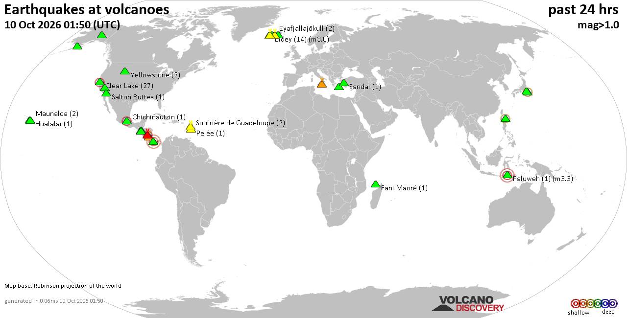
Volcano earthquake report for Saturday, 10 October 2026
• M 3.4 - 31 km NE of Punta Cana, Dominican Republic
• M 4.7 - 2 km WNW of El Cacao, Panama
• M 4.7 - 2 km WNW of El Cacao, Panama
• M 4.7 - 2 km WNW of El Cacao, Panama
• M 4.5 - 103 km SW of Puerto Madero, Mexico
|

#811990
Tue 19 May 2026 03:13:AM
|
Joined: Feb 2001
Posts: 678,977
Launch Director
|
|
Launch Director
Joined: Feb 2001
Posts: 678,977 |
SPC MD 780MD 0780 CONCERNING TORNADO WATCH 225...227... FOR EASTERN KANSAS...NORTHWEST MISSOURI...SOUTHERN IOWA 
Mesoscale Discussion 0780
NWS Storm Prediction Center Norman OK
0854 PM CDT Mon May 18 2026

Areas affected...eastern Kansas...northwest Missouri...southern Iowa

Concerning...Tornado Watch 225...227...

Valid 190154Z - 190500Z

The severe weather threat for Tornado Watch 225, 227 continues.

SUMMARY...Severe winds are likely along the length of an extensive
squall line extending from central Iowa across western Missouri and
into south-central/eastern Kansas. Isolated/brief tornadoes may
still occur from eastern Kansas into western Missouri.

DISCUSSION...Storms have largely consolidated into a squall line
this evening, with various bowing segments with the line. One such
segment is evident over northeast KS, with another moving across
northern MO. The nearly north-south orientation of these segments is
more favorable for significant wind damage as the leading outflow
remains in balance/closer to the storms.

The most favorable combination of low-level shear and instability
currently extends from eastern KS into western MO, just ahead of the
squall line and beneath the 55 kt low-level jet. The EAX VWP
indicates 300 m2/s2 0-1 km SRH which may support periodic QLCS
tornado potential.

Farther southwest into south-central KS, echoes are training slowly,
with robust cores producing hail at times. Measured severe gusts
over 50 kt have occurred here as well, and these storms should
maintain strength as the low-level jet persists directly in from the
south.

..Jewell.. 05/19/2026

...Please see www.spc.noaa.gov for graphic product...

ATTN...WFO...DVN...SGF...DMX...EAX...TOP...ICT...

LAT...LON   39719315 38779344 38219410 37559585 37379804 37459838
            37609834 38089698 38219662 38559603 39179554 39819481
            40269471 40599437 40779427 41129370 41599333 41959315
            42249265 42229242 41949226 40759250 39719315

MOST PROBABLE PEAK TORNADO INTENSITY...100-125 MPH
MOST PROBABLE PEAK WIND GUST...65-80 MPH
MOST PROBABLE PEAK HAIL SIZE...1.00-1.75 IN
Read morehttps://www.spc.noaa.gov/products/md/md0780.html
|
|



CMS The Best Conveyancing solicitors conveyancing quotes throughout the UK
For any webhosting enquiries please email webmaster@aus-city.com
|
|
Forums60
Topics867,917
Posts902,713
Members2,960
| |
Most Online102,106
Jul 10th, 2026
|
|
|









































