|
1 members (Alisa),
2,786
guests, and
22
robots. |
|
Key:
Admin,
Global Mod,
Mod
|
|
S |
M |
T |
W |
T |
F |
S |
|
|
|
1
|
2
|
3
|
4
|
5
|
|
6
|
7
|
8
|
9
|
10
|
11
|
12
|
|
13
|
14
|
15
|
16
|
17
|
18
|
19
|
|
20
|
21
|
22
|
23
|
24
|
25
|
26
|
|
27
|
28
|
29
|
30
|
|
|
|
|
There are no members with birthdays on this day. |
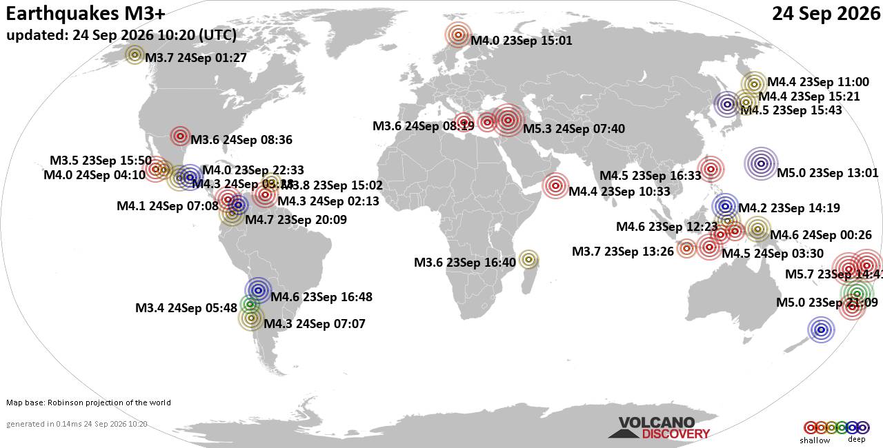
World Earthquake Report for Thursday, 24 September 2026
• Moderate mag. 4.3 earthquake - Madagascar: Mozambique Channel on Thursday, ...
• Small magnitude 3.9 earthquake hits near Hastings, Hastings District, Hawke...
• Volcano earthquake report for Thursday, 24 September 2026
• Light mag. 3.9 earthquake - South Pacific Ocean, 10.2 km south of Hastings,...
• Moderate magnitude 4.1 quake hits 31 miles southeast of Midland, Texas, Uni...
|

#813262
Mon 25 May 2026 05:45:PM
|
Joined: Feb 2001
Posts: 678,977
Launch Director
|
|
Launch Director
Joined: Feb 2001
Posts: 678,977 |
SPC MD 853MD 0853 CONCERNING SEVERE POTENTIAL...WATCH UNLIKELY FOR PORTIONS OF THE NORTHERN GULF COAST AND SOUTHEAST 
Mesoscale Discussion 0853
NWS Storm Prediction Center Norman OK
1223 PM CDT Mon May 25 2026

Areas affected...portions of the northern Gulf Coast and Southeast

Concerning...Severe potential...Watch unlikely

Valid 251723Z - 251930Z

Probability of Watch Issuance...5 percent

SUMMARY...Scattered to numerous thunderstorms this afternoon may
pose a sporadic risk for strong wind gusts. Little in the way of
storm organization is expected.

DISCUSSION...As of 1715 UTC, visible and radar imagery showed a
broad area of thunderstorms ongoing over the central Gulf Coast
states associated with a remnant MCV. Widespread anvil debris
remains apparent and should limit destabilization over much of MS,
western AL and the western FL Panhandle. To the east of the MCV and
clouds, strong diurnal heating is rapidly destabilizing the air mass
across eastern AL, northern FL and much of GA and into SC. Despite
the poor mid-level lapse rates, 70s F surface dewpoints are
supporting ~2000 J/kg of MLCAPE. Sufficient for periodic stronger
updrafts, scattered to numerous thunderstorms are expected this
afternoon and evening as convective temperatures in the mid to upper
80s F are breached.

While some low and mid-level flow enhancement is occurring closer to
the MCV farther west, little in the way of vertical shear is present
over much of the Southeast (EBWD <25 kts). This suggests storm
organization will be quite limited, with a predominant pulse/multi
cell storm mode. High PWAT content (greater than 2 inches) may
support a few stronger downdrafts capable of sporadic damaging
gusts.

Storm coverage should increase this afternoon, along the eastern
edge of the remnant cloud shield and differential heating zone in
AL/GA, and in association with sea breeze convection in northern FL.
A few stronger clusters may evolve as outflows consolidate. However,
the lack of border upper air support  should limit a sustained
severe threat and a watch appears unlikely.

..Lyons/Gleason.. 05/25/2026

...Please see www.spc.noaa.gov for graphic product...

ATTN...WFO...CHS...CAE...GSP...JAX...FFC...TAE...BMX...

LAT...LON   30908240 30518317 30318431 30378535 30518567 30988607
            31988610 32878634 33548621 33788586 34108426 34598200
            34128111 33618105 32428130 31508182 30908240

MOST PROBABLE PEAK WIND GUST...UP TO 60 MPH
Read morehttps://www.spc.noaa.gov/products/md/md0853.html
|
|



CMS The Best Conveyancing solicitors conveyancing quotes throughout the UK
For any webhosting enquiries please email webmaster@aus-city.com
|
|
Forums60
Topics840,505
Posts875,300
Members2,960
| |
Most Online102,106
Jul 10th, 2026
|
|
|





































