|
0 members (),
1,058
guests, and
26
robots. |
|
Key:
Admin,
Global Mod,
Mod
|
|
S |
M |
T |
W |
T |
F |
S |
|
|
|
|
|
|
1
|
2
|
|
3
|
4
|
5
|
6
|
7
|
8
|
9
|
|
10
|
11
|
12
|
13
|
14
|
15
|
16
|
|
17
|
18
|
19
|
20
|
21
|
22
|
23
|
|
24
|
25
|
26
|
27
|
28
|
29
|
30
|
|
31
|
|
|
|
|
|
|
|
There are no members with birthdays on this day. |
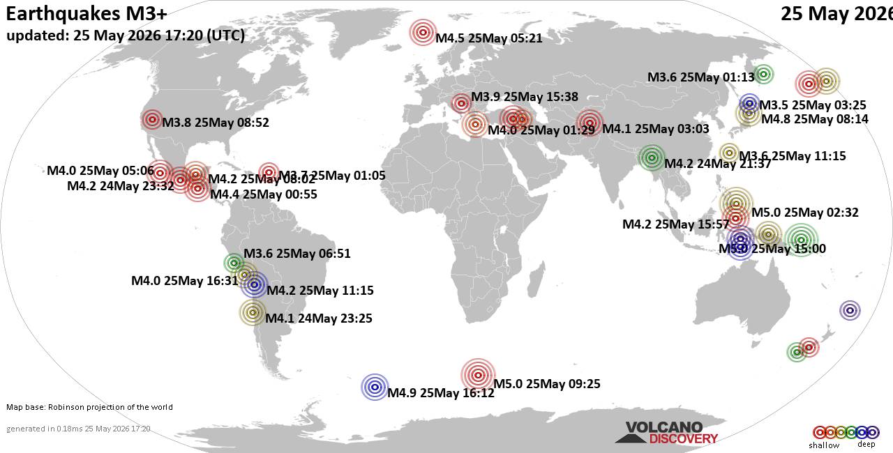
World Earthquake Report for Monday, 25 May 2026
• Moderate mag. 4.1 earthquake - 80 km northwest of Galela, Kabupaten Halmahe...
• Moderate magnitude 4.5 quake hits 102 km northeast of Manokwari, Indonesia ...
• Volcano earthquake report for Monday, 25 May 2026
• Moderate mag. 4.8 earthquake - South Pacific Ocean, 89 km northeast of Mano...
• Moderate mag. 4.0 earthquake - South Pacific Ocean, 81 km southwest of Moll...
|
|
|
Joined: Feb 2001
Posts: 381,904
Launch Director
|
OP

Launch Director
Joined: Feb 2001
Posts: 381,904 |
SPC MD 870MD 0870 CONCERNING SEVERE THUNDERSTORM WATCH 245... FOR PORTIONS OF SOUTH-CENTRAL TEXAS 
Mesoscale Discussion 0870
NWS Storm Prediction Center Norman OK
1017 PM CDT Tue May 26 2026

Areas affected...portions of south-central Texas

Concerning...Severe Thunderstorm Watch 245...

Valid 270317Z - 270445Z

The severe weather threat for Severe Thunderstorm Watch 245
continues.

SUMMARY...The threat for severe wind gusts (and potentially a
significant gust or two), isolated large hail, and perhaps a tornado
or two continues across WW245.

DISCUSSION...A well-defined MCS remains ongoing across portions of
south-central Texas as of 0300 UTC, with several reports of
severe/damaging wind gusts noted over the past 1-2 hours, including
measured 63 and 79 mph wind gusts. Brief embedded circulations have
also been observed via latest EWX radar imagery in the San Antonio
metro vicinity within the past 15-30 minutes. The downstream
environment remains moderately unstable, with 1500-2500 J/kg MLCAPE.
Coupled with effective shear of 30-35 kts, continued maintenance of
this system and potential for severe wind gusts (and potentially a
significant gust or two) appears likely for at least another 1-2
hours. The EWX VAD also sampled approximately 100 m2/s2 0-500 m SRH
just ahead of the convective line, which will promote the potential
for a brief embedded tornado or two.

Latest high-res guidance continues to suggest that a cluster of weak
thunderstorms currently noted in Coahuila, Mexico, will evolve
eastward and potentially intensify over the next few hours, before
advancing into South Texas, perhaps as another cluster/linear MCS.
This would bring additional potential for severe wind gusts,
isolated large hail, and perhaps a brief tornado or two to portions
of WW245.

..Chalmers.. 05/27/2026

...Please see www.spc.noaa.gov for graphic product...

ATTN...WFO...HGX...CRP...EWX...

LAT...LON   29269861 29429872 29689885 29799870 29889814 29869746
            29669696 29329674 28919676 28469691 27939752 27829827
            27869909 28089927 28349917 28689880 28969860 29119855
            29269861

MOST PROBABLE PEAK TORNADO INTENSITY...UP TO 90 MPH
MOST PROBABLE PEAK WIND GUST...55-70 MPH
MOST PROBABLE PEAK HAIL SIZE...1.00-1.75 IN
Read morehttps://www.spc.noaa.gov/products/md/md0870.html
|
|



CMS The Best Conveyancing solicitors conveyancing quotes throughout the UK
For any webhosting enquiries please email webmaster@aus-city.com
|
|
Forums60
Topics776,824
Posts811,623
Members2,960
| |
Most Online22,463
May 9th, 2026
|
|
|