|
1 members (Alisa),
1,769
guests, and
28
robots. |
|
Key:
Admin,
Global Mod,
Mod
|
|
S |
M |
T |
W |
T |
F |
S |
|
|
|
|
|
1
|
2
|
3
|
|
4
|
5
|
6
|
7
|
8
|
9
|
10
|
|
11
|
12
|
13
|
14
|
15
|
16
|
17
|
|
18
|
19
|
20
|
21
|
22
|
23
|
24
|
|
25
|
26
|
27
|
28
|
29
|
30
|
31
|
|
There are no members with birthdays on this day. |
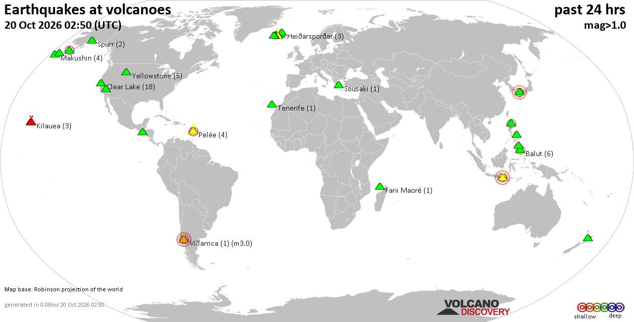
Volcano earthquake report for Tuesday, 20 October 2026
• Moderate mag. 4.0 earthquake - South OF Sumbawa, Indonesia, on Tuesday, Oct...
• M 1.6 - 6 km NE of Aguanga, CA
• M 1.5 - 21 km S of Lindsay, Texas
• M 2.6 - 18 km SSW of Jal, New Mexico
• M 2.0 - 19 km ESE of Naalehu, Hawaii
|

#813568
Wed 27 May 2026 01:01:AM
|
Joined: Feb 2001
Posts: 678,977
Launch Director
|
|
Launch Director
Joined: Feb 2001
Posts: 678,977 |
SPC May 27, 2026 0100 UTC Day 1 Convective OutlookSPC 0100Z Day 1 Outlook 
Day 1 Convective Outlook
NWS Storm Prediction Center Norman OK
0759 PM CDT Tue May 26 2026

Valid 270100Z - 271200Z

...THERE IS A SLIGHT RISK OF SEVERE THUNDERSTORMS ACROSS PARTS OF
SOUTH TEXAS...

...SUMMARY...
Scattered thunderstorms with large hail and severe wind gusts will
be possible this evening in parts of west Texas into south-central
and southeast Texas. Isolated severe storms with strong wind gusts
and hail will also be possible in parts of the upper Mississippi
Valley and northwestern U.S.

...Texas...
A mid-level shortwave trough is evident on water vapor imagery over
west and southwest Texas. Ahead of the trough, a broken line of
strong to severe storms is ongoing from the Texas Hill Country
southwestward to near the Rio Grande River. Moderate to strong
instability is analyzed by the RAP towards the south end of this
line, where MLCAPE is in the 2000 to 3000 J/kg range. As the line
moves eastward into south-central Texas this evening, the more
organized embedded storms may have supercell characteristics and be
capable of large to very large hail. Severe wind gusts will also be
possible along the leading edge of the more intense line segments.
Further north into parts of the Texas Hill Country, instability is
considerably less which will temper the severe potential somewhat.
These storms may be able to produce isolated severe gusts and hail.
This entire line will eventually move eastward across the Texas
Coastal Plain by late in the period, where an a few strong wind
gusts will be possible...see MCD 868.

...Upper Mississippi Valley...
At the surface, a quasi-stationary front is located from
north-central Minnesota east-southeastward into east-central
Wisconsin. Scattered thunderstorms are ongoing near the front. An
axis of instability is analyzed immediately south of the front, with
another pocket of instability located in southern Minnesota and
northern Iowa. The instability along with steep low-level lapse
rates may be enough for an isolated potential for severe wind gusts
early this evening. Hail will also be possible.

...Northern Rockies...
A mid-level low is currently over northern California with
south-southeasterly mid-level flow located over the northwestern
U.S. Within this flow, an axis of instability is analyzed by the RAP
across western Montana, where scattered thunderstorms are ongoing.
In addition to the instability, forecast soundings in western
Montana show moderate deep-layer shear and steep mid-level lapse
rates. This should be enough for isolated severe wind gusts early
this evening. Hail will also be possible, mainly in northwest
Montana where instability is a bit stronger.

..Broyles.. 05/27/2026
Read morehttps://www.spc.noaa.gov/products/outlook/day1otlk_0100.html
|
|



CMS The Best Conveyancing solicitors conveyancing quotes throughout the UK
For any webhosting enquiries please email webmaster@aus-city.com
|
|
Forums60
Topics884,920
Posts919,717
Members2,960
| |
Most Online102,106
Jul 10th, 2026
|
|
|









































