|
0 members (),
941
guests, and
46
robots. |
|
Key:
Admin,
Global Mod,
Mod
|
|
S |
M |
T |
W |
T |
F |
S |
|
|
|
|
|
|
|
1
|
|
2
|
3
|
4
|
5
|
6
|
7
|
8
|
|
9
|
10
|
11
|
12
|
13
|
14
|
15
|
|
16
|
17
|
18
|
19
|
20
|
21
|
22
|
|
23
|
24
|
25
|
26
|
27
|
28
|
29
|
|
30
|
31
|
|
|
|
|
|
|
There are no members with birthdays on this day. |
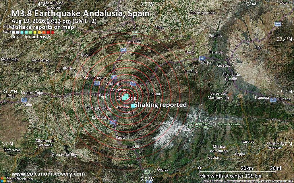
Seismic-like event, possible earthquake, reported few minutes ago near Granada, Andalusia, Spain
• Volcano earthquake report for Wednesday, 19 Aug 2026
• Moderate magnitude 4.8 earthquake 81 km north of Sanchez-Mira, Philippines
• Moderate mag. 4.0 earthquake - North Pacific Ocean, 30 km southeast of Peta...
• Moderate mag. 4.8 earthquake - South China Sea, 36 km west of Calayan Islan...
• World Earthquake Report for Wednesday, 19 August 2026
|

#813914
Thu 28 May 2026 09:36:PM
|
Joined: Feb 2001
Posts: 678,976
Launch Director
|
OP

Launch Director
Joined: Feb 2001
Posts: 678,976 |
SPC MD 883MD 0883 CONCERNING SEVERE POTENTIAL...SEVERE THUNDERSTORM WATCH LIKELY FOR EASTERN WASHINGTON...THE IDAHO PANHANDLE...AND FAR NORTHWEST MONTANA 
Mesoscale Discussion 0883
NWS Storm Prediction Center Norman OK
0434 PM CDT Thu May 28 2026

Areas affected...eastern Washington...the Idaho Panhandle...and far
northwest Montana

Concerning...Severe potential...Severe Thunderstorm Watch likely

Valid 282134Z - 282330Z

Probability of Watch Issuance...80 percent

SUMMARY...The threat for severe thunderstorms capable of 60-75 mph
wind gusts and hail up to golf-ball size is expected to increase
from south to north across the discussion area this afternoon into
evening. A Severe Thunderstorm Watch will likely be required.

DISCUSSION...Visible satellite and mosaic radar data indicate
gradually deepening convection along the Salmon River Mountains and
adjacent high terrain of the southern ID Panhandle into the
Bitterroot Mountains in western MT. Forcing for ascent downstream
from a vigorous short-wave trough pivoting northwest through the
northern Great Basin in conjunction with heating/destabilization
along the high terrain are contributing to the convective
development, with scattered thunderstorms eventually evolving in
these areas.

Strong daytime heating across the discussion area will combine with
boundary-layer dewpoints in the 50s to support further air mass
destabilization through the peak of the diurnal heating cycle, with
the presence of steep low/mid-level lapse rates yielding MLCAPE as
high as 1500-2500 J/kg. The destabilization process will coincide
with gradually strengthening mid- to high-level winds with effective
bulk shear increasing to 30-40 kt, which will favor organized storm
modes, including supercells and bowing structures capable of wind
gusts up to 60-75 mph and hail up to golf-ball size.

..Mead/Guyer.. 05/28/2026

...Please see www.spc.noaa.gov for graphic product...

ATTN...WFO...MSO...OTX...PDT...

LAT...LON   45471474 45421568 45781646 46041692 46071739 46121828
            46811874 47721887 48471865 48651815 48681723 48811646
            48721554 48221500 47481460 46841427 46111420 45471474

MOST PROBABLE PEAK WIND GUST...65-80 MPH
MOST PROBABLE PEAK HAIL SIZE...1.00-1.75 IN
Read morehttps://www.spc.noaa.gov/products/md/md0883.html
|
|



CMS The Best Conveyancing solicitors conveyancing quotes throughout the UK
For any webhosting enquiries please email webmaster@aus-city.com
|
|
Forums60
Topics798,535
Posts833,325
Members2,960
| |
Most Online102,106
Jul 10th, 2026
|
|
|





































