|
|
|
0 members (),
947
guests, and
25
robots. |
|
Key:
Admin,
Global Mod,
Mod
|
|
S |
M |
T |
W |
T |
F |
S |
|
|
|
1
|
2
|
3
|
4
|
5
|
|
6
|
7
|
8
|
9
|
10
|
11
|
12
|
|
13
|
14
|
15
|
16
|
17
|
18
|
19
|
|
20
|
21
|
22
|
23
|
24
|
25
|
26
|
|
27
|
28
|
29
|
30
|
|
|
|
|
There are no members with birthdays on this day. |
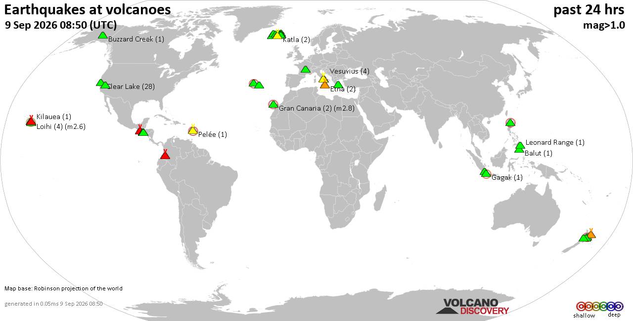
Volcano earthquake report for Wednesday, 9 September 2026
• World Earthquake Report for Wednesday, 9 September 2026
• Strong mag. 5.0 earthquake - Celebes Sea, 49 km north of Tahuna, Indonesia,...
• Moderate mag. 4.7 earthquake - Philippine Sea, 135 km southeast of Shima, M...
• The 10 most powerful earthquakes in the world since 1900
• Moderate mag. 4.0 earthquake - Indian Ocean, 80 km southwest of Labuan, Kab...
|

#818388
Sun 14 Jun 2026 05:52:PM
|
Joined: Feb 2001
Posts: 678,977
Launch Director
|
|
Launch Director
Joined: Feb 2001
Posts: 678,977 |
Magnitude 3.8 earthquake strikes near Los Lunas, Valencia County, New Mexico, USA An earthquake of magnitude 3.8 occurred only 10 minutes ago 23 miles south of Los Lunas, New Mexico, United States, the United States Geological Survey reported.
The quake hit at a shallow depth of 6.2 miles beneath the epicenter near Los Lunas, Valencia County, New Mexico, USA, in the morning on Sunday, June 14th, 2026, at 11:41 am local time. The exact magnitude, epicenter, and depth of the quake might be revised within the next few hours or minutes as seismologists review data and refine their calculations, or as other agencies issue their report.
A second report was later issued by the European-Mediterranean Seismological Centre (EMSC), which listed it as a magnitude 3.8 earthquake as well.
Based on the preliminary seismic data, the quake should not have caused any significant damage, but was probably felt by many people as light vibration in the area of the epicenter.
Weak shaking might have been felt in Las Nutrias (pop. 150) located 0 miles from the epicenter, Jarales (pop. 2,500) 10 miles away, Rio Communities (pop. 4,700) 13 miles away, and Belen (pop. 7,200) 13 miles away.
Other towns or cities near the epicenter where the quake might have been felt as very weak shaking include Los Chavez (pop. 5,400) located 18 miles from the epicenter, El Cerro Mission (pop. 4,700) 21 miles away, Los Lunas (pop. 15,300) 23 miles away, Socorro (pop. 8,700) 29 miles away, South Valley (pop. 41,000) 38 miles away, and Albuquerque (pop. 564,600) 43 miles away.
Earthquake data: Date & time: Jun 14, 2026 11:41 am (GMT -6) local time (14 Jun 2026 17:41 GMT)Magnitude: 3.8 Depth: 10.00 km Epicenter latitude / longitude: 34.47°N / 106.77°W  ( Socorro County, New Mexico, United States) Primary data source: USGShttps://www.volcanodiscovery.com/earthquake/news/307079/Magnitude-38-earthquake-strikes-near-Los-Lunas-Valencia-County-New-Mexico-USA.html
|
|



CMS The Best Conveyancing solicitors conveyancing quotes throughout the UK
For any webhosting enquiries please email webmaster@aus-city.com
|
|
Forums60
Topics822,449
Posts857,242
Members2,960
| |
Most Online102,106
Jul 10th, 2026
|
|
|
|
|

|





































