|
0 members (),
803
guests, and
35
robots. |
|
Key:
Admin,
Global Mod,
Mod
|
|
S |
M |
T |
W |
T |
F |
S |
|
|
|
|
1
|
2
|
3
|
4
|
|
5
|
6
|
7
|
8
|
9
|
10
|
11
|
|
12
|
13
|
14
|
15
|
16
|
17
|
18
|
|
19
|
20
|
21
|
22
|
23
|
24
|
25
|
|
26
|
27
|
28
|
29
|
30
|
31
|
|
|
There are no members with birthdays on this day. |
|
|
|
|
|
|
|
|
|
|
|
|
|
|
by Webmaster - Mon 06 Jul 2026 04:49:PM
|
by Webmaster - Mon 06 Jul 2026 04:49:PM
|
by Webmaster - Mon 06 Jul 2026 04:49:PM
|
|
|
|
|
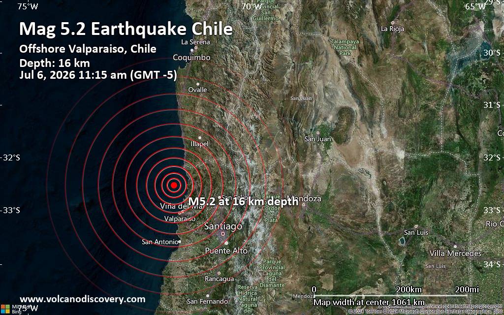
Significant magnitude 5.2 earthquake 58 km north of Valparaiso, Chile
• Small earthquake of magnitude 3.7 just reported 10 km southwest of Glogow, ...
• World Earthquake Report for Monday, 6 July 2026
• Significant 5.3 quake hits near Valparaiso, Provincia de Valparaíso, Regio...
• Moderate mag. 4.6 earthquake - South Pacific Ocean, 45 km north of Valparai...
• Strong mag. 5.2 earthquake - South Pacific Ocean, 58 km north of Valparaiso...
|
|
|
Joined: Feb 2001
Posts: 678,976
Launch Director
|
OP

Launch Director
Joined: Feb 2001
Posts: 678,976 |
SPC MD 1522MD 1522 CONCERNING SEVERE POTENTIAL...SEVERE THUNDERSTORM WATCH LIKELY FOR EASTERN NORTH DAKOTA...NORTHWEST MINNESOTA...NORTHEAST SOUTH DAKOTA 
Mesoscale Discussion 1522
NWS Storm Prediction Center Norman OK
0111 PM CDT Mon Jul 06 2026

Areas affected...Eastern North Dakota...northwest
Minnesota...northeast South Dakota

Concerning...Severe potential...Severe Thunderstorm Watch likely

Valid 061811Z - 062015Z

Probability of Watch Issuance...80 percent

SUMMARY...Large hail and severe winds are possible with initial
supercells that will eventually grow upscale into a more organized
cluster/MCS. A watch is likely this afternoon.

DISCUSSION...A slow moving cold front continues southeastward within
the northern Plains. Though influence from the shortwave trough in
Canada is minimal, areas of strong heating of and upper 60s to low
70s F dewpoint airmass is allowing cumulus to deepen along parts of
the boundary. Additionally, mid-level convection will move eastward
through the Dakotas and may gradually root near the surface. The
strongest initial development will likely occur along the Canadian
border in northwest Minnesota given the greater surface heating and
nominally greater mid-level ascent. Effective shear of 35-40 kt will
support a mixture of supercells and multicells. With time, linear
forcing along the cold front and cold pool mergers will lead to a
broader linear structure. Initial supercells would be capable of
large hail up to 2 inches. As activity congeals, severe wind
gusts/wind damage would become more likely. The environment into the
Mississippi Valley becomes less favorable. Movement of storms toward
the south/southeast into the greater buoyancy is expected with time.

..Wendt/Hart.. 07/06/2026

...Please see www.spc.noaa.gov for graphic product...

ATTN...WFO...FGF...ABR...BIS...

LAT...LON   45739785 46109810 48279763 49079707 49179637 48959581
            46519627 45859646 45659673 45739785

MOST PROBABLE PEAK TORNADO INTENSITY...UP TO 90 MPH
MOST PROBABLE PEAK WIND GUST...65-80 MPH
MOST PROBABLE PEAK HAIL SIZE...1.50-2.50 IN
Read morehttps://www.spc.noaa.gov/products/md/md1522.html
|
|



CMS The Best Conveyancing solicitors conveyancing quotes throughout the UK
For any webhosting enquiries please email webmaster@aus-city.com
|
|
Forums60
Topics786,926
Posts821,700
Members2,960
| |
Most Online22,463
May 9th, 2026
|
|
|